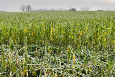
Crop Disaster Assessment
Drones aid in rapid, accurate disaster assessment of crops, aiding recovery and insurance claims

Crop Disaster Assessment
Drones play a crucial role in disaster assessment of crops, providing rapid, accurate data without disturbing the fields. They help in pinpointing affected areas, monitoring disaster progression, supporting insurance claims, and guiding post-disaster recovery.
Traditional Crop Disaster Assessment Pain Points
- Time-consuming, requiring manual labor to inspect vast fields.
- Inaccurate assessment due to human error or inaccessible areas.
- Limited data collection, only visible damage can be recorded.
- Disturbance of the field during inspection can cause further damage.
- Difficulty in monitoring the progression of damage over time.
Advantages of Drone Crop Disaster Assessment
- Rapid and efficient, drones can cover large areas quickly, reducing labor and time.
- High accuracy, drones capture detailed, precise data, even from difficult terrains.
- Comprehensive data, drones can detect hidden damage using infrared or multispectral imaging.
- Non-intrusive, drones survey from the air, minimizing further damage to crops.
- Consistent monitoring, drones can be deployed regularly for up-to-date assessment.