Redefining Efficiency and Versatility in Unmanned Aerial Systems
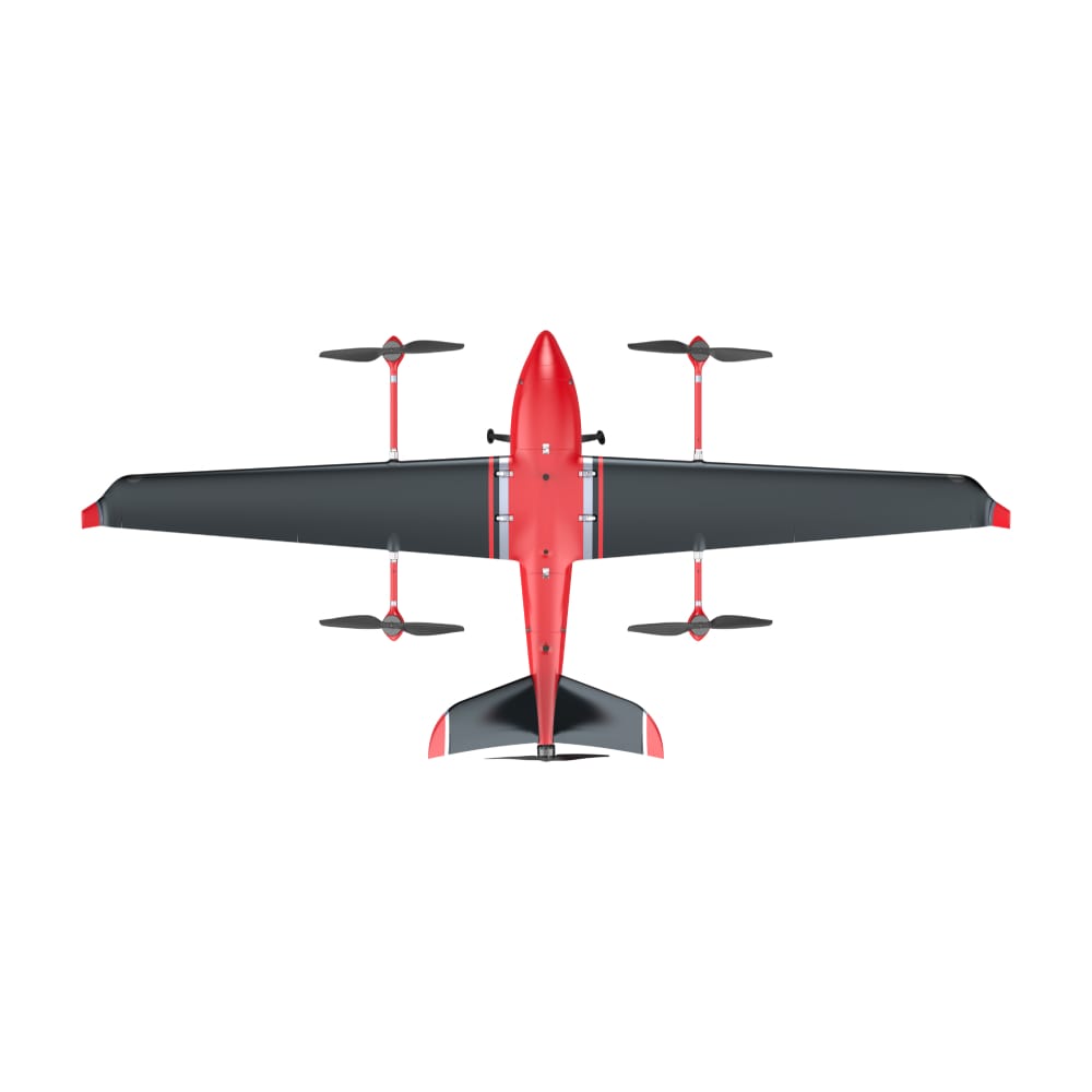
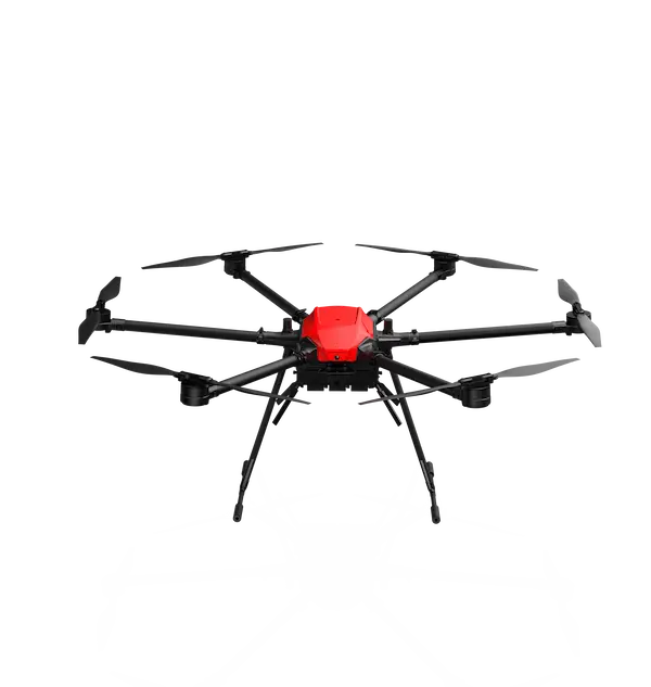
In the dynamic world of unmanned aerial systems (UAS), where precision, endurance, and adaptability are paramount, the MMC M9 emerges as a groundbreaking electric vertical takeoff and landing (VTOL) fixed-wing drone. Engineered for professionals tackling large-scale mapping, power line inspections, border surveillance, or emergency response operations, the M9 combines the agility of multirotor drones with the long-range efficiency of fixed-wing aircraft. With its robust design, extended flight times, and versatile payload options, the M9 is redefining what’s possible in professional aerial missions, delivering unmatched reliability in the most demanding environments. Whether you’re a geospatial surveyor, an energy infrastructure manager, a security professional, or an emergency responder, the MMC M9 is your ultimate tool for achieving mission success.
Why the MMC M9 is the Ideal Choice for Professionals
The MMC M9 stands out as a pinnacle of UAS innovation, offering a suite of features tailored to meet the needs of diverse industries. Its blend of cutting-edge technology and practical design makes it a must-have for professionals seeking efficiency, safety, and precision.
1. Unparalleled Flight Performance
The M9 seamlessly integrates VTOL capabilities with fixed-wing efficiency, delivering exceptional performance across a wide range of conditions:
- Extended Endurance: Achieves 150+ minutes of flight time with no payload and 120+ minutes with a 3kg payload, far surpassing traditional multirotor drones.
- Long-Range Connectivity: Features an 80km encrypted 1.4GHz data link, ensuring real-time data transmission over vast distances.
- High-Speed Operations: Cruises at 68-72 km/h (19-20 m/s) with a maximum speed of 126 km/h (35 m/s), enabling rapid coverage of large areas.
- All-Weather Reliability: Operates in temperatures from -20°C to 60°C and boasts an IP54 rating for dust and water resistance, making it ideal for extreme conditions.
- Compact Deployment: Unlike traditional fixed-wing drones requiring runways or catapults, the M9 takes off and lands vertically in a 10×10 meter space, perfect for rugged or confined environments.
2. Military-Grade Durability & Redundancy
Built for mission-critical reliability, the M9 is engineered to withstand the toughest challenges:
- Carbon-Fiber Airframe: Lightweight yet robust, ensuring durability without compromising performance.
- Triple-Redundant Systems: Equipped with dual IMUs, dual barometers, and dual GPS, guaranteeing operational stability.
- Fail-Safe Recovery: Automatically switches to multirotor mode for safe landing if fixed-wing mode fails.
- Level 6 Wind Resistance: Handles gusts up to 12 m/s in fixed-wing mode, ensuring steady performance in windy conditions.
These features make the M9 a trusted choice for high-stakes missions where failure is not an option.
Key Applications – Where the MMC M9 Excels
The MMC M9 is designed to address the unique needs of four core user groups, delivering tailored solutions for a variety of professional applications.
1. Surveying & Mapping
For geospatial professionals, the M9 is a high-efficiency mapping powerhouse that outperforms traditional methods:
- Precision Positioning: PPK/RTK technology delivers 1cm accuracy, ideal for high-precision surveys.
- Versatile Payloads: Compatible with high-resolution cameras, LiDAR, and multispectral sensors, enabling diverse data collection.
- Extensive Coverage: Maps 50+ km² per day, compared to 10-15 km² for multirotor drones, drastically reducing project timelines.
- Automated Terrain Following: Enables ultra-low-altitude surveys for detailed topographic data.
Use Cases:
- Cadastral Mapping: Produces 1:500 scale maps for land management and urban planning.
- Mining Volume Calculations: Accurately measures stockpile volumes for resource management.
- 3D City Modeling: Supports urban development with high-resolution 3D models.
Testimonial: “The M9 transformed our cadastral mapping process, covering vast areas in a single day with unmatched precision,” says a GIS surveyor from a leading mapping firm.
2. Energy & Infrastructure Inspections
The M9 revolutionizes inspections for energy and utility sectors, minimizing risks and maximizing efficiency:
- Long-Range Inspections: Covers 100+ km per flight for power lines, pipelines, wind turbines, and solar farms.
- Thermal Imaging: Detects faults like hot spots or leaks with precision, reducing downtime.
- AI-Powered Analytics: When paired with MMC’s software, the M9 offers automated defect detection, streamlining reporting.
- Reduced Logistics: Eliminates frequent battery swaps, enabling continuous operations over large areas.
Use Cases:
- Power Line Patrols: Inspects high-voltage lines in remote regions without risking human lives.
- Oil & Gas Pipelines: Monitors pipelines for leaks and structural issues.
- Renewable Energy: Ensures wind turbines and solar panels operate at peak efficiency.
Testimonial: “With the M9, we cut our power line inspection time by 60% compared to helicopter-based methods,” reports an energy utility manager.
3. Security & Surveillance
For defense, law enforcement, and conservation agencies, the M9 provides advanced surveillance capabilities:
- Long-Range Monitoring: Offers 80km real-time video transmission with 30x zoom and infrared (IR) for day and night operations.
- Stealth Operations: Low-noise design ensures discreet surveillance for covert missions.
- Robust Connectivity: AES-128 encrypted transmission and anti-jamming GPS protect sensitive data.
Use Cases:
- Border Surveillance: Monitors coastlines and borders for unauthorized activity.
- Wildlife Protection: Detects illegal logging and poaching in remote areas.
- Disaster Assessment: Provides real-time imagery for fires, floods, and earthquakes.
Testimonial: “The M9’s stealth and long-range capabilities have been critical for our border patrol missions,” says a security agency officer.
4. Emergency Response & Disaster Relief
In emergencies, the M9’s rapid deployment and advanced imaging save lives and accelerate recovery:
- Quick Setup: Deploys in 3 minutes without requiring runways or specialized equipment.
- High-Resolution Imaging: Delivers detailed aerial data for damage assessment and rescue planning.
- Thermal Imaging for SAR: Locates missing persons in low-visibility conditions.
Use Cases:
- Earthquake/Tsunami Analysis: Maps disaster zones for rapid response planning.
- Wildfire Monitoring: Tracks fire spread and containment efforts.
- Search & Rescue: Identifies heat signatures in remote or hazardous areas.
Testimonial: “During a recent wildfire, the M9’s thermal imaging helped us locate stranded hikers in minutes,” says an emergency response coordinator.
What Makes the MMC M9 Stand Out?
The M9’s cutting-edge features set it apart as the ultimate VTOL drone for professional applications.
Modular & Quick-Swap Payload System
- Supports 5+ payload types, including visible-light cameras, IR cameras, LiDAR, and multispectral sensors.
- 3-minute payload swaps without tools, enabling rapid adaptation to mission requirements.
Fully Autonomous Operation
- One-click takeoff and landing simplifies operations for users of all skill levels.
- Pre-programmed flight paths support up to 8 missions with 800 waypoints each, ideal for complex surveys.
- AI-powered obstacle avoidance (optional) ensures safe navigation in cluttered environments.
Military-Level Data Security
- AES-128 encryption protects data during transmission.
- Anti-jamming GPS and datalink ensure reliable operation in contested environments.
Easy Transport & Deployment
- Fits in a standard SUV, with disassembly in under 5 minutes.
- Requires no specialized crew, making it accessible for small teams.
Who Should Use the MMC M9?
The M9 is tailored for professionals across industries who demand high-performance aerial solutions:
- Surveying & GIS Companies
- Replace costly manned aircraft with a cost-effective, high-accuracy solution.
- Achieve cm-level precision for large-scale mapping projects.
- Energy & Utility Inspectors
- Reduce inspection costs and risks with long-range, automated flights.
- Streamline reporting with AI-driven analytics.
- Defense & Security Agencies
- Conduct long-endurance reconnaissance with secure, real-time data.
- Maintain situational awareness in remote or contested areas.
- Emergency Services & NGOs
- Deploy rapidly for disaster mapping and search-and-rescue operations.
- Leverage night-vision and thermal imaging for critical missions.
Why Professionals Choose the MMC M9
The M9 has earned praise from users across industries for its reliability and versatility:
“The M9’s ability to cover 50 km² in a single flight revolutionized our mining surveys. The RTK accuracy is unmatched.”
—Geospatial engineer
“For pipeline inspections, the M9’s endurance and thermal imaging cut our operational time in half while improving safety.”
—Energy sector manager
“The M9’s stealth and long-range video feed gave us a critical edge in wildlife protection missions.”
—Conservation officer
“In a recent flood response, the M9’s rapid deployment and high-resolution imagery helped us save lives faster.”
—Emergency responder
The Future of Professional VTOL Drones is Here
The MMC M9 is not just a drone—it’s a high-performance aerial platform that empowers professionals to achieve extraordinary results. Its combination of long endurance, military-grade reliability, and versatile payload options makes it the ideal choice for mapping uncharted terrain, securing borders, inspecting critical infrastructure, or saving lives in emergencies. With the M9, you can fly longer, see more, and accomplish the impossible.
Ready to transform your operations?
📩 Contact our experts for a customized demo.
🌐 Visit our website for technical specifications and case studies.
Fly Longer. See More. Achieve the Impossible with MMC M9.