Forestry
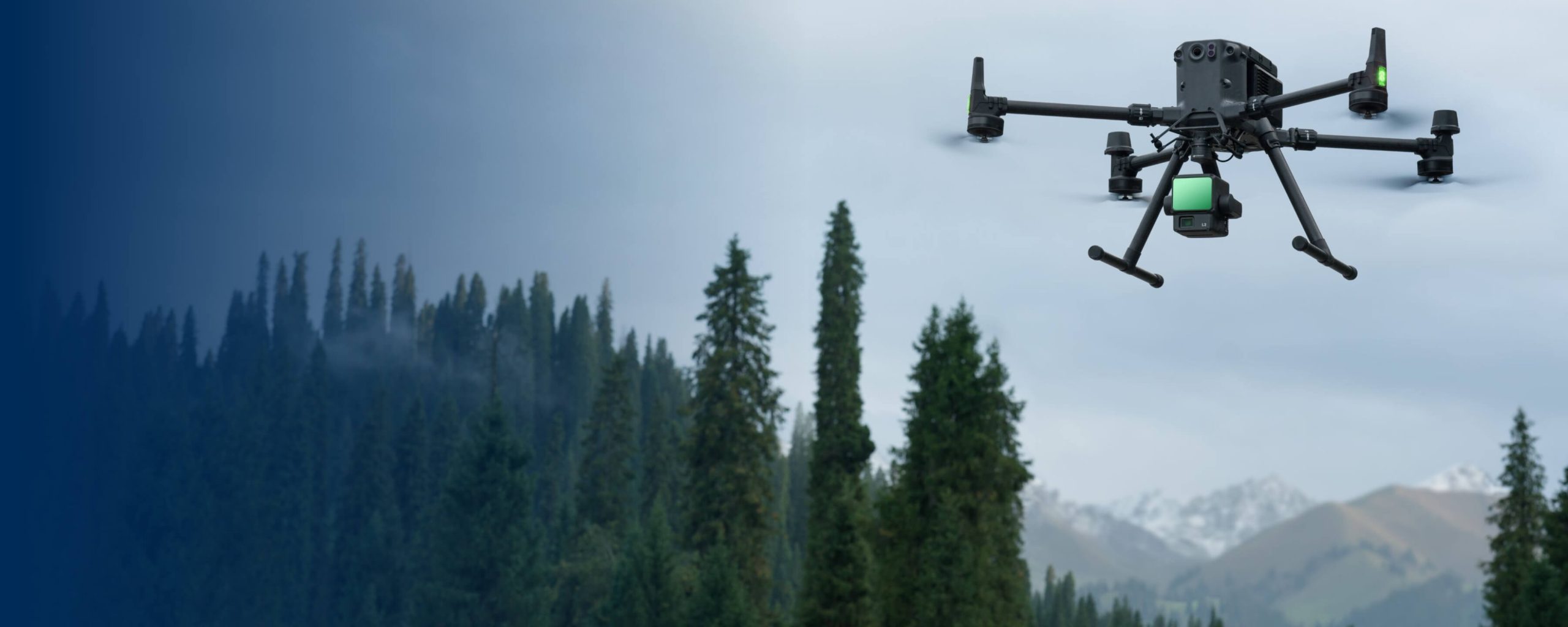
MMC forestry solution revolutionizes forest inventory and management by offering efficient, accurate, and digitized data collection over large areas. Equipped with high-resolution imaging and mapping capabilities, drones streamline forest surveys, enabling precise tracking of tree count, health, and density. This aerial perspective enhances planning, monitoring, and sustainable forest management with reduced labor and time costs.
Painpoints
- – Forest resource surveys are labor-intensive, and traditional methods demand significant manpower. This is particularly challenging in areas with complex geographical features where staff cannot easily access the site for surveys.
- – Conventional survey methods struggle to rapidly, comprehensively, and accurately capture information about the target and its surrounding environment.
Advantages
- Drones are swift and adaptable, capable of quickly reaching and scanning areas of interest without being hindered by terrain or other conditions.
- They generate precise digital models of forests, facilitating effective management of forest inventories.
Solution
Accurate Forest Inventory
Skylle Ⅱ + M100 LiDAR: Forest inventory solution with 3 returns, 720k points/sec, 2.5 km²/flight, and 3D models via LiDAR/photogrammetry.
- 3D modeling: Combines LiDAR (3 returns) and photogrammetry for detailed forest models with one drone.
- Vast coverage: Surveys up to 2.5 km²/flight, ideal for extensive forest inventory projects.
- High-performance LiDAR: 720,000 points/sec and 3 returns capture precise understory/terrain data.
- Versatile outputs: Generates DEM/DSM and advanced point cloud classification for in-depth analysis.
Drone Platform
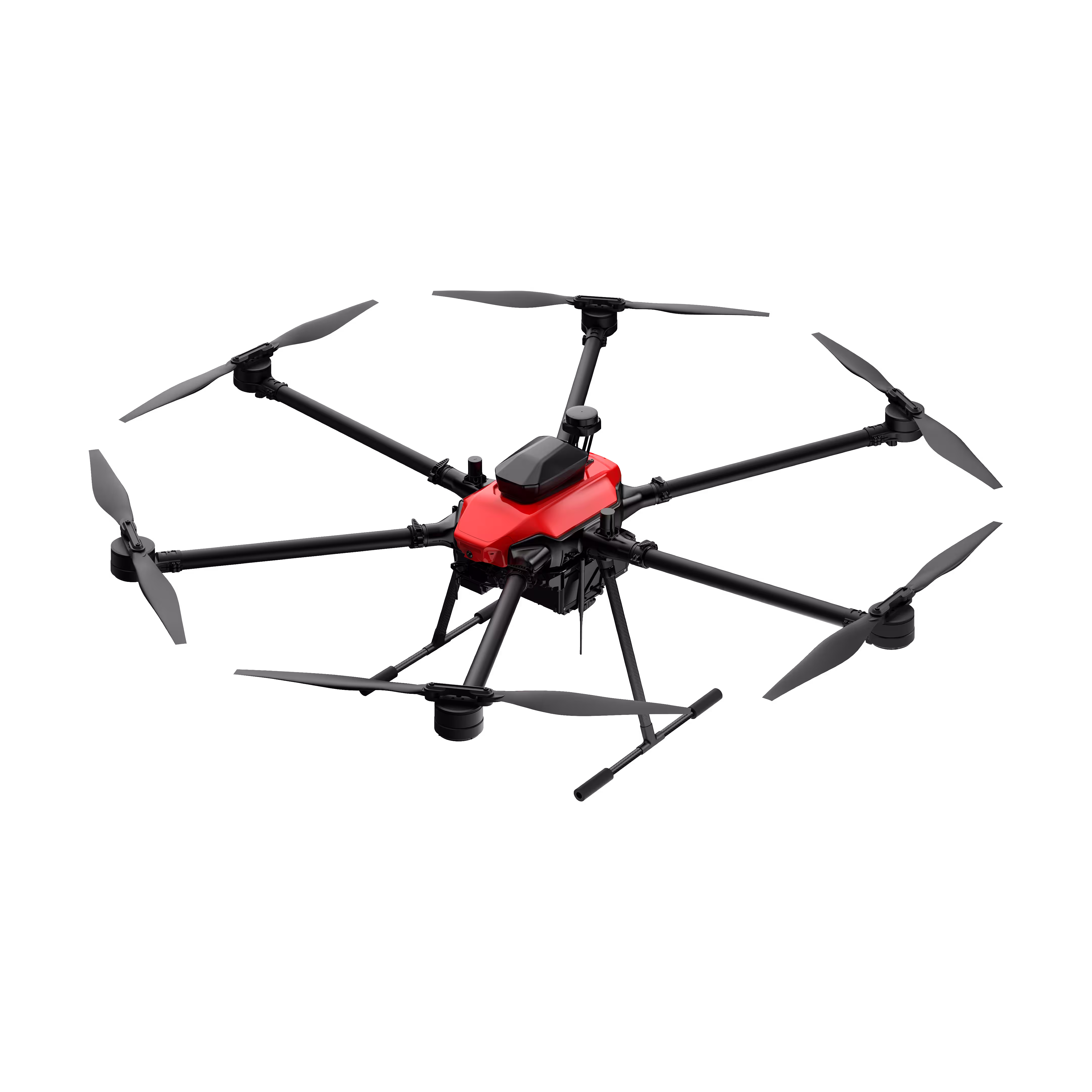
Skylle Ⅱ
Hexacopter Industrial Heavy-Lift Drone - 10kg Payload | 60min Flight Time | RTK cm-Level Positioning | IP54 Rated Read More
Learn MorePayload And Software
Revolutionize Forestry: Skylle Ⅱ + M100 LiDAR – Accurate Forest Inventory for Precision 3D Modeling & In-Depth Analysis
In forestry, precision and scale are everything. From tracking biomass to mapping terrain, forest managers need tools that deliver detailed, actionable data across vast landscapes—without sacrificing accuracy. Introducing the Accurate Forest Inventory Solution: Skylle Ⅱ drone paired with M100 LiDAR sensor. This powerful duo merges photogrammetry and LiDAR in one platform, redefining forest inventory with unmatched efficiency, high-resolution 3D modeling, and comprehensive analytics.
All-in-One 3D Forest Modeling: Photogrammetry + LiDAR, Single Drone
Why choose between photogrammetry and LiDAR when you can have both? Skylle Ⅱ seamlessly integrates M100 LiDAR with its imaging capabilities, capturing both visual data and precise laser point clouds in a single flight. This fusion creates detailed 3D forest models that reveal every tree, canopy layer, and terrain feature—critical for accurate inventory, growth monitoring, and habitat analysis. One drone, endless insights: forestry has never been this streamlined.
Survey 2.5 km² in One Flight: Unrivaled Efficiency for Vast Forests
Large-scale forestry demands efficiency, and Skylle Ⅱ delivers. With optimized flight planning and extended battery life, it surveys up to 2.5 km² in a single flight—enough to cover remote woodlands or commercial plantations in hours, not days. No more fragmented data from multiple flights; just seamless, wide-area coverage that keeps your forest inventory on schedule and under budget.
High-Performance LiDAR: 3 Returns, 720,000 Points/Second
At the core of this solution lies M100 LiDAR’s exceptional power. Its 3-return capability penetrates dense canopies to capture understory and terrain data, while a 720,000 points/second rate ensures dense, accurate point clouds. Whether mapping steep slopes or thick forests, M100 cuts through vegetation to deliver the detail needed for precise tree counting, height measurement, and volume estimation—even in the most challenging environments.
Versatile Outputs & Advanced Classification: Beyond Raw Data
Data is only valuable if it drives action. The solution generates a suite of outputs, including Digital Elevation Models (DEM) for terrain analysis and Digital Surface Models (DSM) for canopy mapping. Plus, advanced point cloud classification automatically distinguishes trees, undergrowth, and ground—enabling in-depth insights like biomass calculation, species distribution, and risk assessment. Turn raw data into strategic forest management decisions, effortlessly.
Why Skylle Ⅱ + M100 LiDAR? Forestry Inventory, Perfected
Skylle Ⅱ’s rugged design thrives in harsh forest conditions—from high humidity to rugged terrain—ensuring reliable performance when you need it most. M100 LiDAR’s precision transforms how you see your forest, turning vast landscapes into actionable 3D models. Together, they eliminate guesswork, reduce field time, and empower forest managers to make data-driven decisions that protect ecosystems and maximize sustainability.
Elevate Your Forest Inventory Today
Whether managing conservation areas, commercial forests, or research plots, Skylle Ⅱ + M100 LiDAR is the tool that grows with your needs. Efficient, accurate, and versatile—it’s not just a solution; it’s the future of forestry inventory.
Ready to Map Smarter?
Unlock the full potential of your forest with Skylle Ⅱ + M100 LiDAR. Precision, efficiency, and 3D clarity—delivered.