Wildfires
MMC’s Wildfires solution uses thermal imaging and live video to spot hotspots, track fire spread, and boost safety and efficiency in large-scale wildfire response.
Painpoints
- – The rapid expansion and unpredictability of wildfires complicate ground crews' ability to evaluate the situation in real time and make accurate decisions.
- – Firefighters face significant risks due to their limited knowledge of the situation.
- – A lack of information makes it difficult for incident commanders to effectively deploy resources and track the effectiveness of mitigation efforts.
Advantages
- Gain real-time aerial insights, enabling firefighters to make informed, strategic decisions amidst the chaos of wildfires.
- Enhance personnel safety with advanced situational awareness, thereby reducing firefighters' exposure to hidden dangers.
- Collect critical data to optimize resource allocation and monitor the impact of firefighting strategies in real time.
Solution
Portable and Rapid Response
- Compact and lightweight design, less than 1kg and easy to carry in the response vehicle.
- Fast and easy deployment, get airborne in around 30 seconds.
- 640 × 480 thermal radiometric sensor for accurate temperature readings.
- Thermal palettes and temperature measurement tools for easy data interpretation.
Drone Platform
X8T
Triple-Camera Thermal Imaging Drone - 48MP | 30X Zoom | 640×480 IR | AI-Powered Night Vision | 47min Flight Time Read More
Learn MorePayload And Software
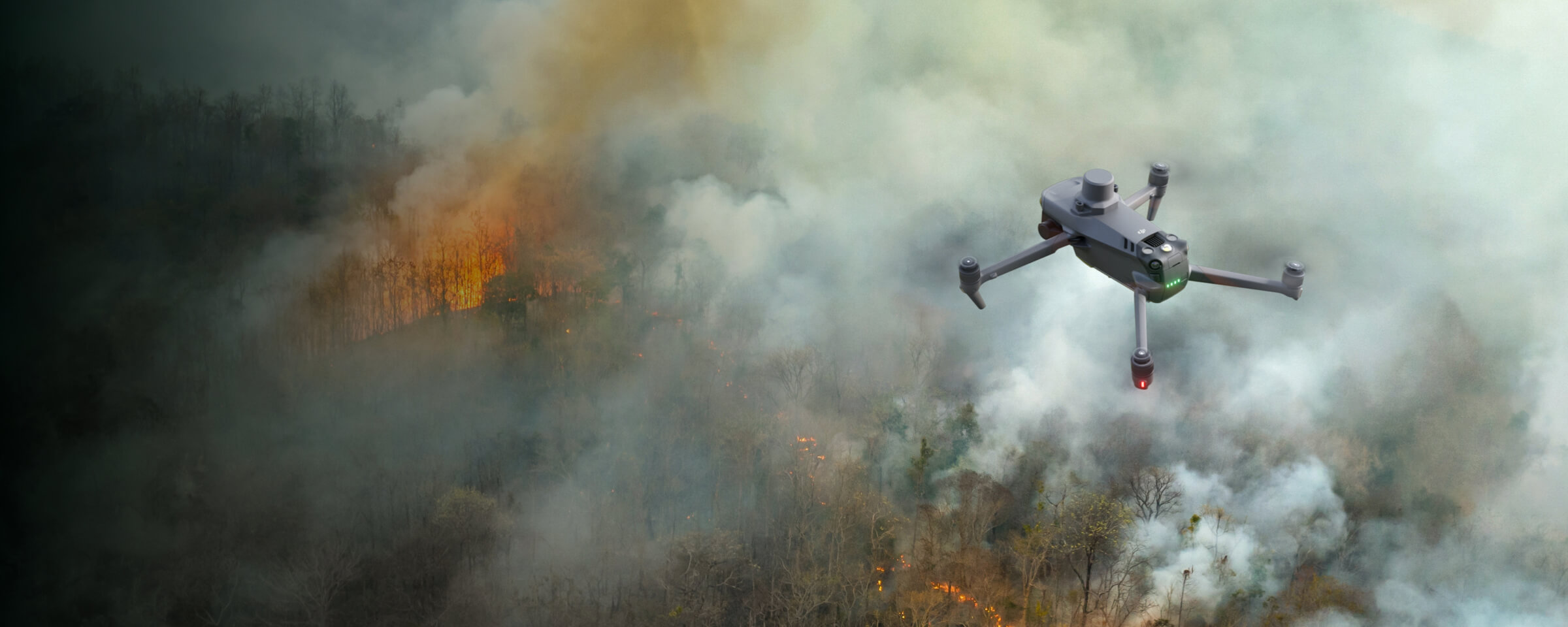
X8T Thermal Drone: Portable and Rapid Response for Wildfires in Firefighting
Compact & Lightweight Design: Easy Transport for Wildfire Response
The X8T features a compact, lightweight design (max takeoff weight ≈1190g) and foldable structure (folded: 218×106×72.6mm), making it easy to carry on fire response vehicles. This portability ensures quick transport to remote wildfire locations, enabling immediate deployment for urgent firefighting missions.
Rapid Deployment: 30-Second Airborne for Urgent Wildfire Missions
Designed for fast and easy deployment, the X8T can get airborne in around 30 seconds. Its quick setup minimizes on-site preparation time, allowing firefighters to swiftly assess wildfire spread, hotspots, and terrain, critical for timely response strategies.
640×480 Thermal Radiometric Sensor: Accurate Temperature Data for Wildfires
Equipped with a 640×480 thermal radiometric sensor, the X8T delivers precise temperature readings essential for wildfire reconnaissance. It identifies hidden hotspots, measures heat intensity, and tracks fire progression, providing reliable data to evaluate wildfire risks and prioritize suppression efforts.
Thermal Palettes & Measurement Tools: Simplifying Wildfire Data Interpretation
The X8T includes thermal palettes (e.g., white热, iron红, rainbow) and temperature measurement tools, simplifying data interpretation for wildfires. These features help firefighters quickly analyze thermal patterns, distinguish active flames from smoldering areas, and make informed decisions during rapid response.
High Performance Fire Response
- Reliable multipurpose drone platform easily adapts to the mission needs.
- Powerful infrared sensor with 640 × 480 resolution provides superb thermal imagery.
- Robust and reliable, IP54 graded, allows you to fly when is most needed.
- Laser range finder to get accurate coordinates of objects up to 3,000 meters.
- Enhanced full-color or black-white night vision to easily identify risks.
Drone Platform
X8T
Triple-Camera Thermal Imaging Drone - 48MP | 30X Zoom | 640×480 IR | AI-Powered Night Vision | 47min Flight Time Read More
Learn MorePayload And Software
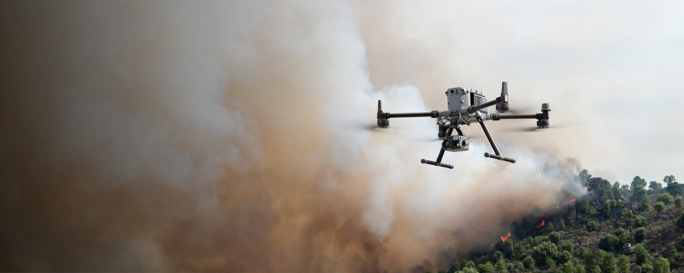
X8T Thermal Drone: High Performance Fire Response for Wildfires
Enhanced Thermal Imaging: 640×480 Infrared Sensor for Wildfire Dynamics
The X8T is equipped with a powerful infrared sensor featuring 640×480 resolution, delivering superb thermal imagery critical for wildfires. This high-definition thermal data enables firefighters to identify hidden hotspots, track fire spread, and assess vegetation or structural heat intensity, enhancing situational awareness during wildfire operations.
Night Scene Mode: Low-Light Operations in Wildfire Response
With the new Night Scene mode, the X8T excels in low-light conditions common in wildfires. Enhanced full-color or black-white night vision capabilities, paired with AI super night vision, allow firefighters to easily identify risks like smoldering embers or rugged terrain, ensuring effective response even after dark.
Robust Design: Reliability in Harsh Wildfire Environments
Built for durability, the X8T operates in temperatures from 0°C to 40°C and resists winds up to 12m/s, ensuring reliability in wildfire conditions. Its robust airframe supports uninterrupted missions, providing critical data when most needed.
Laser Range Finder: Precise Coordinates for Wildfire Tactics
Integrated with a laser range finder, the X8T provides accurate coordinates of objects up to 3,000 meters, aiding in mapping wildfire perimeters and pinpointing critical targets. This tool supports strategic resource deployment and containment efforts.
Versatile Multipurpose Platform: Adapting to Wildfire Missions
As a reliable multipurpose drone platform, the X8T easily adapts to wildfire mission needs, from thermal reconnaissance to risk assessment. Its compact design and smart features streamline operations, enhancing overall wildfire response efficiency.
Versatile Aerial Thermal Reconnaissance
- Rugged, weatherproof mid-size airframe, provides balance between portability and endurance.
- 640 × 480 thermal radiometric sensor for accurate temperature readings.
- Optical zoom for detailed object inspection from a safe distance.
- Laser range finder to get accurate coordinates of targets.
- Hot-swappable batteries and improved charging station for continuous operation.
- Night scene feature provides enhanced awareness for low-light operations.
Drone Platform
X8T
Triple-Camera Thermal Imaging Drone - 48MP | 30X Zoom | 640×480 IR | AI-Powered Night Vision | 47min Flight Time Read More
Learn MorePayload And Software
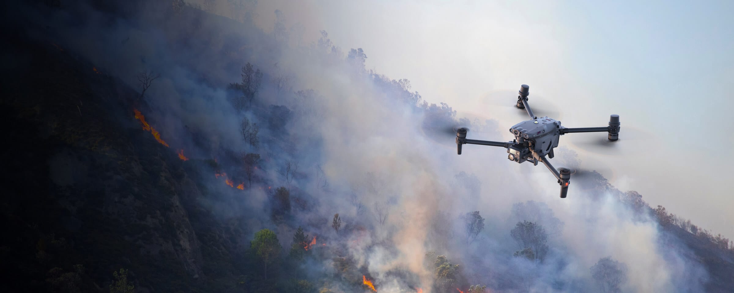
X8T Thermal Drone: Versatile Aerial Thermal Reconnaissance for Wildfires
Balanced Portability & Performance: Adaptable for Wildfire Reconnaissance
The MMC X8T strikes a perfect balance between portability and performance, integrating a hybrid sensor with visual, thermal, and laser range finder capabilities. Its compact folded size (218×106×72.6mm) and lightweight design (≈1190g max takeoff weight) ensure easy transport, while robust features meet diverse wildfire emergency needs.
Rugged Weatherproof Airframe: Endurance in Wildfire Conditions
Featuring a rugged mid-size airframe, the X8T operates reliably in wildfire environments. Withstanding winds up to 12m/s and temperatures from 0°C to 40°C, it balances portability and endurance, ensuring continuous reconnaissance during prolonged wildfire missions.
640×480 Thermal Radiometric Sensor: Accurate Temperature Data for Wildfires
Equipped with a 640×480 thermal radiometric sensor, the X8T delivers accurate temperature readings critical for wildfires. It identifies hidden hotspots, measures heat intensity, and tracks fire spread, providing precise data to evaluate wildfire risks.
Optical Zoom: Safe Distance Inspection of Wildfire Details
The X8T’s 30x hybrid zoom enables detailed object inspection from a safe distance, essential for wildfire operations. Firefighters can analyze terrain, vegetation, or structural damage without proximity risks, enhancing operational safety.
Laser Range Finder: Precise Target Coordinates for Wildfire Tactics
Integrated with a laser range finder, the X8T provides accurate target coordinates, aiding in mapping wildfire perimeters and pinpointing critical hotspots. This tool supports strategic resource deployment and containment efforts.
Hot-Swappable Batteries: Continuous Operation for Prolonged Wildfire Missions
Hot-swappable batteries and an improved charging station ensure the X8T maintains continuous operation. With a 47-minute maximum flight time and 90-minute charging cycle, it minimizes downtime for prolonged wildfire reconnaissance.
Night Scene Feature: Enhanced Low-Light Awareness in Wildfires
The X8T’s night scene feature, paired with AI super night vision, enhances awareness for low-light wildfire operations. It improves visibility of smoldering areas or dark terrain, ensuring round-the-clock reconnaissance capabilities.