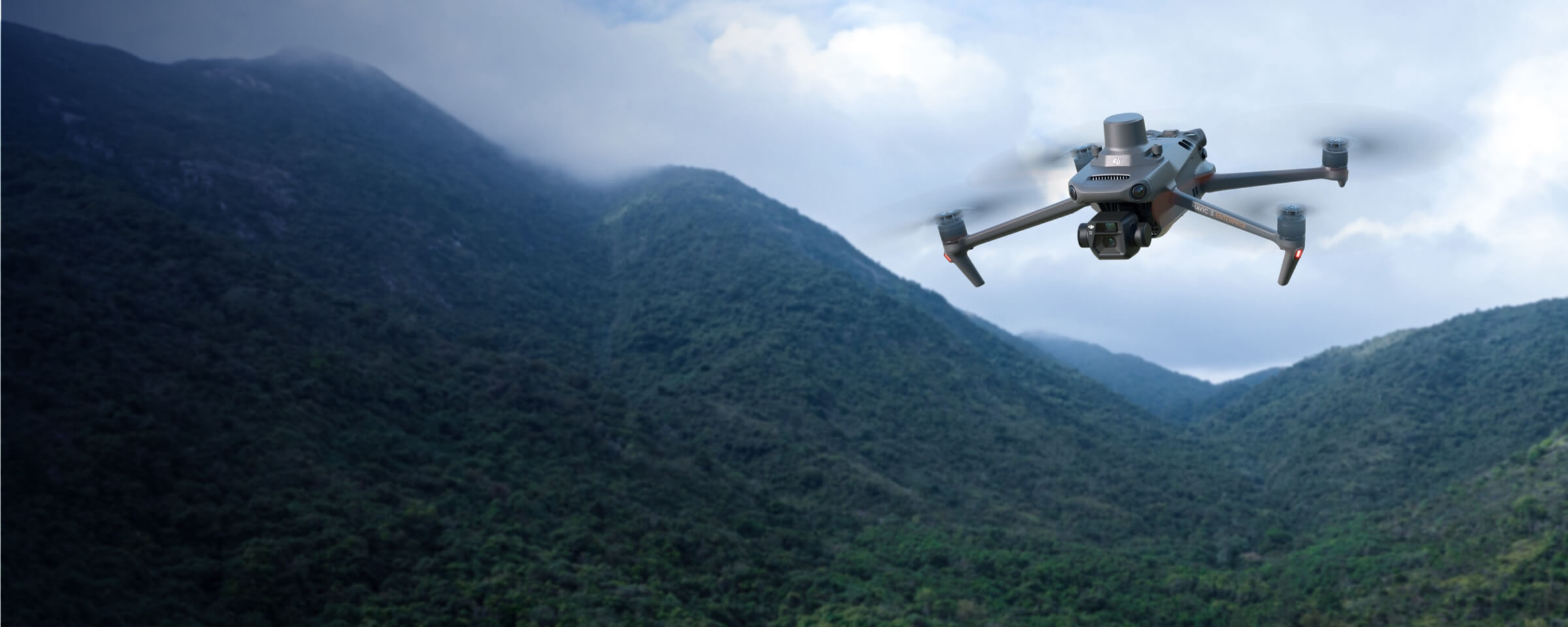
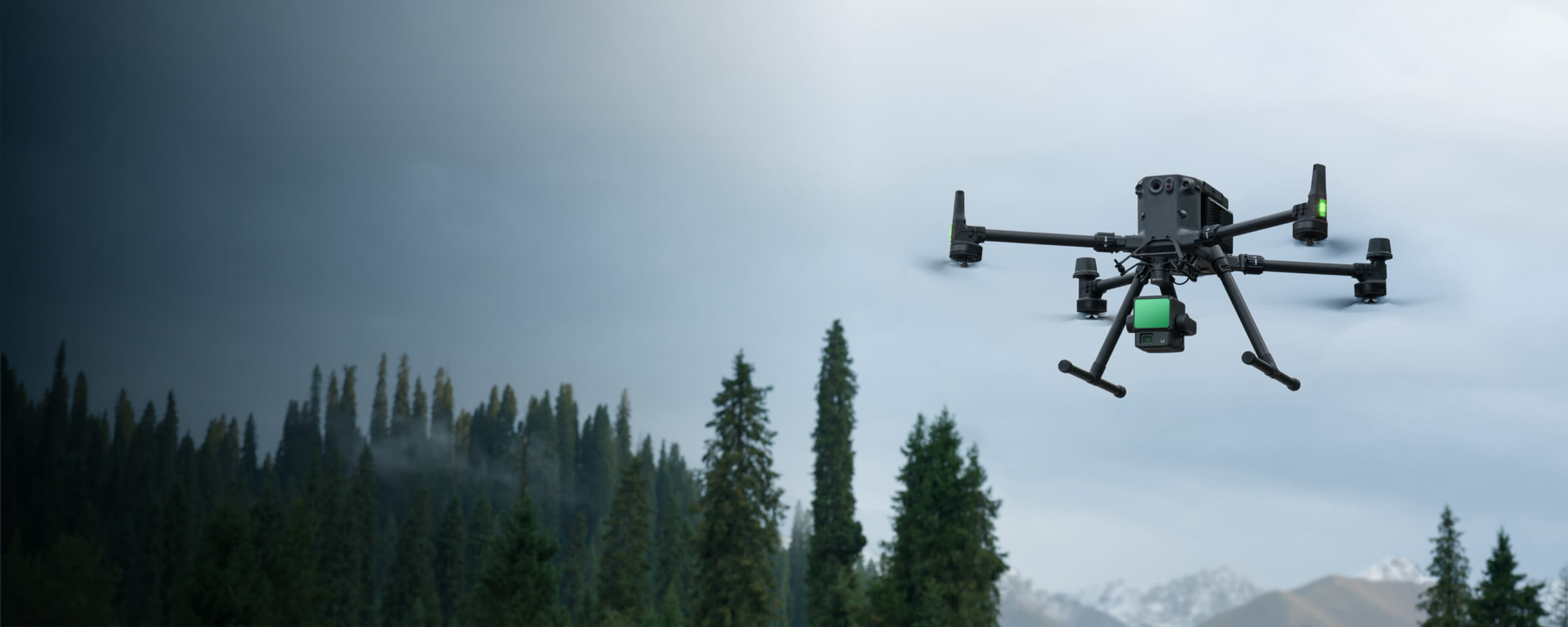
Land Survey
MMC Drones revolutionize land surveying by quickly generating accurate 2D and 3D models, enabling efficient data collection over large areas. With advanced UAV technology, they enhance safety by minimizing personnel exposure to hazardous environments and reduce costs through automated, high-resolution mapping. Ideal for topographic surveys and construction planning, MMC Drones streamline workflows while delivering precise, actionable geospatial data.
Painpoints
- – Field work is slow and inefficient using traditional surveying methods, increasing operational costs and on-site time requirements.
- – Traditional Surveying outputs lack visual references or low resolution, leading to a limited perspective of the landscape.
- – Collecting usable data in complex and remote areas is difficult and hazardous.
- – Frequently tracking landscape changes is inefficient with traditional methods.
Advantages
- Significantly reduce costs and save time by using affordable UAS solutions that automate data collection and processing.
- Visualize results with accurate, high-resolution maps, Point Clouds, and 3D models.
- Reduce personnel risk in hazardous environments with switly aerial data collection.
- Keep digital records that can be easily used for regular land cover comparisons, so teams can more easily and dynamically monitor changes.
Solution
Portable Surveying & Mapping
The integrated solution combines the Skylle Ⅱ-P UAV and MMC X4 Pro camera, delivering a portable, high-precision surveying system for centimeter-level mapping with efficient field coverage and reliable data capture in complex terrains.
- Portable & Rapid Deployment: Lightweight carbon fiber airframe with quick-release arms/landing gear, enabling single-person setup ≤5min; backpack-transportable and total system weight ≤37.5kg for field mobility.
- Centimeter-Level Precision: Integrated RTK/PPK module supporting multi-constellation positioning, achieving 1.0cm+1ppm horizontal and 1.5cm+1ppm vertical accuracy, compatible with mechanical shutter payloads for blur-free imagery and precise POS data.
- High Field Efficiency: 22000mAh dual backup batteries provide 40min flight time at 5kg payload; with 15m/s cruising speed and 0.5km swath width, it covers 2km² per flight.
- Real-Time Terrain Adaptability: Optional 360° omnidirectional obstacle avoidance and laser altimeter enable dynamic altitude adjustment, ensuring consistent data capture over variable terrains.
Drone Platform
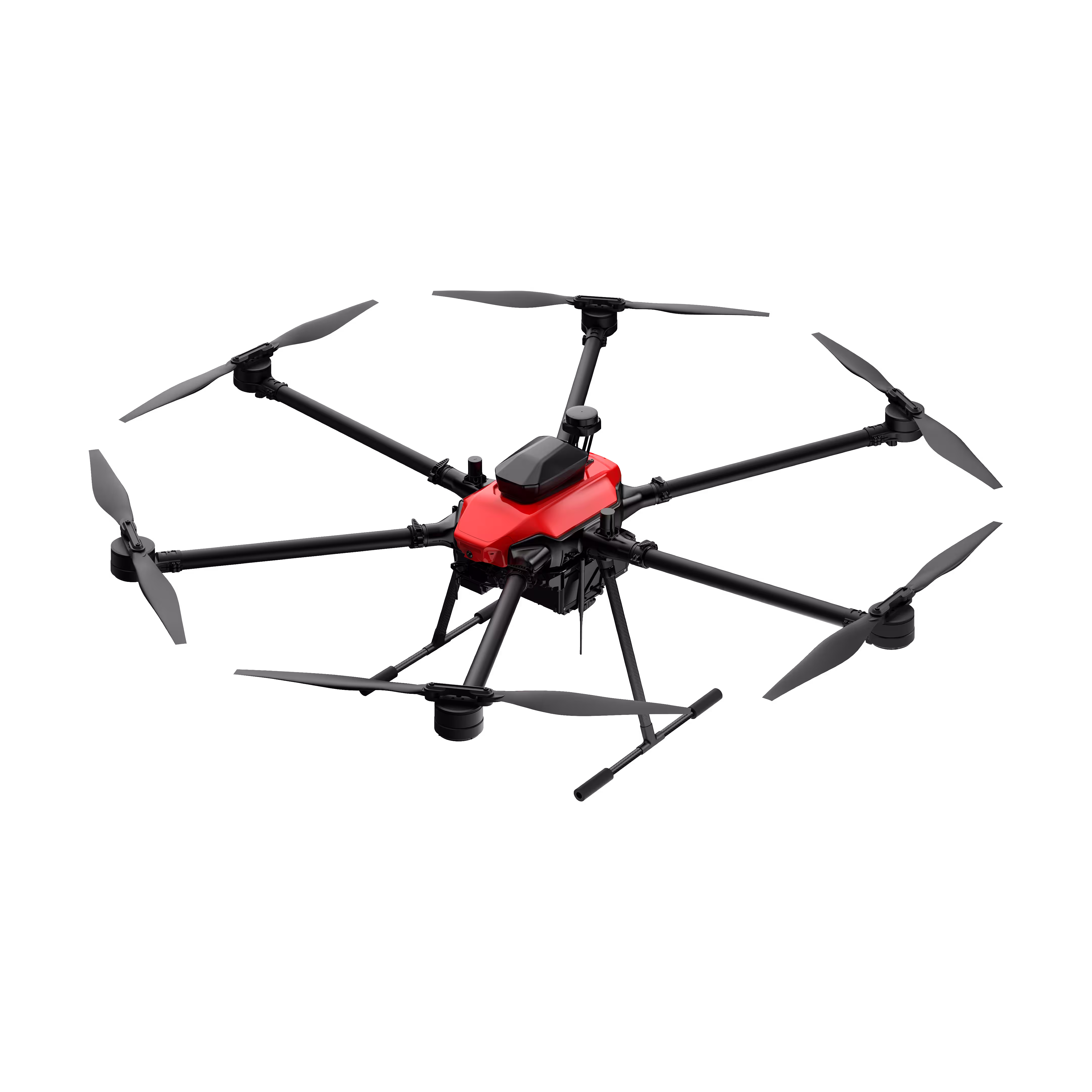
Skylle Ⅱ
Hexacopter Industrial Heavy-Lift Drone - 10kg Payload | 60min Flight Time | RTK cm-Level Positioning | IP54 Rated Read More
Learn MorePayload And Software
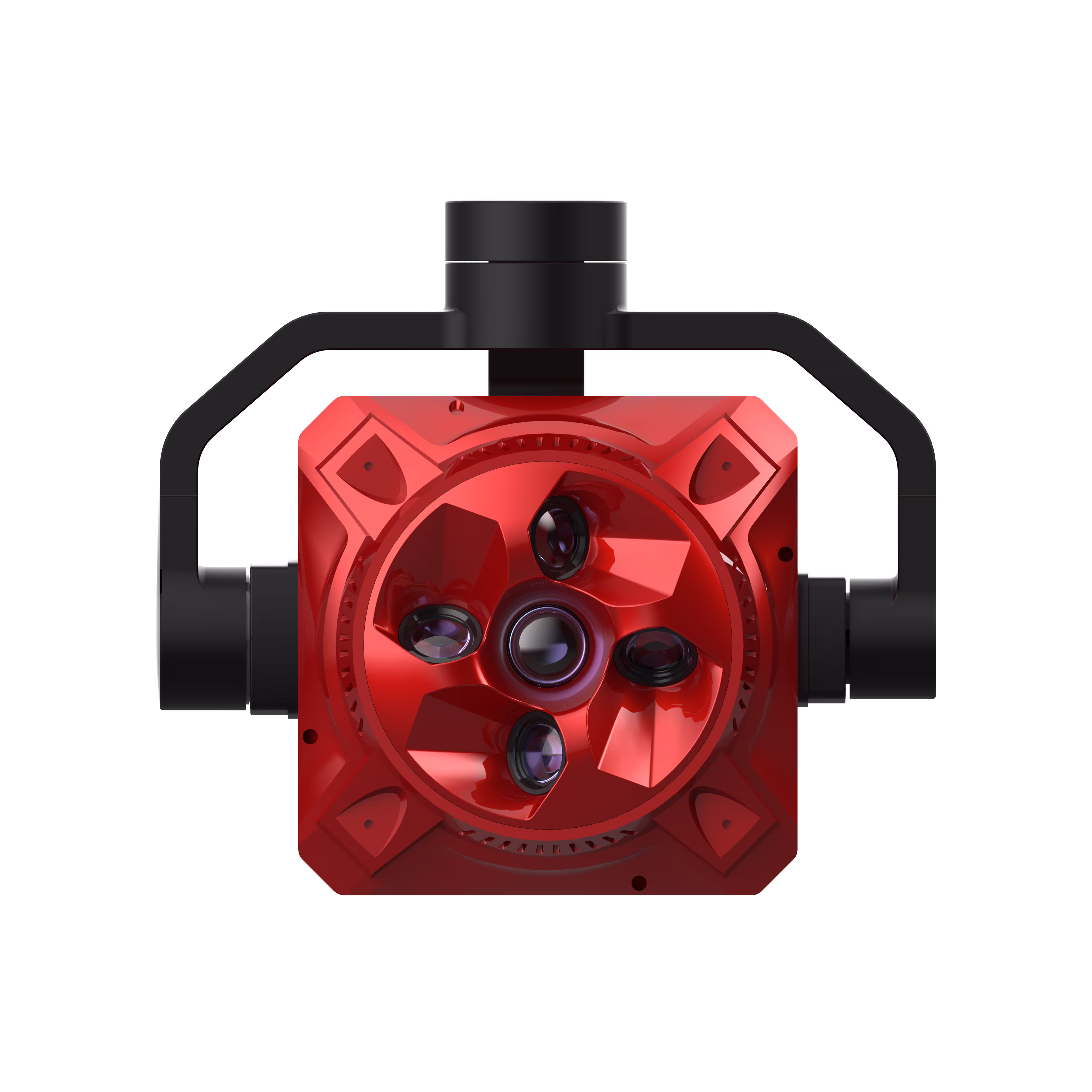
X4 Pro
MMC X4 Pro is a high-performance, multi-purpose aerial survey camera designed for 3D modeling and precision mapping. As a professional five-lens oblique photography system, it breaks through the limitations of traditional single-angle mapping cameras, providing an integrated, high-precision, and efficient aerial survey solution for various mapping scenarios. Read More
Learn MoreSkylle Ⅱ-P UAV and MMC X4 Pro: Advanced Portable Surveying & Mapping Integration
When it comes to high-precision field surveying and mapping, the combination of the Skylle Ⅱ-P unmanned aerial vehicle (UAV) and the MMC X4 Pro orthophoto camera emerges as a game-changing solution. Designed to address the demands of modern surveying tasks—portability, accuracy, efficiency, and adaptability to complex terrains—this integrated system sets a new standard for on-site data collection.
The Skylle Ⅱ-P UAV: Engineered for Mobility and Precision
At the core of this solution is the Skylle Ⅱ-P, a hexacopter UAV built to balance performance with ease of use. Its modular design prioritizes rapid deployment, featuring quick-release arms and detachable landing gear that allow a single operator to set up the system in minutes. Transport is simplified with dedicated backpacks, ensuring the entire platform, including the airframe and accessories, can be easily carried to remote or challenging work sites .
Beyond portability, the Skylle Ⅱ-P excels in data accuracy. Equipped with advanced RTK/PPK positioning technology, it supports multi-constellation satellite navigation (GPS, GLONASS, BDS), delivering centimeter-level horizontal and vertical precision critical for surveying applications. This capability ensures that every image captured by the MMC X4 Pro is geotagged with pinpoint accuracy, laying the foundation for reliable mapping outputs .
Efficiency is another hallmark of the Skylle Ⅱ-P. Powered by dual backup batteries, it achieves a flight time of up to 40 minutes when carrying the MMC X4 Pro, covering expansive areas without frequent recharging. With a cruising speed optimized for surveying, it can complete a 2 km² mapping mission in a single flight, meeting the demands of large-scale projects while minimizing operational downtime .
The MMC X4 Pro: High-Resolution Imaging for Detailed Mapping
Complementing the Skylle Ⅱ-P is the MMC X4 Pro, a specialized orthophoto camera engineered for surveying and mapping. As a key component of the system, it boasts high-resolution imaging capabilities, ensuring sharp, detailed captures even from elevated flight altitudes. Its lightweight design (compatible with the Skylle Ⅱ-P’s payload capacity) and seamless integration with the UAV’s flight control system make it a versatile tool for both novice and expert operators .
The MMC X4 Pro’s mechanical shutter technology eliminates motion blur, a critical feature when capturing images at high speeds, ensuring each frame is crisp and distortion-free. This, combined with the Skylle Ⅱ-P’s stable flight characteristics, results in consistent image overlap and alignment—essential for generating accurate orthomosaics and 3D models .
Synergy in the Field: Why This Combination Stands Out
Together, the Skylle Ⅱ-P and MMC X4 Pro redefine portable surveying. The UAV’s agility and endurance paired with the camera’s precision imaging create a system that thrives in diverse environments, from urban construction sites to rugged rural landscapes. Whether tasked with topographic mapping, infrastructure inspection, or environmental monitoring, this integration delivers reliable, centimeter-level data with unmatched efficiency .
For professionals seeking a balance of mobility, accuracy, and productivity, the Skylle Ⅱ-P and MMC X4 Pro combination represents a comprehensive solution that streamlines fieldwork and elevates mapping outcomes.
Full-Frame High-Performance Surveying & Mapping
In the realm of professional surveying and mapping, precision, efficiency, and adaptability are paramount. The integrated solution of the Skylle Ⅱ-P and MMC X4 Pro full-frame mapping camera redefines high-performance fieldwork, combining cutting-edge aerial mobility with industry-leading imaging technology to deliver centimeter-level data for complex terrains and large-scale projects.
- Unmatched Portability & Rapid Deployment
- Centimeter-Level Precision: RTK/PPK & Full-Frame Synergy
- Field-Proven Efficiency: Maximize Coverage, Minimize Downtime
- Adaptive Terrain Mastery: Real-Time Data Consistency
- Seamless Integration: Plug-and-Play Workflow
Drone Platform
Skylle Ⅱ
Hexacopter Industrial Heavy-Lift Drone - 10kg Payload | 60min Flight Time | RTK cm-Level Positioning | IP54 Rated Read More
Learn MorePayload And Software
X4 Pro
MMC X4 Pro is a high-performance, multi-purpose aerial survey camera designed for 3D modeling and precision mapping. As a professional five-lens oblique photography system, it breaks through the limitations of traditional single-angle mapping cameras, providing an integrated, high-precision, and efficient aerial survey solution for various mapping scenarios. Read More
Learn MoreFull-Frame High-Performance Surveying & Mapping Solution: Skylle Ⅱ-P UAV + MMC X4 Pro Camera
In the realm of professional surveying and mapping, precision, efficiency, and adaptability are paramount. The integrated solution of the Skylle Ⅱ-P unmanned aerial vehicle (UAV) and MMC X4 Pro full-frame mapping camera redefines high-performance fieldwork, combining cutting-edge aerial mobility with industry-leading imaging technology to deliver centimeter-level data for complex terrains and large-scale projects.
1. Unmatched Portability & Rapid Deployment
The Skylle Ⅱ-P UAV features a lightweight carbon fiber integrated airframe, engineered for single-person operability. Its quick-release arms and detachable landing gear enable setup in ≤5 minutes, while backpack-compatible dimensions (airframe: 820mm×750mm×590mm; arms: 800mm×630mm×380mm) and a maximum takeoff weight (MTOW) of ≤37.5kg ensure effortless transport to remote field sites. This design prioritizes mobility without compromising structural integrity, making it ideal for teams requiring rapid response in diverse environments .
2. Centimeter-Level Precision: RTK/PPK & Full-Frame Synergy
At the core of this solution lies unrivaled accuracy. The Skylle Ⅱ-P integrates an advanced RTK/PPK module, supporting multi-constellation positioning (GPS, GLONASS, BDS) to achieve horizontal accuracy of 1.0cm + 1ppm and vertical accuracy of 1.5cm + 1ppm. Paired with the MMC X4 Pro’s mechanical shutter and full-frame sensor, it eliminates motion blur, ensuring blur-free imagery with precise POS data integration—critical for orthophoto generation and 3D modeling .
3. Field-Proven Efficiency: Maximize Coverage, Minimize Downtime
Equipped with dual 22000mAh backup batteries, the Skylle Ⅱ-P delivers 40 minutes of flight time at a 5kg payload (the MMC X4 Pro weighs ~1.5kg). With a cruising speed of 15m/s and a 0.5km swath width (optimized for 5cm ground sampling distance/GSD), it covers 2 km² per flight—enabling large-scale surveys to be completed in fewer missions. The MMC X4 Pro further enhances efficiency with 20MP resolution per lens and 5 synchronized imaging, ensuring 5cm GSD at 100m altitude for detailed terrain reconstruction .
4. Adaptive Terrain Mastery: Real-Time Data Consistency
The Skylle Ⅱ-P’s optional 360° omnidirectional obstacle avoidance (horizontal) and laser altimeter enable dynamic altitude adjustment, ensuring consistent data capture over variable terrains—from rugged mountains to urban landscapes. This adaptability, combined with the MMC X4 Pro’s industrial-grade metal composite body (lightweight yet high-strength), guarantees reliable performance even in harsh field conditions .
5. Seamless Integration: Plug-and-Play Workflow
Designed for user-centric operation, the MMC X4 Pro features a plug-and-play design with a unified signal interface, enabling automatic recognition by the Skylle Ⅱ-P’s flight control system. It supports USB 3.1 data transfer (600MB/s) and Gigabit Ethernet, allowing rapid offloading of field data—eliminating bottlenecks in post-processing workflows .
Conclusion: Redefining Full-Frame Surveying Excellence
The Skylle Ⅱ-P and MMC X4 Pro solution stands as a benchmark for full-frame high-performance surveying, merging portability, precision, and efficiency into a single, integrated system. Whether for 3D modeling, orthophoto generation, or large-scale topographic mapping, it empowers professionals to tackle complex terrains with confidence, delivering actionable data that drives informed decision-making.
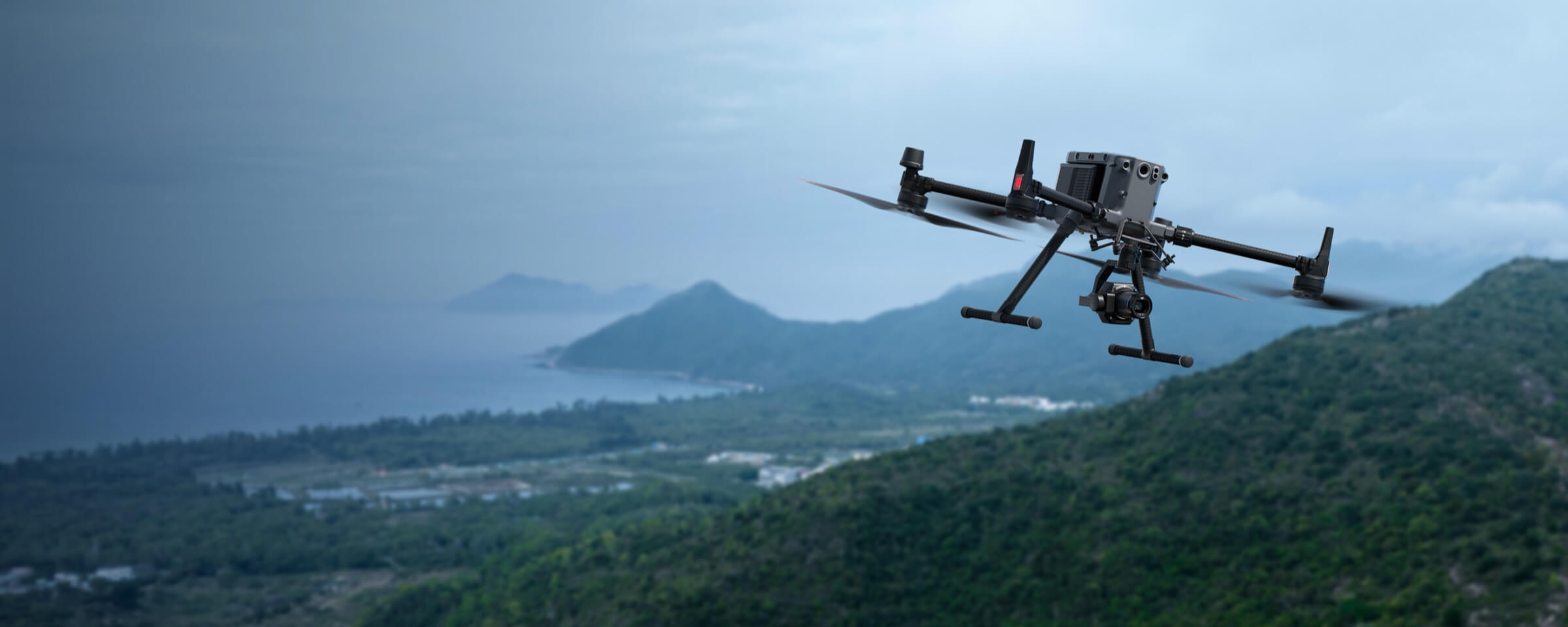
LiDAR Mapping
The Skylle Ⅱ & M100 LiDAR Mapping Solution integrates Skylle Ⅱ with M100 LiDAR sensor, delivering centimeter-level 3D point cloud data for industries like surveying, power inspection, and digital city modeling. With Skylle Ⅱ’s 80-minute endurance and 10kg payload capacity, paired with M100’s 450m range and 5cm@50m accuracy, it ensures efficient, reliable mapping even in harsh environments.
- Ultra-High Precision: Achieves 0.02m horizontal/0.05m vertical POS accuracy and 5cm elevation precision at 50m, powered by high-precision GNSS/INS and solid-state LiDAR.
- Extended Efficiency: Skylle Ⅱ’s 80-minute flight time (no payload) and M100’s 140pts/m² density enable 10km² daily coverage, reducing fieldwork time by 40%.
- High Localization: >99% hardware localization and 100% domestic software ensure data security and freedom from foreign tech barriers.
- Versatile Adaptability: Supports mapping, power line inspection, and forestry inventory, with Skylle Ⅱ’s IP54 protection and -20℃~65℃ operation for all-weather reliability.
Drone Platform
Skylle Ⅱ
Hexacopter Industrial Heavy-Lift Drone - 10kg Payload | 60min Flight Time | RTK cm-Level Positioning | IP54 Rated Read More
Learn MorePayload And Software
Skylle Ⅱ & M100 LiDAR Mapping Solution: Redefining Precision in Aerial Surveying
In the dynamic world of geospatial technology, efficiency, accuracy, and reliability are non-negotiable. Introducing the Skylle Ⅱ & M100 LiDAR Mapping Solution—a groundbreaking integration of the high-performance Skylle Ⅱ UAV platform and the cutting-edge M100 (Dragon LM100) LiDAR sensor. Designed to empower industries with unprecedented 3D spatial data capture, this solution sets new standards for precision mapping, infrastructure inspection, and environmental monitoring.
Solution Overview: Where Power Meets Precision
The Skylle Ⅱ & M100 Solution combines the rugged, long-endurance Skylle Ⅱ hexacopter UAV with the ultra-lightweight, high-accuracy M100 LiDAR sensor. This synergy delivers a turnkey system capable of capturing centimeter-level 3D point clouds and actionable insights across vast terrains, even in challenging environments. Whether for topographic mapping, power line inspection, or digital twin creation, this solution transforms how industries visualize and analyze spatial data.
Core Components: Engineering Excellence
1. Skylle Ⅱ UAV: The Ultimate Flight Platform
Built for industrial resilience, the Skylle Ⅱ hexacopter is engineered to thrive in the harshest conditions. Key features include:
- Robust Airframe: Carbon fiber monocoque construction ensures durability while keeping the airframe weight at 8kg (empty), supporting a maximum payload of 10kg—ideal for integrating the M100 LiDAR and auxiliary sensors.
- Extended Endurance: With dual 22000mAh smart batteries, it achieves 80 minutes of flight time (no payload) and over 40 minutes with the M100, enabling large-area surveys in a single mission.
- All-Weather Reliability: IP54 protection rating resists rain and dust, while operation in -20℃ to 65℃ temperatures ensures performance in extreme climates. Its 6-level wind resistance (12m/s) guarantees stability during data capture.
- Seamless Integration: Quick-release payload interfaces allow 1-minute switching between sensors, while 20km long-range data link ensures real-time monitoring and control.
2. M100 LiDAR Sensor: Precision Redefined
The M100 is a compact, all-in-one LiDAR system that integrates a laser scanner, GNSS positioning, INS navigation, and a 26MP camera into a 1.2kg package. Its technical prowess includes:
- Unmatched Accuracy: Achieves 5cm elevation precision at 50m flight height and 10cm at 100m, powered by high-precision GNSS (GPS/GLONASS/BDS/Galileo) and INS with 0.025° attitude accuracy.
- Extended Range & Density: A 450m maximum range (80% reflectivity) and 140 points/m² density (at 100m altitude, 10m/s speed) ensure detailed data capture over large areas.
- Solid-State Scanning: The state-of-the-art solid-state laser scanner delivers efficient, reliable operation with minimal maintenance, while dual scanning modes (repeatable/non-repeatable) adapt to diverse mapping needs.
- Highly Integrated Design: All critical components (laser, IMU, camera, storage) are integrated into a compact 13.8×9.4×9.1cm enclosure, reducing payload complexity and power consumption to just 20W.
Technical Advantages: Why Choose This Solution?
- Efficiency Redefined: Covers 10 km² per day (5cm resolution), slashing fieldwork time by 40% compared to traditional surveys.
- Made in China, Trusted Globally: With >99% hardware localization and 100% domestic software, the solution avoids supply chain risks and ensures data security.
- Versatile Applications: Seamlessly adapts to mapping, power line inspection, forestry inventory, urban planning, and disaster assessment.
- User-Centric Design: Quick payload swapping, intuitive software, and rugged portability enable single-operator deployment, minimizing training and operational costs.
Applications: Transforming Industries
- Topographic Mapping: Generate high-resolution DEM/DTM for land surveys and construction planning with sub-centimeter accuracy.
- Power Infrastructure: Detect conductor sag, vegetation encroachment, and hardware defects in transmission lines with precision.
- Digital Cities: Create detailed 3D models for urban planning, smart city management, and heritage preservation.
- Forestry & Agriculture: Measure biomass, monitor growth, and assess health with detailed canopy and terrain data.
Join the Mapping Revolution
The Skylle Ⅱ & M100 LiDAR Mapping Solution isn’t just a tool—it’s a catalyst for innovation. By combining industrial-grade durability, pinpoint accuracy, and unmatched efficiency, it empowers professionals to tackle the most demanding spatial data challenges with confidence.
Ready to elevate your surveying capabilities? Contact us today for a demo and discover how this solution can transform your workflow.