Cadastral Survey
MMC Drones' Cadastral Survey Solutions leverage high-accuracy UAS technology to streamline land administration and property mapping. Our drones rapidly capture precise geospatial data, enabling the quick generation of digital cadastral models with centimeter-level accuracy. By replacing traditional ground surveys, we reduce time, costs, and manual errors while improving data reliability—ideal for governments, land registries, and real estate developers.
Painpoints
- – Cadastral surveys usually require collecting large data sets, including data gathered by ground teams in hazardous or inaccessible areas.
- – Traditional cadastral survey methods lack visual data, limiting adequate land-use analysis.
Advantages
- UAS Solutions can cover larger areas than terrestrial surveying tools, improving field data collection efficiency and reducing collection time.
- Keep digital records that can be easily used for regular land cover comparisons, so teams can monitor changes dynamically.
Solution
Portable Surveying & Mapping
The Skylle Ⅱ & M100 Portable Drone Surveying & Mapping Solution integrates the lightweight Skylle Ⅱ hexacopter (10kg empty weight, foldable design) with the 1.2kg M100 LiDAR sensor, delivering a backpack-friendly cadastral survey tool. Ideal for land boundary mapping and legal documentation, it combines 5cm@50m elevation precision, 450m LiDAR range, and 80-minute flight time, enabling quick deployment (<5 minutes setup) and efficient data capture in remote or urban cadastral scenarios.
- Ultra-Portable Design: Skylle Ⅱ’s foldable quick-release arms and backpack-sized carrying case enable effortless transport; M100’s 1.2kg weight ensures the combined system remains lightweight for remote cadastral sites.
- Cadastral-Grade Precision: 0.02m horizontal/0.05m vertical POS accuracy and 5cm elevation precision at 50m, meeting legal standards for boundary delineation and ownership documentation.
- Efficient Fieldwork: 80-minute flight time (Skylle Ⅱ) and 140pts/m² point cloud density (M100) reduce survey time by 60%, covering large cadastral parcels in single missions.
- Rugged Adaptability: IP54 protection and -20℃~65℃ operating temperature (Skylle Ⅱ) ensure reliable performance in harsh cadastral environments, from mountainous terrains to urban areas.
Drone Platform
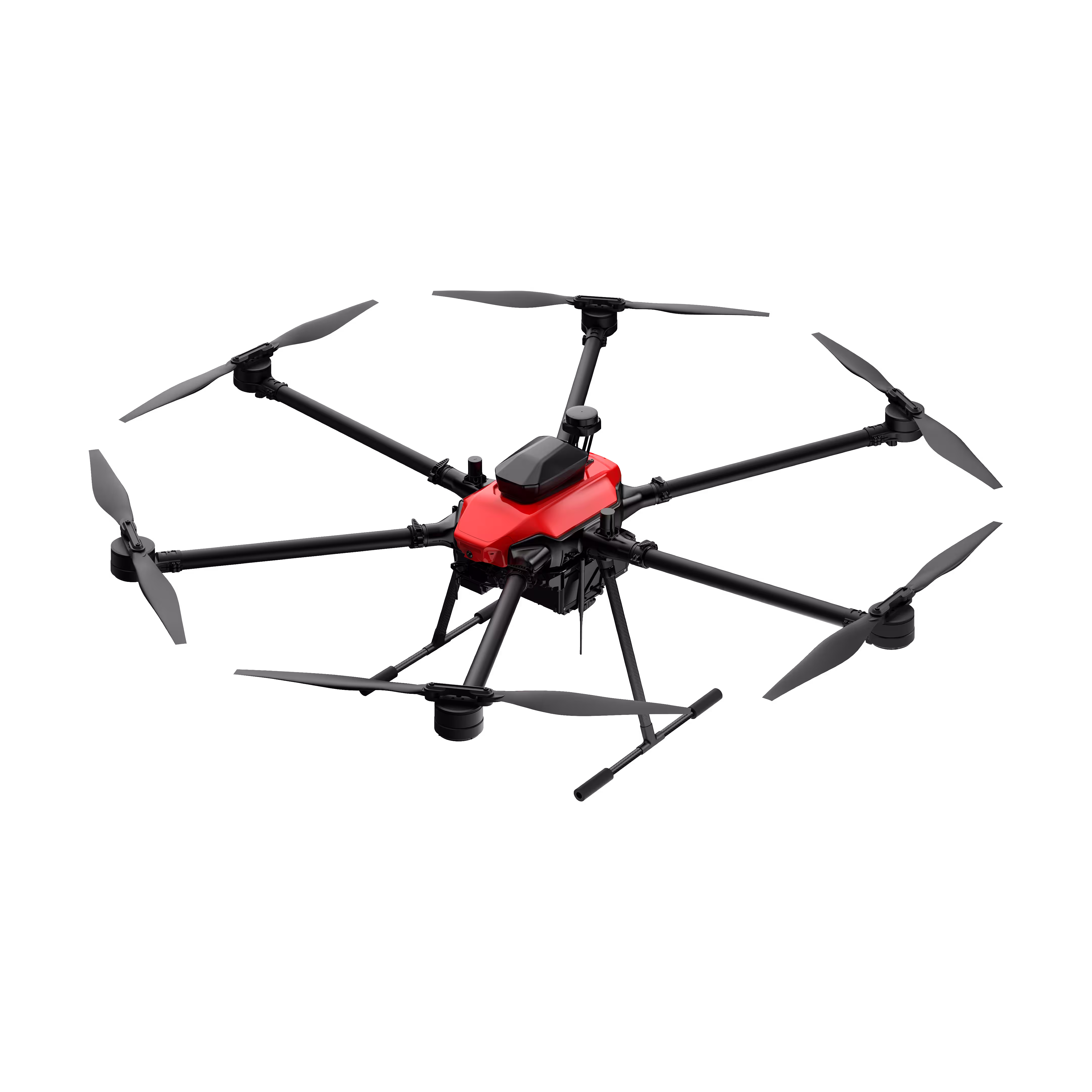
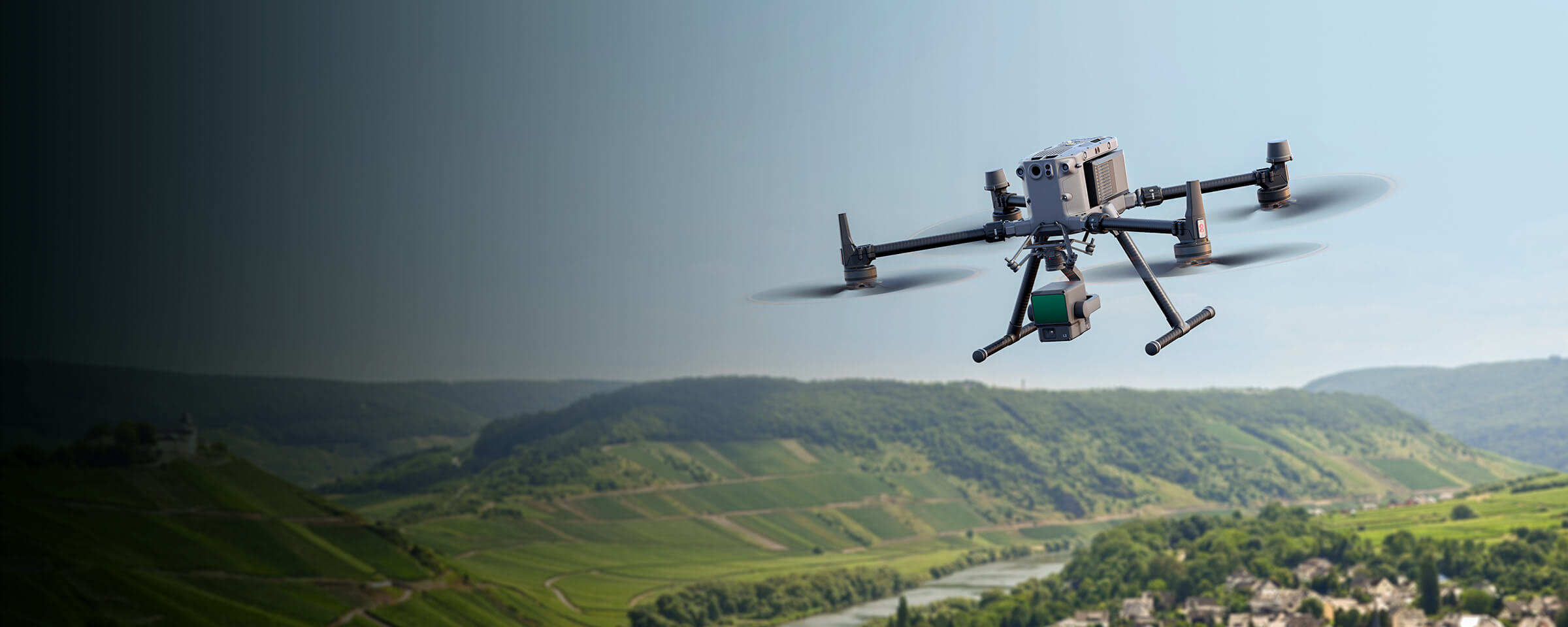
Skylle Ⅱ
Hexacopter Industrial Heavy-Lift Drone - 10kg Payload | 60min Flight Time | RTK cm-Level Positioning | IP54 Rated Read More
Learn MorePayload And Software
Skylle Ⅱ & M100: Portable Drone Solution for Precision Cadastral Survey
Redefine Cadastral Survey with Unmatched Portability
Cadastral survey demands accuracy to map land boundaries, resolve ownership disputes, and support legal documentation—but traditional methods often struggle with bulky equipment, limited access to remote sites, and time-consuming setup. The Skylle Ⅱ & M100 Portable Drone Surveying & Mapping Solution changes the game. Engineered for cadastral surveyors, this integrated system combines the ultra-portable Skylle Ⅱ hexacopter with the lightweight M100 LiDAR sensor, delivering centimeter-level precision in a backpack-friendly package. Now, cadastral survey teams can reach even the most remote terrains, set up in minutes, and capture critical spatial data without sacrificing accuracy.
Portable by Design: From Backpack to Sky in Minutes
Skylle Ⅱ: Built for On-the-Go Cadastral Teams
The Skylle Ⅱ redefines portability for industrial drones. Weighing just 8kg (empty) with a foldable, quick-release design, it fits into a portable carrying case or backpack—no need for trucks or heavy cases. Its carbon fiber frame balances durability and lightness, while quick-release arms and landing gear enable setup in under 5 minutes. Whether hiking to mountainous parcels or navigating narrow urban alleys, surveyors can transport the system effortlessly, turning any location into a launchpad for cadastral data capture.
M100 LiDAR: Lightweight Power for Cadastral Precision
The M100 LiDAR sensor complements Skylle Ⅱ’s portability with its 1.2kg ultra-lightweight build, ensuring the combined system remains easy to carry and deploy. Despite its small size, it delivers the precision cadastral survey requires: 5cm elevation accuracy at 50m flight height and 0.02m horizontal positioning. This means surveyors can capture detailed 3D point clouds—critical for defining property lines and legal boundaries—without hauling heavy ground-based equipment.
Why Portability Matters for Cadastral Survey
Cadastral survey often takes teams to remote, hard-to-reach areas—from rural farmlands to rugged hilltops. The Skylle Ⅱ & M100 Solution eliminates the logistical headaches:
- Backpack-Ready: No bulky gear; the entire system fits in a backpack, making it ideal for hiking or off-road transport.
- Rapid Deployment: 1-minute payload swaps and quick-release components let surveyors start mapping within minutes of arriving on-site.
- Versatile Terrain Access: Skylle Ⅱ’s vertical takeoff and landing (VTOL) capability requires minimal space, adapting to tight urban lots or uneven rural fields.
For cadastral surveyors, portability isn’t just convenience—it’s the key to covering more ground, reducing project timelines, and ensuring no parcel is left unmapped, even in the most remote locations.
Precision Meets Portability: Cadastral Survey Redefined
In cadastral survey, accuracy is non-negotiable. The M100 LiDAR’s 450m range and 140 points/m² density capture detailed topographic data, while Skylle Ⅱ’s 80-minute flight time (with payload) ensures large parcels are mapped in a single mission. This powerful combination delivers the precision needed for legal documentation—all in a system that fits in a backpack.
Ready to Transform Your Cadastral Workflow?
The Skylle Ⅱ & M100 Portable Drone Surveying & Mapping Solution isn’t just a tool—it’s a mobility revolution for cadastral survey. Lightweight, fast to deploy, and packed with precision, it lets you focus on what matters: delivering accurate, legally sound cadastral data, anywhere.
Elevate your cadastral survey with portability and precision. Contact us today.
Full-Frame High-Performance Surveying & Mapping
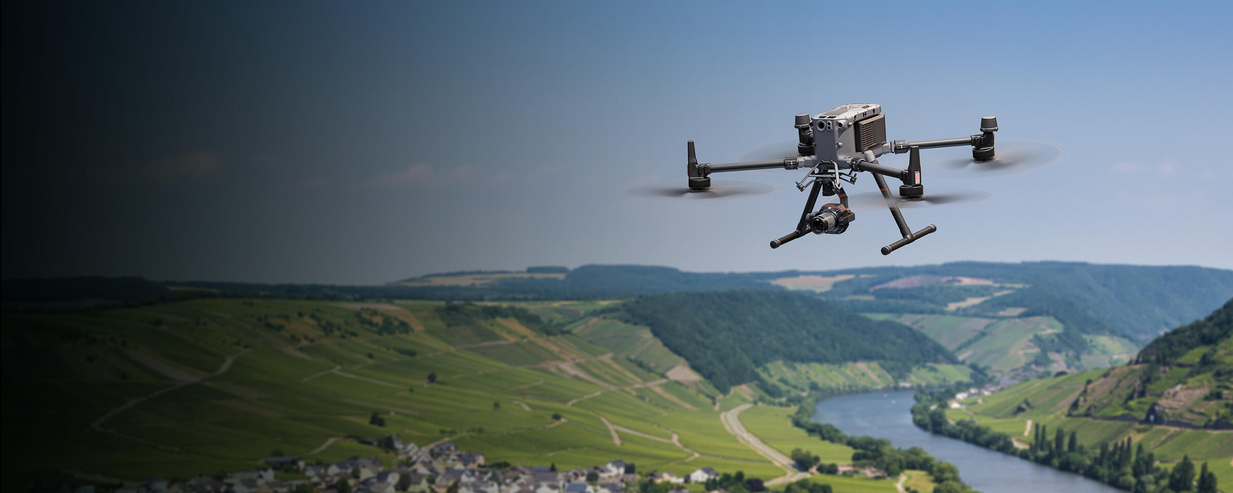
The Skylle Ⅱ and HT18R integration delivers a full-frame high-performance cadastral survey solution, combining Skylle Ⅱ’s rugged carbon fiber build, extended endurance (80-minute flight time), and 10kg payload capacity with HT18R’s tri-axis stabilized multi-sensor array (48MP visible, thermal, and 2000m laser rangefinder). This synergy ensures comprehensive coverage, centimeter-level precision, and adaptability to harsh environments, redefining efficiency in land boundary mapping and spatial data acquisition.
- Full-Frame Sensing Prowess: HT18R’s dual 48MP visible/thermal sensors and laser rangefinder capture detailed, gap-free data from macro to micro scales.
- High-Performance Platform: Skylle Ⅱ’s aerospace-grade carbon fiber construction, IP54 protection, and quick-deploy design enable reliable operations in extreme conditions (-20℃ to 65℃, 12m/s winds).
- Precision & Efficiency: RTK integration and automated workflows ensure centimeter-level accuracy, while 80-minute flight time maximizes daily survey coverage.
- Seamless Adaptability: Modular avionics (5G, RTK, dual-image transmission) and multi-spectral sensing tackle diverse cadastral scenarios, from urban lots to remote terrains.
Drone Platform
Skylle Ⅱ
Hexacopter Industrial Heavy-Lift Drone - 10kg Payload | 60min Flight Time | RTK cm-Level Positioning | IP54 Rated Read More
Learn MorePayload And Software
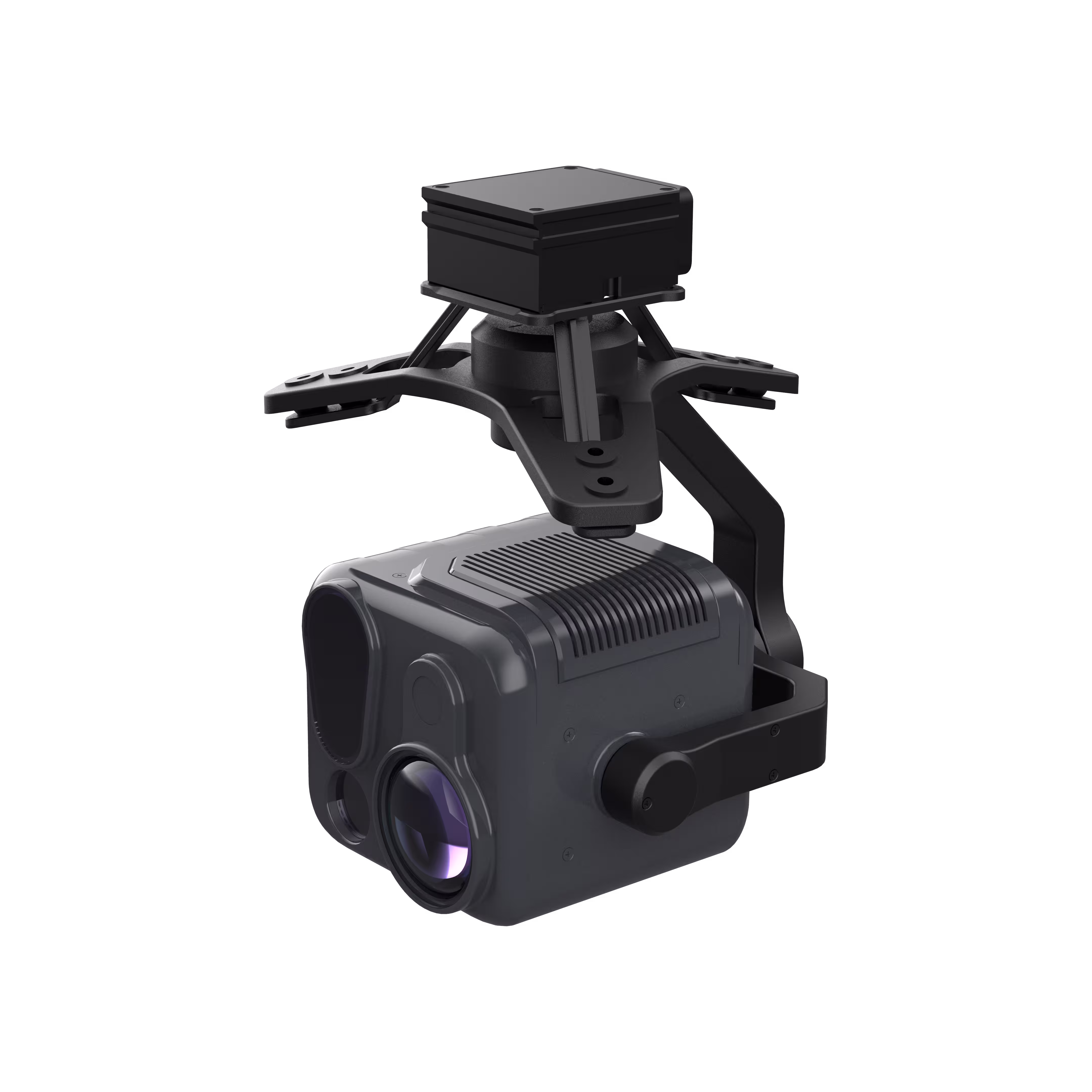
HT18R
Industrial-Grade 4-Sensor Payload Redefining Precision Inspection HT18R Find More Why Choose MMC HT18R? Multi-Sensor Integration Combines 48MP wide-angle/telephoto visible cameras, 640×512 thermal imager, and 2000m laser rangefinder, enabling comprehensive day-night observation and data collection in one payload. Read More
Learn MoreSkylle Ⅱ & HT18R: Redefine Cadastral Survey with Full-Frame High-Performance Mapping Excellence
In the realm of cadastral surveying, precision, efficiency, and adaptability are non-negotiable. Introducing the game-changing combination of Skylle Ⅱ (the next-gen industrial hexacopter) and HT18R (high-precision tri-axis stabilized payload), a full-frame high-performance surveying and mapping solution engineered to elevate land boundary demarcation, topographic mapping, and spatial data acquisition to unprecedented heights.
Skylle Ⅱ: The Powerhouse Platform for Uncompromising Performance
At the core of this solution lies Skylle Ⅱ, a hexacopter built for resilience and efficiency. Crafted with aerospace-grade carbon fiber monocoque construction, it thrives in harsh operational environments—from extreme temperatures (-20℃ to 65℃) to heavy rain (IP54 protection), ensuring uninterrupted missions even in challenging terrains. Its quick-release arms and landing gear enable rapid deployment, while modular avionics with versatile interfaces (supporting 5G, RTK, dual-image transmission, and onboard computers) ensure seamless integration with advanced peripherals, future-proofing your survey capabilities.
Boasting a maximum takeoff weight of 27.2 kg and a 10 kg payload capacity, Skylle Ⅱ effortlessly carries HT18R and auxiliary tools, while dual backup smart batteries deliver an impressive 80-minute no-load flight time—maximizing daily survey coverage. With 6-level wind resistance (12 m/s) and a 20 km image transmission range, it maintains stability and control even in gusty conditions, ensuring consistent data capture across vast areas.
HT18R: Full-Frame Sensing for Hyper-Detailed Data Capture
Complementing Skylle Ⅱ’s robust platform is HT18R, a tri-axis stabilized pod that redefines “full-frame” data acquisition. Equipped with dual 1/2-inch CMOS 48MP visible-light cameras (wide-angle + telephoto) and a 640×512 infrared camera, it captures crisp 6K visible imagery and high-resolution thermal data, ensuring day-night versatility for cadastral surveys. The integrated 2000m laser rangefinder adds precision, enabling accurate distance measurements critical for boundary delineation.
HT18R’s sensors work in intelligent synergy: the wide-angle lens covers large swaths for regional mapping, while the telephoto lens zooms into fine details (e.g., parcel markers, structural edges). The infrared camera penetrates vegetation or low-light conditions, revealing hidden features essential for comprehensive cadastral records. Its tri-axis stabilization (0.01° accuracy) eliminates motion blur, ensuring every pixel counts—even during high-speed flight.
Full-Frame High-Performance: Why It Matters for Cadastral Survey
“Full-frame” isn’t just a buzzword—it’s the foundation of reliable cadastral data. Skylle Ⅱ and HT18R together deliver:
- Comprehensive Coverage: Skylle Ⅱ’s long endurance and HT18R’s multi-sensor array eliminate data gaps, capturing every inch of terrain from macro to micro.
- Unmatched Precision: Centimeter-level positioning (via RTK integration) and high-resolution imaging ensure compliance with strict cadastral accuracy standards.
- Efficiency Redefined: Rapid deployment, extended flight time, and automated data capture reduce field hours, accelerating project delivery.
- Adaptability: From urban lots to remote rural areas, the solution’s rugged design and multi-spectral sensing tackle diverse survey scenarios with ease.
Elevate Your Cadastral Workflow Today
Skylle Ⅱ and HT18R aren’t just tools—they’re a commitment to excellence in cadastral surveying. Whether you’re mapping land boundaries, updating property records, or conducting topographic surveys, this full-frame high-performance solution empowers you to capture more, work smarter, and deliver results that stand the test of time.
Skylle Ⅱ + HT18R: Where full-frame capability meets high-performance engineering—redefining what’s possible in cadastral mapping.
LiDAR Mapping
The integrated solution of Skylle Ⅱ UAV and M100 LiDAR payload revolutionizes cadastral survey with advanced LiDAR mapping capabilities. The M100 delivers centimeter-level precision (0.02m horizontal/0.05m vertical accuracy), 450m max range with 3-echo detection, and high-efficiency scanning (720,000 points/second), while the Skylle Ⅱ provides robust performance (10kg payload, 80-minute flight time) and all-weather reliability, ensuring seamless, high-precision 3D point cloud capture for land parcel mapping.
- Ultra-High Precision: Leverages GNSS/INS integration for 0.02m horizontal and 0.05m vertical positioning accuracy, critical for boundary demarcation.
- Extended Range & Penetration: 450m max range (80% reflectivity) with 3-echo detection captures under-canopy terrain data for complex cadastral scenarios.
- High-Efficiency Scanning: 240kHz pulse frequency and 720,000 points/second (3 echoes) enable rapid coverage of up to 2km² per flight.
- Integrated Imaging: Built-in 26MP camera synchronizes point cloud and photo capture, enhancing feature recognition for land use analysis.
Drone Platform
Skylle Ⅱ
Hexacopter Industrial Heavy-Lift Drone - 10kg Payload | 60min Flight Time | RTK cm-Level Positioning | IP54 Rated Read More
Learn MorePayload And Software
Skylle Ⅱ & M100: Redefining Cadastral Survey with Cutting-Edge LiDAR Mapping
In the realm of cadastral survey, precision, efficiency, and reliability are non-negotiable. The Skylle Ⅱ UAV paired with the M100 LiDAR payload emerges as a game-changing solution, integrating advanced laser scanning technology to deliver centimeter-level 3D point clouds and high-resolution imagery—empowering surveyors to streamline workflows and elevate data accuracy.
LiDAR Excellence: M100’s Core Capabilities
At the heart of this solution lies the M100 LiDAR system, a compact yet powerful module engineered for demanding cadastral scenarios:
- Ultra-High Precision: Leveraging high-precision laser scanning, GNSS post-processing differential positioning, and inertial navigation, the M100 achieves horizontal positioning accuracy of 0.02m, vertical accuracy of 0.05m, and attitude precision of 0.025° (pitch/roll) .
- Extended Range & Penetration: With a maximum range of 450m (80% reflectivity) and 3-echo detection, it effortlessly captures under-canopy terrain data, critical for complex land parcel mapping .
- High-Efficiency Scanning: The solid-state laser scanner boasts a 70.4° horizontal FOV, 240kHz pulse frequency, and 720,000 points/second (3 echoes), ensuring rapid coverage of up to 2km² per flight .
- Integrated Imaging: A built-in 26MP camera synchronizes point cloud and photo capture, enhancing feature recognition for boundary demarcation and land use analysis .
Skylle Ⅱ: The Ideal Platform for LiDAR Deployment
The Skylle Ⅱ UAV, built with aerospace-grade carbon fiber, offers the payload capacity, endurance, and stability required for seamless LiDAR operations:
- Robust Performance: With a max takeoff weight of 27.2kg and 10kg payload capacity, it effortlessly carries the M100 while delivering 80 minutes of flight time for extended missions .
- All-Weather Reliability: IP54 protection and -20°C to 65°C operating temperature range ensure consistent performance in harsh field conditions .
- Rapid Deployment: Quick-release arms and modular design enable setup in minutes, minimizing downtime between surveys .
Why Choose This Integrated Solution?
- End-to-End Localization: The M100 achieves >99% hardware localization and 100% domestic data processing software, ensuring data security and compliance with local regulations .
- Versatile Scanning Modes: Switch between non-repetitive (70.4°×77.2°) and repetitive (70.4°×4.5°) scanning to adapt to varying terrain complexities .
- Seamless Workflow: From rapid data acquisition to one-click point cloud processing, the solution reduces post-survey workload, accelerating deliverables for cadastral projects .
Elevate Your Cadastral Surveys Today
For professionals seeking to transform cadastral mapping with speed, accuracy, and scalability, the Skylle Ⅱ-M100 LiDAR solution sets a new standard. Contact us to explore how this integrated platform can optimize your surveying workflows and deliver actionable geospatial insights.
“Precision redefined—where LiDAR technology meets uncompromising performance.”