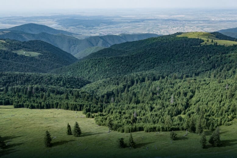
Surveying And Mapping
MMC Drones delivers precise topographic surveys using advanced drone technology, generating 2D/3D maps and terrain models. Our solutions outperform traditional methods with faster data collection, lower costs, and centimeter-level accuracy - ideal for construction, mining, and land development. Automated workflows enhance safety and productivity while reducing errors.
MMC Drone Solutions for Surveying And Mapping
Land Survey
MMC Drones revolutionize land surveying by quickly generating accurate 2D and 3D models, enabling efficient data collection over large areas. They enhance safety by minimizing personnel exposure to hazardous environments and reduce costs through automated, high-resolution mapping.
Cadastral Survey
MMC Drones' Cadastral Survey Solutions leverage high-accuracy UAS technology to streamline land administration and property mapping. Our drones rapidly capture precise geospatial data, enabling the quick generation of digital cadastral models with centimeter-level accuracy. By replacing traditional ground surveys, we reduce time, costs, and manual errors while improving data reliability—ideal for governments, land registries, and real estate developers.
Urban Planning
MMC Drones' Urban Planning Solutions empower city planners and developers with high-precision 2D/3D modeling for smarter decision-making. Our drone-captured data seamlessly integrates with GIS platforms, delivering accurate visualizations of terrain, infrastructure, and development scenarios.
Traditional Challenges for Land Survey
- Field work is slow and inefficient using traditional surveying methods, increasing operational costs and on-site time requirements.
- Traditional Surveying outputs lack visual references or low resolution, leading to a limited perspective of the landscape.
- Collecting usable data in complex and remote areas is difficult and hazardous.
- Frequently tracking landscape changes is inefficient with traditional methods.
How Drones Aid Land Survey
- Significantly reduce costs and save time by using affordable UAS solutions that automate data collection and processing.
- Visualize results with accurate, high-resolution maps, Point Clouds, and 3D models.
- Reduce personnel risk in hazardous environments with switly aerial data collection.
- Keep digital records that can be easily used for regular land cover comparisons, so teams can more easily and dynamically monitor changes.
Related Case Studies
Related Products
Drones
Skylle Ⅱ
Hexacopter Industrial Heavy-Lift Drone - 10kg Payload | 60min Flight Time | RTK cm-Level Positioning | IP54 Rated Read More
Learn More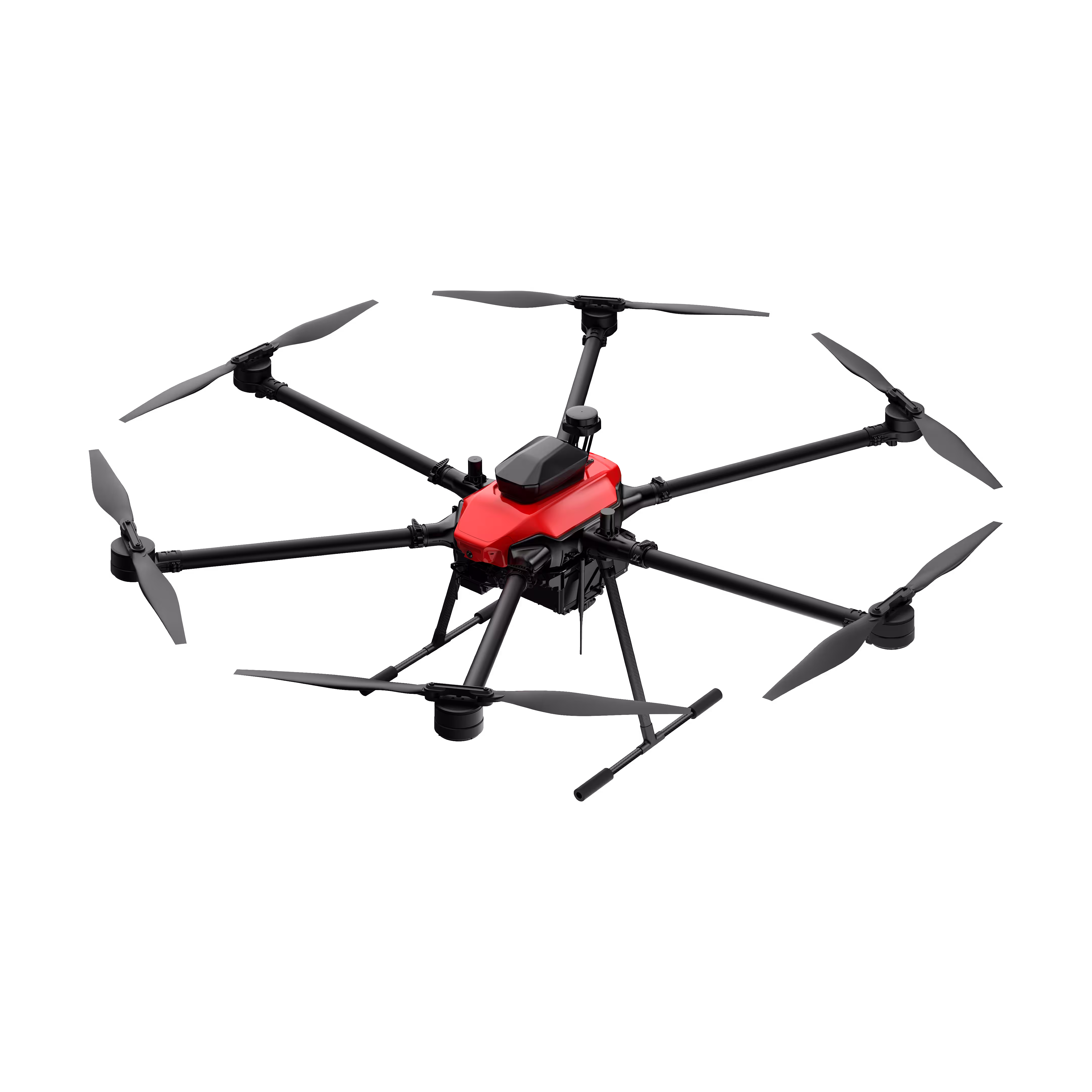
Payloads
X4 Pro
MMC X4 Pro is a high-performance, multi-purpose aerial survey camera designed for 3D modeling and precision mapping. As a professional five-lens oblique photography system, it breaks through the limitations of traditional single-angle mapping cameras, providing an integrated, high-precision, and efficient aerial survey solution for various mapping scenarios. Read More
Learn More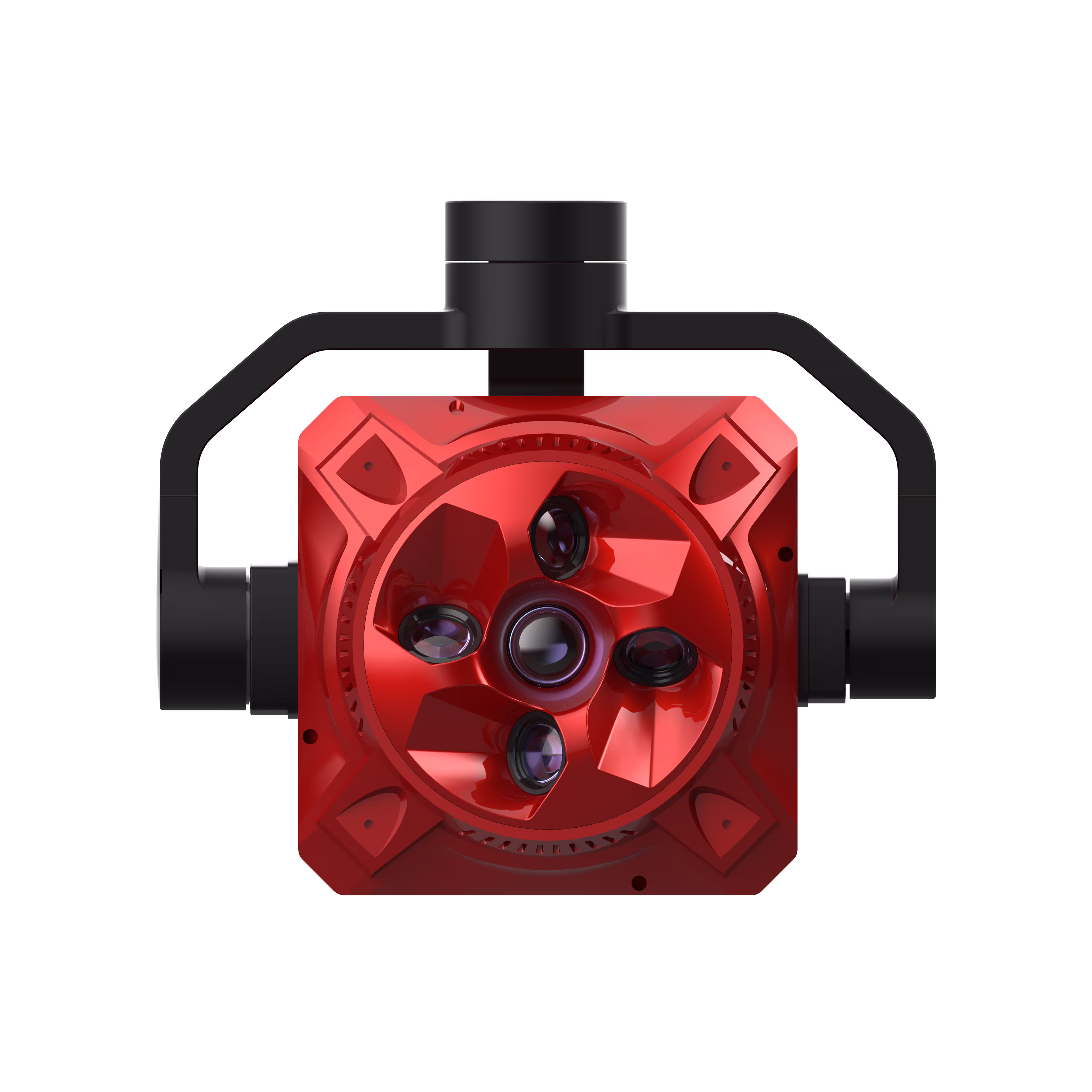

Traditional Challenges for Cadastral Survey
- Cadastral surveys usually require collecting large data sets, including data gathered by ground teams in hazardous or inaccessible areas.
- Traditional cadastral survey methods lack visual data, limiting adequate land-use analysis.
How Drones Aid Cadastral Survey
- UAS Solutions can cover larger areas than terrestrial surveying tools, improving field data collection efficiency and reducing collection time.
- Keep digital records that can be easily used for regular land cover comparisons, so teams can monitor changes dynamically.
Related Case Studies
Related Products
Drones
Skylle Ⅱ
Hexacopter Industrial Heavy-Lift Drone - 10kg Payload | 60min Flight Time | RTK cm-Level Positioning | IP54 Rated Read More
Learn More
Payloads
X4 Pro
MMC X4 Pro is a high-performance, multi-purpose aerial survey camera designed for 3D modeling and precision mapping. As a professional five-lens oblique photography system, it breaks through the limitations of traditional single-angle mapping cameras, providing an integrated, high-precision, and efficient aerial survey solution for various mapping scenarios. Read More
Learn More

Traditional Challenges for Urban Planning
- Land Management and Land Use Planning relies on a combination of low resolution images, physical maps, and contour maps, which are low-resolution and not frequently updated.
- Urban data collection is inefficient and time-consuming due to complex environments.
How Drones Aid Urban Planning
- Keep data accurate and up to date with drone-generated 2D maps and 3D models for more informed design and planning.
- Increase mapping efficiency in cities or rural areas with easy-to-create flight plans, reducing costs and field work duration.
Related Case Studies
Related Products
Drones
Skylle Ⅱ
Hexacopter Industrial Heavy-Lift Drone - 10kg Payload | 60min Flight Time | RTK cm-Level Positioning | IP54 Rated Read More
Learn More
Payloads
X4 Pro
MMC X4 Pro is a high-performance, multi-purpose aerial survey camera designed for 3D modeling and precision mapping. As a professional five-lens oblique photography system, it breaks through the limitations of traditional single-angle mapping cameras, providing an integrated, high-precision, and efficient aerial survey solution for various mapping scenarios. Read More
Learn More