Urban Fires
MMC’s Urban Fires solution uses thermal imaging and real-time aerial views to locate hotspots, improve safety, and enhance response efficiency in city fire emergencies.
Painpoints
- – Firefighters often have little information about the complexity of the situation before entering a structure.
- – Information exchange between fire brigades is often inefficient, hindering the effectiveness of the fire response and the chances of early mitigation.
- – Main fire sources might be hidden under debris, smoke, or flames, making it difficult to identify and extinguish them.
Advantages
- Assess the severity of the incident in real-time and deploy teams to focus on the major sources of fire.
- Monitor the fire incident with a thermal aerial perspective to better coordinate the response and strategically deploy fire brigades.
- Thermal drone imagery can detect different fire sources and their respective temperatures.
Solution
Quick Risk Assessment
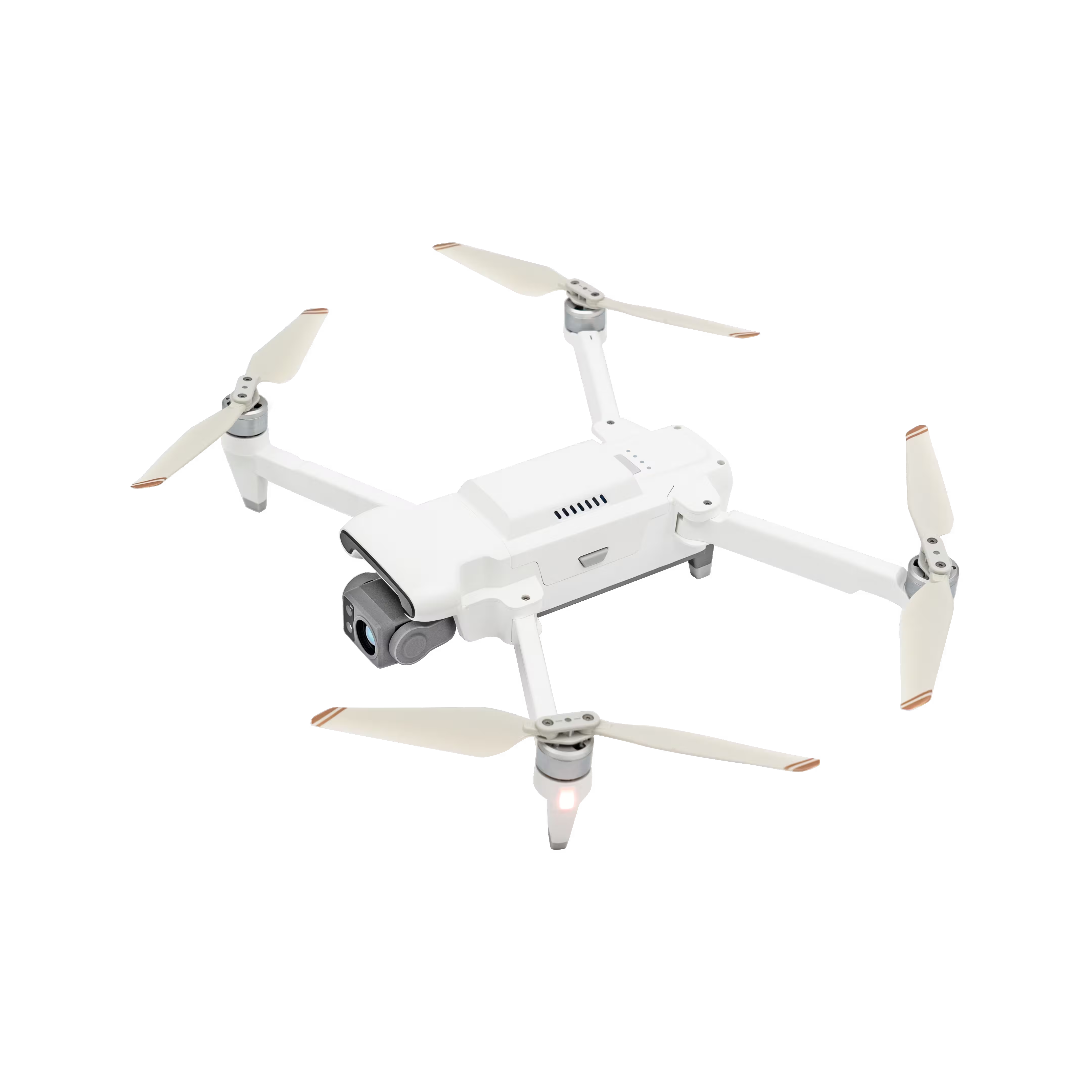
- Compact and lightweight design, less than 1kg and easy to carry in the response vehicle.
- Fast and easy deployment, get airborne in around 30 seconds.
- 640 × 480 thermal radiometric sensor for accurate temperature readings.
- Thermal palettes and temperature measurement tools for easy data interpretation.
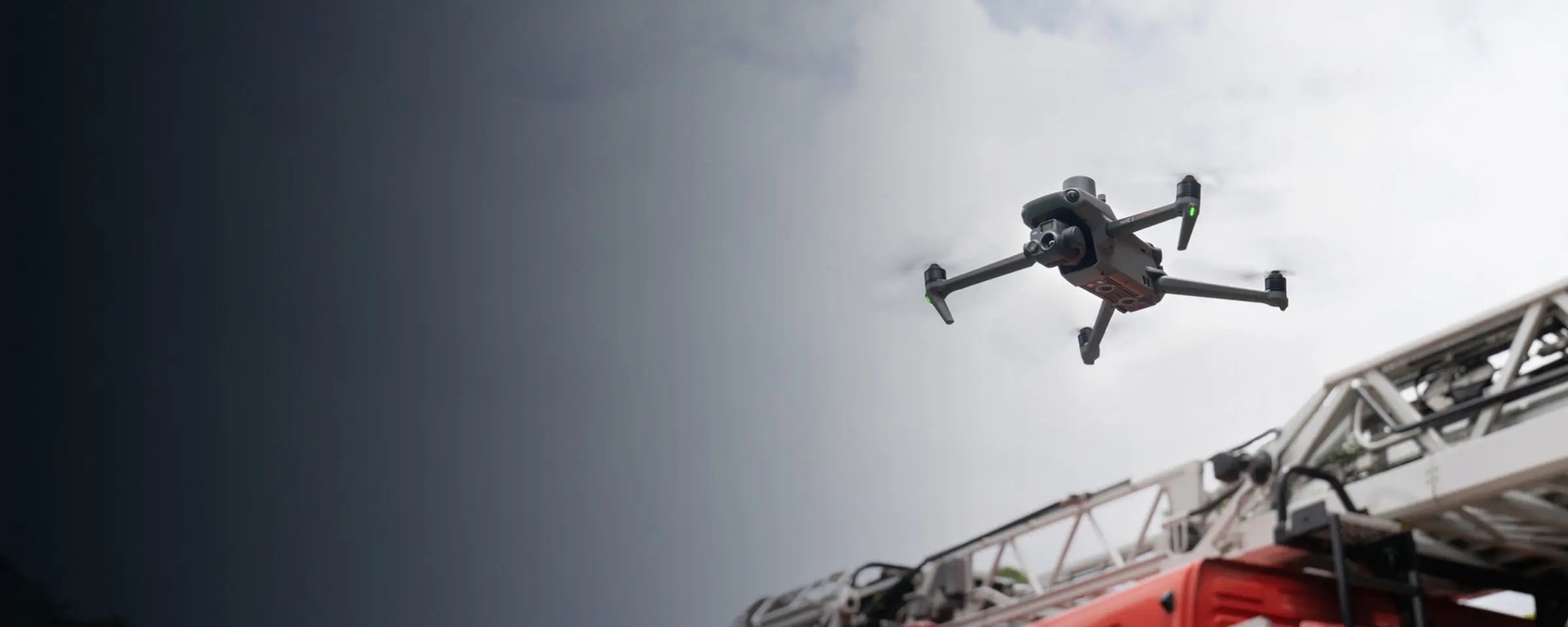
Drone Platform
X8T
Triple-Camera Thermal Imaging Drone - 48MP | 30X Zoom | 640×480 IR | AI-Powered Night Vision | 47min Flight Time Read More
Learn MorePayload And Software
X8T Thermal Drone: Quick Risk Assessment for Urban Fires in Firefighting
Portable Design: Enabling Rapid Urban Fire Response
The X8T features a compact, lightweight design (less than 1kg), easily portable on fire response vehicles. This portability ensures firefighters can quickly transport it to urban fires, enabling immediate deployment for initial risk assessments without delays.
Fast Deployment: Minimizing Response Time in Urban Fires
With fast and easy deployment, the X8T can get airborne in around 30 seconds. Its quick setup reduces on-site preparation time, allowing firefighters to swiftly assess urban fires and prioritize response strategies.
640×480 Thermal Sensor: Accurate Temperature Data for Urban Fires
Equipped with a 640×480 thermal radiometric sensor, the X8T delivers accurate temperature readings critical for urban fires. It identifies hotspots, and measures heat intensity, providing reliable data to evaluate fire risks.
Thermal Palettes & Measurement Tools: Simplifying Urban Fire Data Interpretation
The X8T includes thermal palettes and temperature measurement tools, simplifying data interpretation for urban fires. These features help firefighters quickly analyze thermal patterns, understand fire behavior, and make informed decisions during risk assessments.
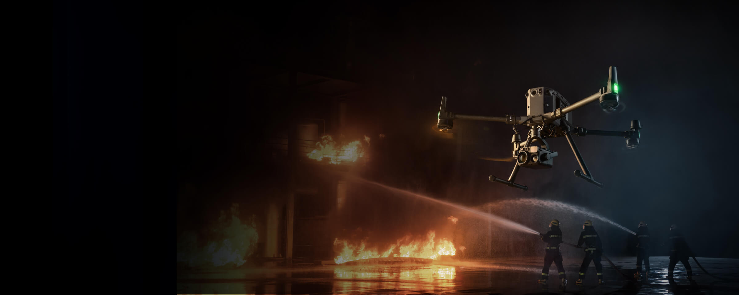
High Performance Fire Response
- Reliable multipurpose drone platform easily adapts to the mission needs.
- Powerful infrared sensor with 640 × 480 resolution provides superb thermal imagery.
- Robust and weatherproof airframe graded IP54, allows you to fly when is most needed.
- Laser range finder to get accurate coordinates of objects up to 3,000 meters range.
- Enhanced full-color or black-white night vision to easily identify risks.
Drone Platform
X8T
Triple-Camera Thermal Imaging Drone - 48MP | 30X Zoom | 640×480 IR | AI-Powered Night Vision | 47min Flight Time Read More
Learn MorePayload And Software
X8T Thermal Drone: High Performance Fire Response for Urban Fires
Enhanced Thermal Imaging: Critical Insight for Urban Fire Dynamics
The X8T is equipped with a powerful infrared sensor featuring 640×480 resolution, delivering superb thermal imagery essential for urban fires. This high-definition thermal data allows firefighters to identify hotspots, track fire spread, and assess structural integrity in real time, enhancing situational awareness during critical operations.
Night Scene Mode: Low-Light Operations in Urban Fire Response
With the new Night Scene mode, the X8T excels in low-light conditions common in urban fires. Enhanced full-color or black-white night vision capabilities enable firefighters to easily identify risks, such as hidden flames or structural hazards, ensuring effective response even after dark.
Robust & Weatherproof Design: Reliability in Urban Fire Environments
The X8T features a robust airframe graded IP54, built to withstand harsh conditions during urban fires. Its durability ensures operation when most needed, providing consistent performance in smoke, rain, or high temperatures, critical for uninterrupted fire response.
Laser Rangefinder: Accurate Target Coordinates for Urban Fire Tactics
Equipped with a laser range finder, the X8T delivers accurate coordinates of objects up to 3,000 meters, supporting precise planning for urban fire suppression. This tool helps定位 hotspots or hazardous areas, enabling targeted and efficient resource deployment.
Versatile Platform: Adapting to Urban Fire Mission Needs
As a reliable multipurpose drone platform, the X8T easily adapts to diverse urban fire response tasks. From initial risk assessment to ongoing monitoring, its flexibility ensures it meets the dynamic demands of firefighting operations, enhancing overall response effectiveness.
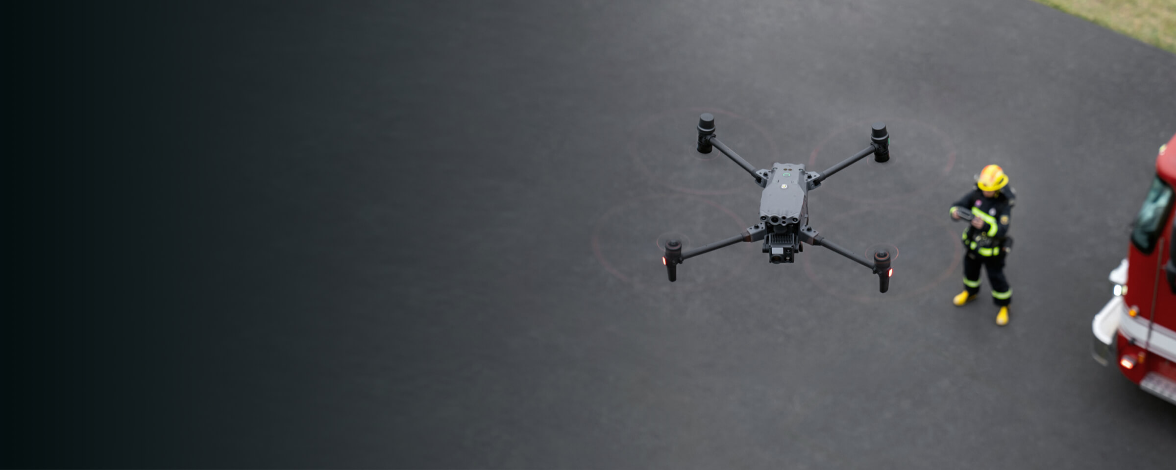
Versatile Aerial Thermal Reconnaissance
- Rugged, weatherproof IP55 mid-size airframe, provides balance between portability and endurance.
- 640 × 480 thermal radiometric sensor for accurate temperature readings.
- Optical zoom for detailed object inspection from a safe distance.
- Laser range finder to get accurate coordinates of targets.
- Hot-swappable batteries and improved charging station for continuous operation.
- Night scene feature provides enhanced awareness for low-light operations.
Drone Platform
X8T
Triple-Camera Thermal Imaging Drone - 48MP | 30X Zoom | 640×480 IR | AI-Powered Night Vision | 47min Flight Time Read More
Learn MorePayload And Software
X8T Thermal Drone: Versatile Aerial Thermal Reconnaissance for Urban Fires
Balanced Portability & Performance: Adaptable for Urban Fire Emergencies
The MMC X8T strikes a perfect balance between portability and performance, integrating a hybrid sensor with visual, thermal, and laser range finder capabilities. Its compact design (folded: 218×106×72.6mm) and lightweight build (≈1190g) ensure easy transport, while robust performance meets diverse urban fire emergency needs.
Rugged IP55 Weatherproof Design: Endurance in Urban Fire Conditions
Featuring a rugged, weatherproof IP55 mid-size airframe, the X8T balances portability and endurance. This durability ensures reliable operation in harsh urban fire environments, from high temperatures to smoke, supporting uninterrupted reconnaissance missions.
640×480 Thermal Radiometric Sensor: Accurate Temperature Insights for Urban Fires
Equipped with a 640×480 thermal radiometric sensor, the X8T delivers accurate temperature readings critical for urban fire reconnaissance. It identifies hotspots, measures heat intensity, and visualizes fire spread, enabling precise risk assessment.
Optical Zoom: Safe Distance Inspection of Urban Fire Details
The X8T’s optical zoom allows detailed object inspection from a safe distance, crucial for urban fire scenarios. With 30x hybrid zoom, firefighters can analyze structural damage or trapped individuals without proximity risks, enhancing operational safety.
Laser Range Finder: Precise Target Coordinates for Urban Fire Tactics
Integrated with a laser range finder, the X8T provides accurate target coordinates, supporting strategic urban fire response. This tool pinpoints hotspots or hazardous areas, enabling targeted resource deployment and efficient suppression efforts.
Continuous Operation: Hot-Swappable Batteries for Uninterrupted Urban Fire Recon
Hot-swappable batteries and an improved charging station ensure the X8T maintains continuous operation during prolonged urban fire missions. Combined with a 47-minute maximum flight time, it minimizes downtime, keeping reconnaissance efforts ongoing.
Night Scene Feature: Enhanced Low-Light Awareness in Urban Fires
The X8T’s night scene feature enhances awareness for low-light urban fire operations. By improving visibility in dark environments, it helps identify hidden risks like smoldering embers or structural weaknesses, ensuring round-the-clock reconnaissance.