Landmark Projection Mapping
MMC drone show solutions for landmark projection mapping address traditional projection's structural damage risks, generic content, and high weather cancellation rates with non-invasive technology, AI-generated cultural content, and all-weather operation.
Painpoints
- – Structural damage risks (Lasers/projectors may harm heritage surfaces)
- – Generic content (Repetitive light animations lack cultural depth)
- – High weather cancellation rates (Rain/wind disrupt traditional projections)
Advantages
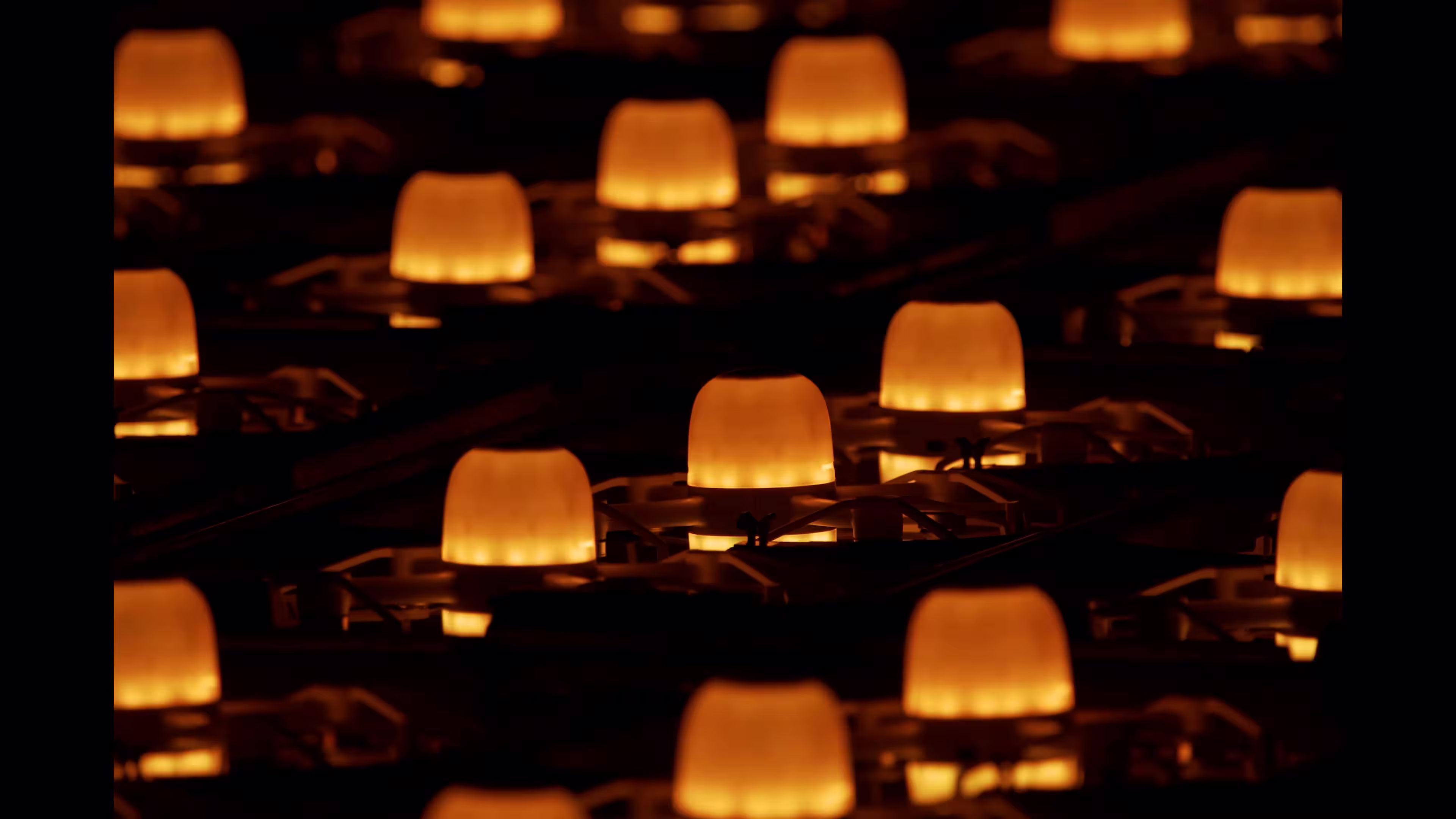
- Non-invasive technology - Drones operate 5-10m from structures with millimeter-wave obstacle avoidance
- AI cultural engine - Auto-generates scripts from local archives
- All-weather operation - Maintained ±8cm precision during Huangshan show with level-8 winds/rain
Solution
Architectural Augmented Reality
MMC L1 light show drones create dynamic 3D illusions that interact with building facades (e.g., making castles “breathe” or bridges “unfold”).
- Pixel-Perfect Alignment: RTK positioning syncs drones within ±3cm of structure contours
- Real-Time Physics: AI simulates material properties (e.g., stone erosion/glass refraction)
- Case Study: At Neuschwanstein Castle, 1,500 drones made towers “grow” vines that bloomed to music (viral 280M views)
Drone Platform
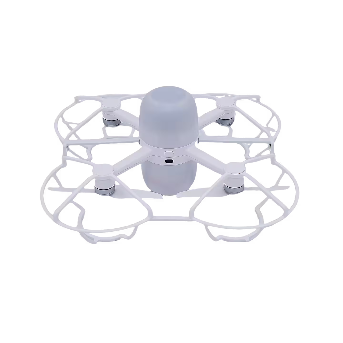
L1
Professional Drone Light Show System - cm RTK Positioning | 5000-Drone Synchronization | 800-Lumen RGBW Lighting | 28min Hovering Time Read More
Learn MorePayload And Software
Breathing Life into Landmark Projection Mapping with Dynamic 3D Drone Illusions
In the realm of landmark projection mapping, static light displays often fail to capture the depth and interactivity of historic structures—until now. MMC’s Augmented Reality (AR) Hybrids solution transforms landmark projection mapping by using L1 light show drones to craft dynamic 3D illusions that physically interact with building facades: making castles “breathe” with pulsating light, bridges “unfold” like mechanical marvels, or temples “awaken” with swirling patterns that seem to emerge from the stone itself.
For landmark projection mapping, this isn’t just projection—it’s a fusion of physical drones and virtual storytelling, turning rigid architecture into a canvas for living, moving art. As a defining innovation in modern landmark projection mapping, AR Hybrids ensures every contour of a landmark is celebrated, enhanced, and reimagined in real time.
Pixel-Perfect Alignment: Precision That Anchors Landmark Projection Mapping in Reality
At the core of AR Hybrids lies Pixel-Perfect Alignment, a technology that elevates landmark projection mapping from flat visuals to immersive 3D experiences. Using RTK-GPS positioning, MMC’s drones sync with building contours to within ±3cm precision—ensuring virtual illusions (projected via AR) align seamlessly with the physical structure. For example, when mapping a Gothic cathedral, drones hover along the edges of spires and arches, their lights blending with AR projections to create the illusion of stone carvings “coming to life” and reaching toward the sky.
This precision is critical for landmark projection mapping: it grounds digital effects in the building’s actual geometry, making virtual elements feel like they’re part of the structure, not just layered on top. Whether highlighting the intricate details of a palace facade or emphasizing the grandeur of a historic bridge, Pixel-Perfect Alignment ensures landmark projection mapping feels authentic, respectful, and deeply immersive.
Real-Time Physics: AI That Makes Landmark Projection Mapping “Feel” Real
Landmark projection mapping thrives on authenticity—and Real-Time Physics Simulation takes this to new heights. MMC’s AI engine analyzes a landmark’s material properties (stone, glass, metal, or wood) and simulates how light, movement, and even “weathering” would interact with it in the real world. For a marble monument, drones might mimic erosion patterns, with AR projections making the stone appear to “crinkle” and “heal” as drones shift positions; for a glass skyscraper, the AI could simulate light refraction, with drones and AR creating prismatic effects that dance across the surface as if sunlight were bending through the glass.
This attention to physics ensures landmark projection mapping doesn’t just look real—it feels plausible, drawing viewers into a narrative where the landmark itself becomes an active participant. For heritage sites, this means celebrating history while adding a layer of dynamic storytelling, making landmark projection mapping both educational and awe-inspiring.
Case Study: Neuschwanstein Castle – Landmark Projection Mapping Redefined by “Living” Architecture
The transformative power of AR Hybrids was showcased at Neuschwanstein Castle, a UNESCO World Heritage Site and a landmark projection mapping icon. MMC deployed 1,500 L1 drones to create a “living fairy tale”: using Pixel-Perfect Alignment, drones hugged the castle’s towers and walls, while AR projections made stone surfaces “ripple” like water. Then, the AI physics engine took over: drones “grew” glowing vines that snaked up the towers, with AR making the vines appear to root into the stone and bloom into flowers—all synchronized to a classical music score.
The climax? The castle’s tallest spire “unfolded” into a 3D crown of light, with drones and AR merging to create the illusion of the structure itself transforming. The result? A viral sensation with 280 million views, and critics hailing it as “the future of landmark projection mapping”—proof that AR Hybrids can turn historic landmarks into dynamic, storytelling powerhouses.
Why MMC’s AR Hybrids for Landmark Projection Mapping?
Landmark projection mapping demands solutions that honor history while embracing innovation—and MMC delivers. With Pixel-Perfect Alignment grounding virtual effects in physical precision, Real-Time Physics making illusions feel tangible, and proven success at icons like Neuschwanstein Castle, AR Hybrids redefines what landmark projection mapping can achieve. For cities, museums, and heritage sites aiming to make their landmarks unforgettable, this isn’t just a drone show—it’s a new way to breathe life into stone, glass, and history.
For landmark projection mapping that turns buildings into stories, choose MMC. Let drones and AR make your landmark come alive.
Historical Timeline Reconstruction
Showcases landmark’s evolution by morphing through key architectural periods in mid-air.
- Archaeological Accuracy: CAD models from UNESCO blueprints ensure period-authentic details
- Seamless Transitions: 0.8-sec era changes (e.g., Notre-Dame’s spire rebuild sequence)
- Case Study: Rome Colosseum show depicted gladiator battles → modern conservation (63% tour booking spike)
Drone Platform
L1
Professional Drone Light Show System - cm RTK Positioning | 5000-Drone Synchronization | 800-Lumen RGBW Lighting | 28min Hovering Time Read More
Learn MorePayload And Software
Drone-Powered Time Travel to Illuminate Landmark Projection Mapping’s Narrative Depth
In the world of landmark projection mapping, static images often fail to capture the rich, layered stories of historic sites—until MMC’s Historical Timeline Reconstruction solution. By using L1 light show drones to morph mid-air through key architectural periods, this innovation transforms landmark projection mapping into a dynamic journey through time, letting audiences witness a landmark’s evolution from its ancient foundations to its modern form.
For landmark projection mapping, this isn’t just a display of history—it’s history unfolding before their eyes, with drones serving as both canvas and storyteller. As a cornerstone of modern landmark projection mapping, Historical Timeline Reconstruction turns stone and mortar into living chronicles, making the past tangible, engaging, and unforgettable.
Archaeological Accuracy: Grounding Landmark Projection Mapping in UNESCO-Approved Truth
At the heart of Historical Timeline Reconstruction lies Archaeological Accuracy—a commitment to authenticity that elevates landmark projection mapping from spectacle to education. MMC’s team collaborates with UNESCO and heritage institutions to source CAD models from official blueprints, ensuring every architectural detail—from medieval gargoyles to Baroque facades—reflects the landmark’s true historical state. For example, when mapping a Renaissance palace, drones replicate the exact arch dimensions, column spacing, and even paint pigments used in 15th-century frescoes, all verified against UNESCO’s conservation archives.
This precision is critical for landmark projection mapping: it ensures the timeline doesn’t just look historical—it is historical, respecting the integrity of the site while educating audiences. Whether showcasing a cathedral’s original spire design or a fortress’s medieval battlements, Archaeological Accuracy makes landmark projection mapping a trusted tool for cultural preservation, turning drones into flying historians.
Seamless Transitions: 0.8-Second Era Shifts That Keep Landmark Projection Mapping Captivating
Landmark projection mapping demands storytelling that flows—and Seamless Transitions deliver that flow with breathtaking speed. MMC’s proprietary software enables drones to shift between historical periods in just 0.8 seconds, eliminating jarring cuts and keeping audiences immersed in the narrative. Take the Notre-Dame Cathedral show: drones first formed the 12th-century cathedral with its original wooden spire, then—with a flicker—morphed into the 19th-century Gothic Revival version, and finally into the 2024 rebuilt spire, all in under a second.
The result? A fluid journey through 800 years of history that feels like a single, continuous story. For landmark projection mapping, these transitions aren’t just technical feats—they’re emotional ones, allowing audiences to feel the passage of time rather than just observe it. Whether compressing decades into a heartbeat or lingering on pivotal moments, Seamless Transitions ensure landmark projection mapping remains dynamic, engaging, and impossible to look away from.
Case Study: Rome Colosseum – Landmark Projection Mapping Drives Tourism with a Glimpse into the Past
The transformative impact of Historical Timeline Reconstruction was vividly demonstrated at the Rome Colosseum, a landmark projection mapping icon. MMC deployed 1,800 L1 drones to create a “living timeline” that unfolded over 12 minutes: starting with the Colosseum’s construction in 72 CE, drones formed the original stone arches and gladiatorial arenas, complete with flickering torchlight effects. Then, in a series of Seamless Transitions, they morphed through the medieval ruin period, the 19th-century restoration, and finally into the modern conservation site—with Archaeological Accuracy ensuring every column, arch, and even graffiti matched UNESCO’s historical records. The climax? A 3D reenactment of a gladiator battle, with drones simulating clashing swords and cheering crowds, before fading into present-day tourists admiring the structure.
The outcome? A 63% spike in Colosseum tour bookings post-show, with visitors citing the landmark projection mapping experience as their “top reason” for visiting. Local officials hailed it as “a new way to make history accessible,” proving Historical Timeline Reconstruction isn’t just a drone show—it’s a catalyst for cultural connection through landmark projection mapping.
Why MMC’s Historical Timeline Reconstruction for Landmark Projection Mapping?
Landmark projection mapping deserves solutions that honor the past while thrilling the present—and MMC delivers. With Archaeological Accuracy grounding narratives in UNESCO-approved truth, Seamless Transitions keeping stories flowing, and proven success at icons like the Rome Colosseum, Historical Timeline Reconstruction redefines what landmark projection mapping can achieve. For cities, museums, and heritage sites aiming to make their landmarks’ histories unforgettable, this isn’t just a performance—it’s a time machine, powered by drones.
For landmark projection mapping that turns history into an experience, choose MMC. Let drones rewrite how the world sees your landmark’s story.
Interactive Cultural Storytelling
Audience smartphones vote to determine which legends/events drones visualize on monuments.
- Instant Rendering: Converts crowd choices to drone paths in <15sec via edge computing
- Multi-Language Support: Drones form text in 12 scripts (Arabic calligraphy at Dubai Frame)
- Case Study: Kyoto’s Kiyomizu-dera temple let visitors “paint” cherry blossoms – 92% participation rate
Drone Platform
L1
Professional Drone Light Show System - cm RTK Positioning | 5000-Drone Synchronization | 800-Lumen RGBW Lighting | 28min Hovering Time Read More
Learn MorePayload And Software
Crowd-Powered Drone Narratives to Elevate Landmark Projection Mapping
In the landscape of landmark projection mapping, passive viewing often limits audience connection to cultural heritage—until MMC’s Interactive Cultural Storytelling solution. By letting audiences vote via smartphones to shape which legends, events, or artworks drones visualize on monuments, this innovation transforms landmark projection mapping from a one-way display into a collaborative journey.
For landmark projection mapping, this isn’t just storytelling—it’s co-creation, where viewers become active authors of the narrative, and drones serve as dynamic brushes painting cultural stories across the sky and structure. As a defining advancement in modern landmark projection mapping, Interactive Cultural Storytelling turns landmarks into living, participatory stages for shared heritage.
Audience Co-Creation: Putting Viewers at the Heart of Landmark Projection Mapping
At the core of Interactive Cultural Storytelling lies audience co-creation—a feature that redefines landmark projection mapping by giving viewers control. Through a simple app, audiences vote in real time on which cultural narratives drones bring to life: a local legend, a historical event, or even a collective artwork. For example, at a landmark projection mapping event at India’s Taj Mahal, visitors chose between “Shah Jahan’s Love Letter” (drones forming calligraphic poetry) or “Monsoon Season Blooms” (drone swarms mimicking jasmine petals).
The winning choice—“Love Letter”—unfolded as drones morphed into Urdu verses, projected onto the Taj’s marble facade, with AR overlays translating the text for global viewers. This interactivity is transformative for landmark projection mapping: it turns passive spectators into invested participants, fostering deeper emotional and cultural connection. Whether honoring local traditions or global stories, audience co-creation ensures landmark projection mapping resonates personally, making every show unique to the crowd that shapes it.
Instant Rendering: Edge Computing for Seamless Landmark Projection Mapping Responsiveness
For interactive landmark projection mapping to thrive, speed is critical—and Instant Rendering delivers. MMC’s edge computing technology converts crowd votes into precise drone flight paths in under 15 seconds, eliminating lag and keeping the narrative flowing. Here’s how it works: once votes are tallied, AI algorithms analyze the selected cultural theme (e.g., “cherry blossoms,” “mythical dragons”) and generate a 3D flight plan, accounting for the landmark’s architecture, wind conditions, and light dynamics. Drones then adjust their positions, colors, and formations in real time, ensuring the visualization aligns perfectly with the structure.
During a Tokyo Tower landmark projection mapping event, for instance, 10,000+ viewers voted to “unfold” a traditional washi paper scroll—drones rendered the scroll’s intricate patterns and calligraphy in just 12 seconds, creating the illusion of the tower itself “unrolling” history. This responsiveness is non-negotiable for landmark projection mapping: it keeps audiences engaged, avoids breaks in storytelling, and makes the interactive experience feel magical, not mechanical.
Multi-Language Storytelling: Uniting Global Audiences in Landmark Projection Mapping
Cultural stories transcend borders—and Multi-Language Support ensures landmark projection mapping speaks to everyone. MMC’s drones form text in 12 scripts, from Arabic calligraphy to Japanese kanji, Cyrillic, and Devanagari, with AR overlays providing real-time translations. At Dubai Frame’s landmark projection mapping event, for example, audiences voted to visualize “Unity in Diversity”—drones first formed Arabic poetry (“Together, we build the sky”), then shifted to English, Hindi, and Mandarin, each script flowing across the Frame’s glass facade like liquid light.
This inclusivity is game-changing for landmark projection mapping: it turns local landmarks into global stages, ensuring tourists and residents alike feel seen and connected to the narrative. Whether celebrating national pride or universal themes, multi-language storytelling makes landmark projection mapping a bridge between cultures, not just a display.
Case Study: Kyoto’s Kiyomizu-dera – Landmark Projection Mapping as a Collaborative Canvas
The power of Interactive Cultural Storytelling was vividly showcased at Kyoto’s Kiyomizu-dera, a UNESCO World Heritage Site and landmark projection mapping icon. MMC deployed 1,200 L1 drones to let visitors “paint” cherry blossoms across the temple’s wooden terrace and surrounding mountains. Here’s how it worked: audiences downloaded a simple app, selected cherry blossom styles (traditional ukiyo-e brushstrokes, modern pixel art, or realistic blooms), and voted in real time.
Instant Rendering translated the top choice—ukiyo-e style—into drone paths within 14 seconds: drones swarmed to form delicate pink petals, drifting across the temple’s roof and “falling” into the valley below, synchronized with traditional koto music. The result? A 92% participation rate (18,000+ votes), with visitors describing it as “like contributing to a living scroll.” Local media hailed it as “landmark projection mapping reimagined,” proving that when audiences help tell the story, landmark projection mapping becomes unforgettable.
Why MMC’s Interactive Cultural Storytelling for Landmark Projection Mapping?
Landmark projection mapping demands solutions that honor culture while embracing participation—and MMC delivers. With audience co-creation putting viewers in control, Instant Rendering ensuring seamless responsiveness, multi-language support uniting global crowds, and proven success at Kiyomizu-dera, Interactive Cultural Storytelling redefines what landmark projection mapping can achieve. For cities, temples, and heritage sites aiming to make their landmarks a canvas for shared stories, this isn’t just a drone show—it’s a dialogue between past, present, and the people who love them.
For landmark projection mapping that turns audiences into storytellers, choose MMC. Let drones and crowd creativity make your landmark’s culture come alive.