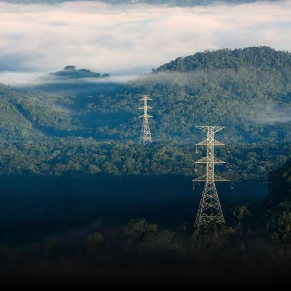
Power & Utility Inspectors: See the Invisible, Fix the Unseen
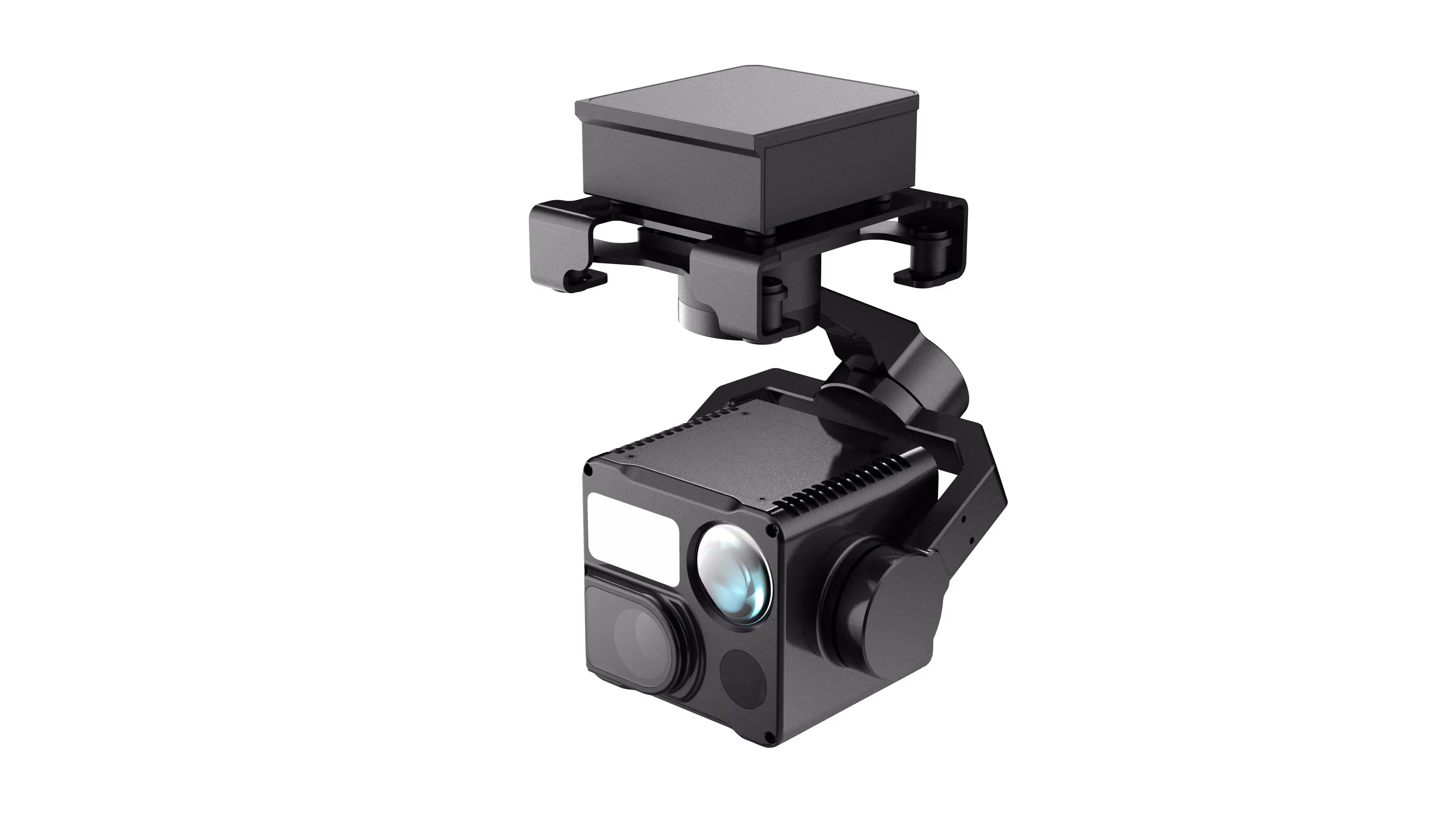
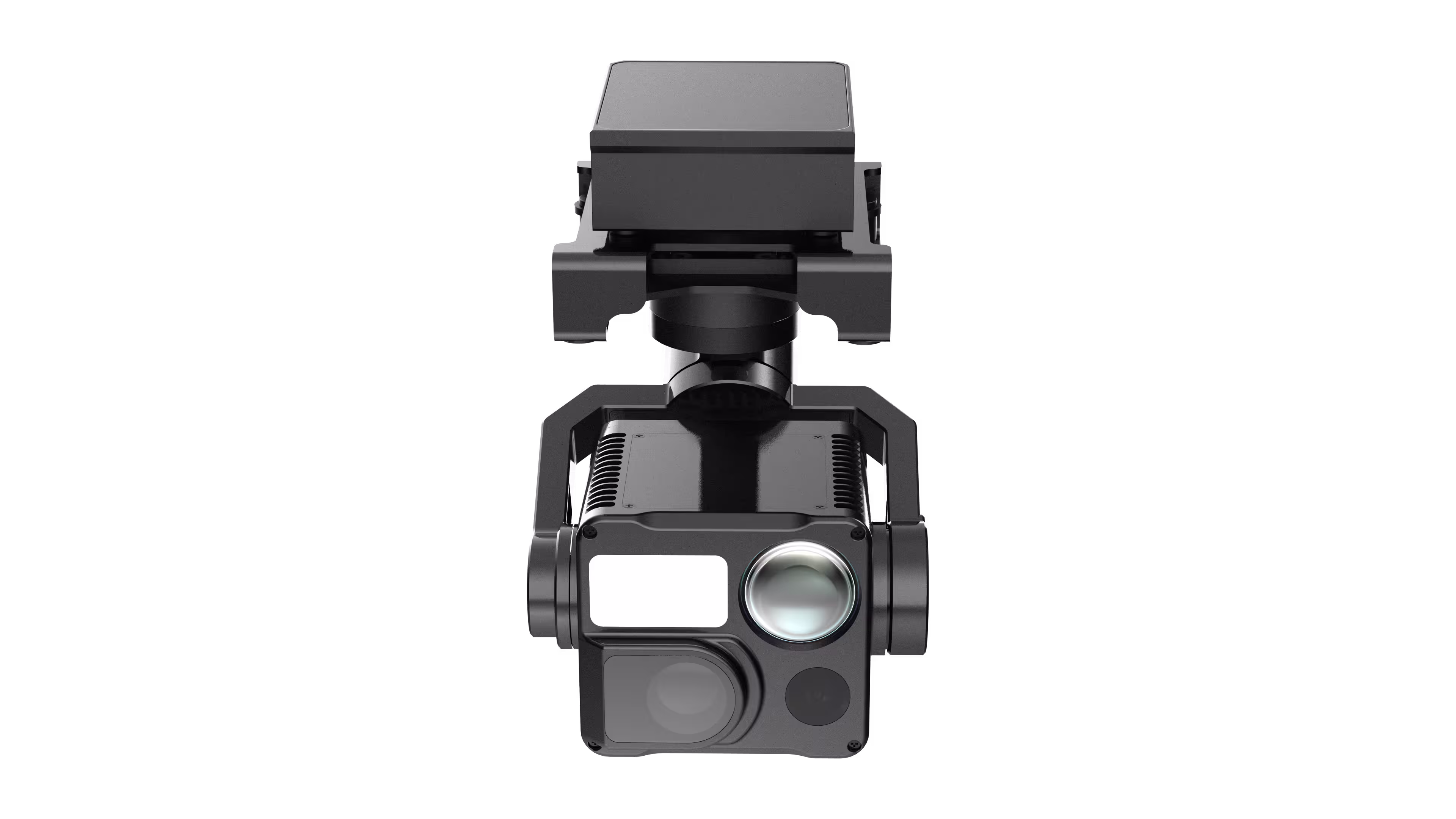
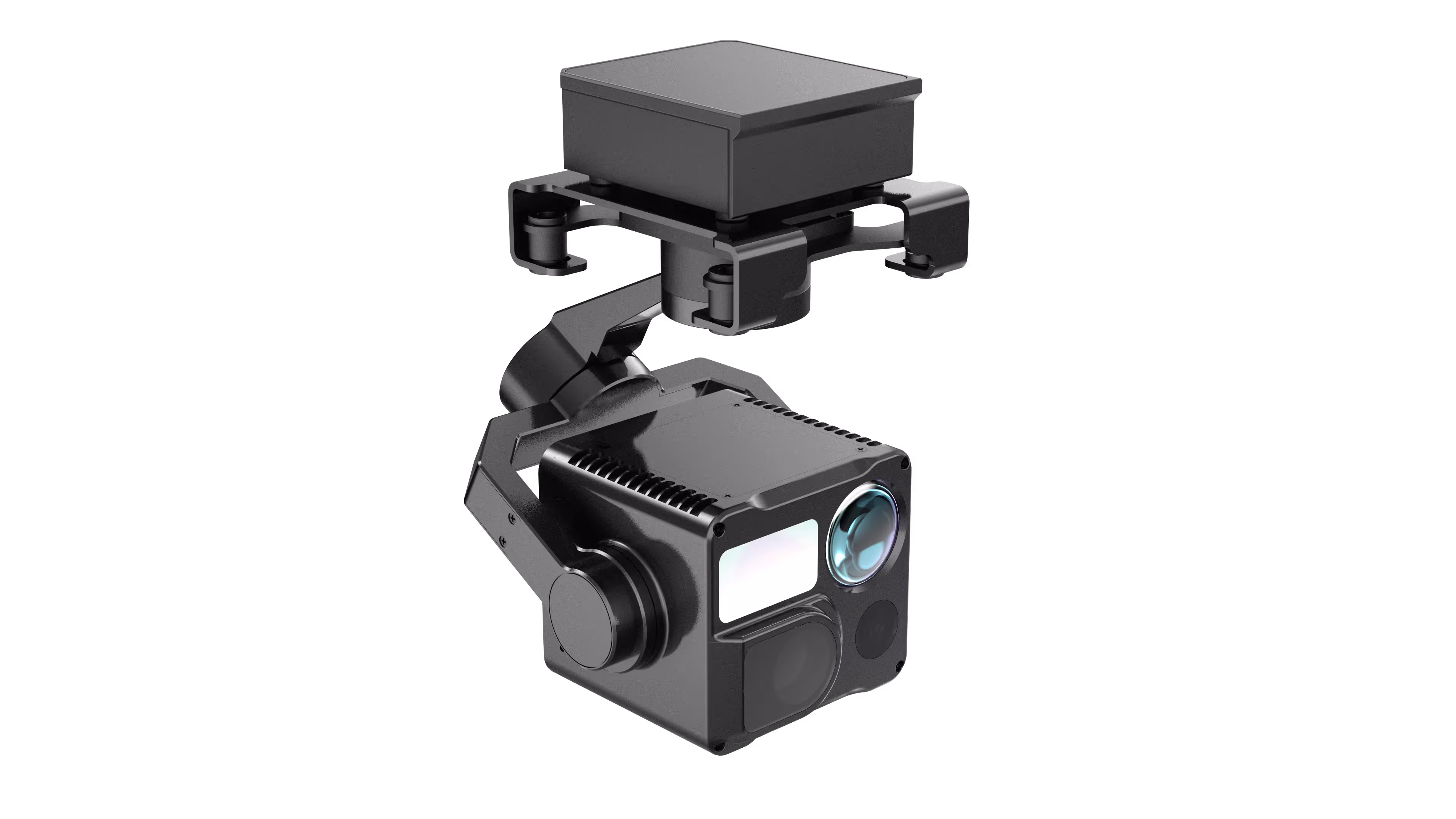
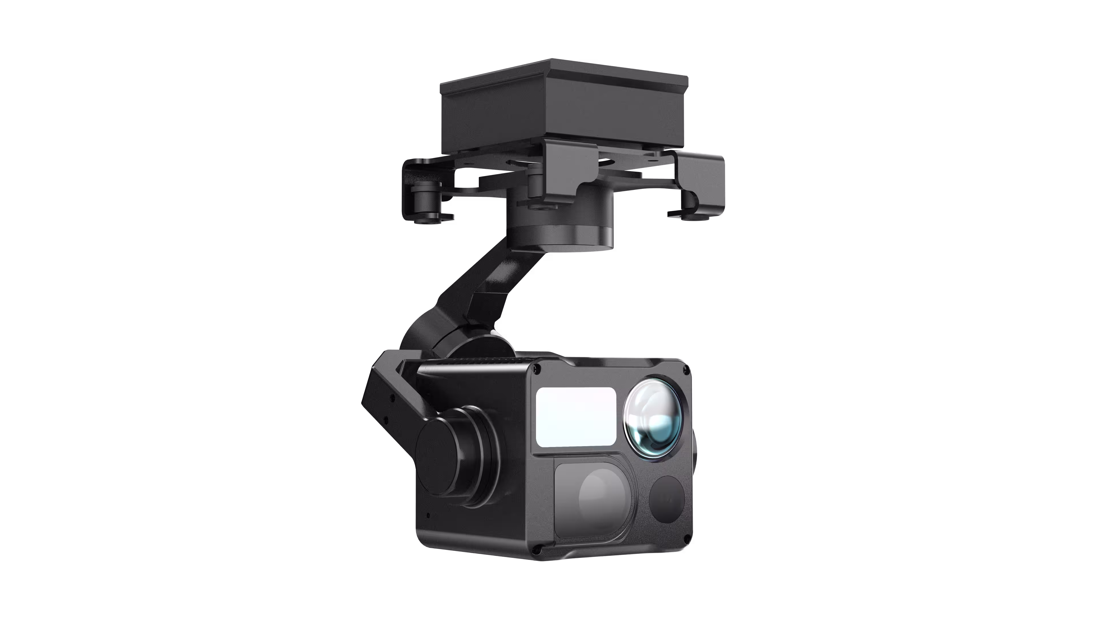
You patrol hundreds of miles of power lines, wind turbines, and substations—where a loose connector or overheating transformer could trigger blackouts or disasters. The HT10RW turns your drone into a precision diagnostic tool: 48MP Visible Cameras (telephoto + wide-angle) with 11x optical zoom (160x hybrid zoom) let you zoom from a bird’s-eye view to a close-up of a frayed insulator, capturing 8000×6000 photos to document even hairline cracks. 640×512 Thermal Imager (13mm lens) cuts through glare and darkness, highlighting hotspots (-20°C~+550°C) in transformers or power cables before they ignite. 1200m Laser Rangefinder pinpoints exact coordinates of faulty equipment, so your crew arrives at the right spot—first time, every time.
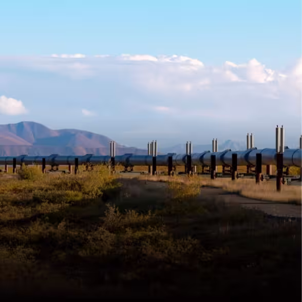
Oil & Gas Pipeline Operators: Monitor Vast Terrain, Mitigate Risks
Your pipelines snake through remote deserts, rugged mountains, and dense forests—where leaks, corrosion, or third-party interference threaten environmental disaster and revenue loss. The HT10RW transforms oversight: Dual Visible Sensors switch seamlessly between wide-angle (79° FOV) for sweeping pipeline corridors and telephoto (9° FOV) to inspect welds or valve rust from 1km away. Thermal Imaging detects subtle temperature anomalies (e.g., underground leaks warming soil) that visible light misses, even at night or in fog (thanks to electronic fog penetration). Lightweight Design (380g) pairs with drones like LOONG 2C/S/2/2P, extending flight time to cover more ground without sacrificing payload power.
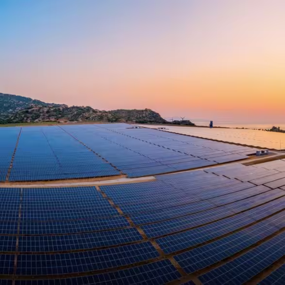
Solar Farm Managers: Maximize Efficiency, Minimize Downtime
Your solar arrays span acres—each panel’s performance directly impacts your bottom line. The HT10RW turns solar inspection from a tedious crawl into a fast, data-driven sweep: High-Res Visible Imaging (48MP) identifies physical defects: cracked glass, delaminated cells, or debris shading panels. Thermal Sensors map hotspots caused by faulty inverters or damaged diodes, quantifying energy loss in real time. 4K30fps Video Recording creates actionable reports, letting you prioritize repairs and boost array output by up to 15%.
Fire & Emergency Responders: Navigate Chaos, Save Lives
When wildfires rage or buildings burn, seconds mean the difference between containment and catastrophe. The HT10RW is your eyes in the sky: Thermal Imaging cuts through smoke to locate trapped victims, map fire spread, or identify hidden hotspots in walls. Laser Rangefinder calculates distances to flames or structures, helping ground crews plan safe approach routes. Day/Night Operation ensures 24/7 readiness—no matter if it’s dawn, dusk, or midnight, you see clearly when it matters most.