For Public Safety & Law Enforcement: Dominate the Night, Own the Distance
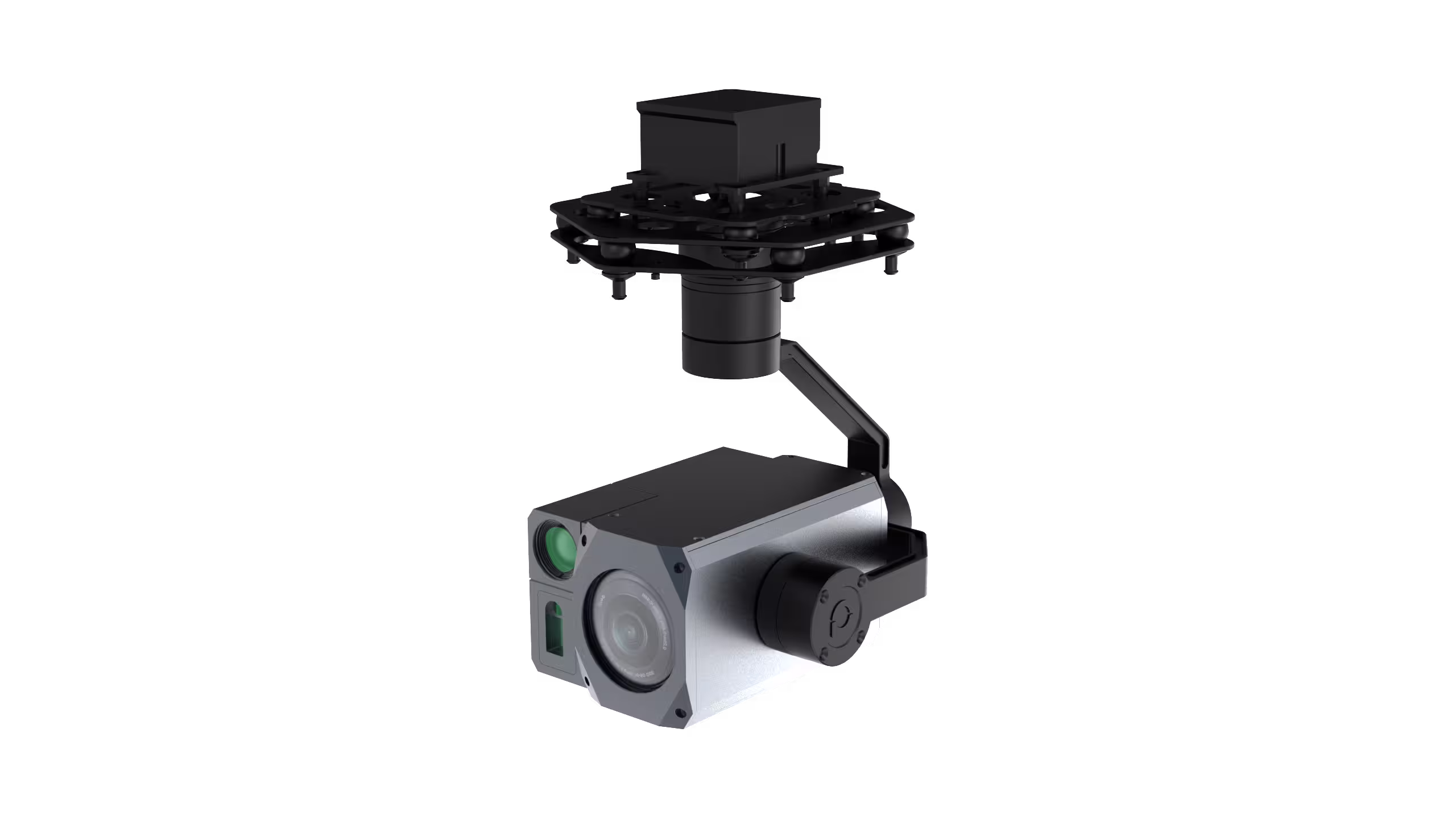
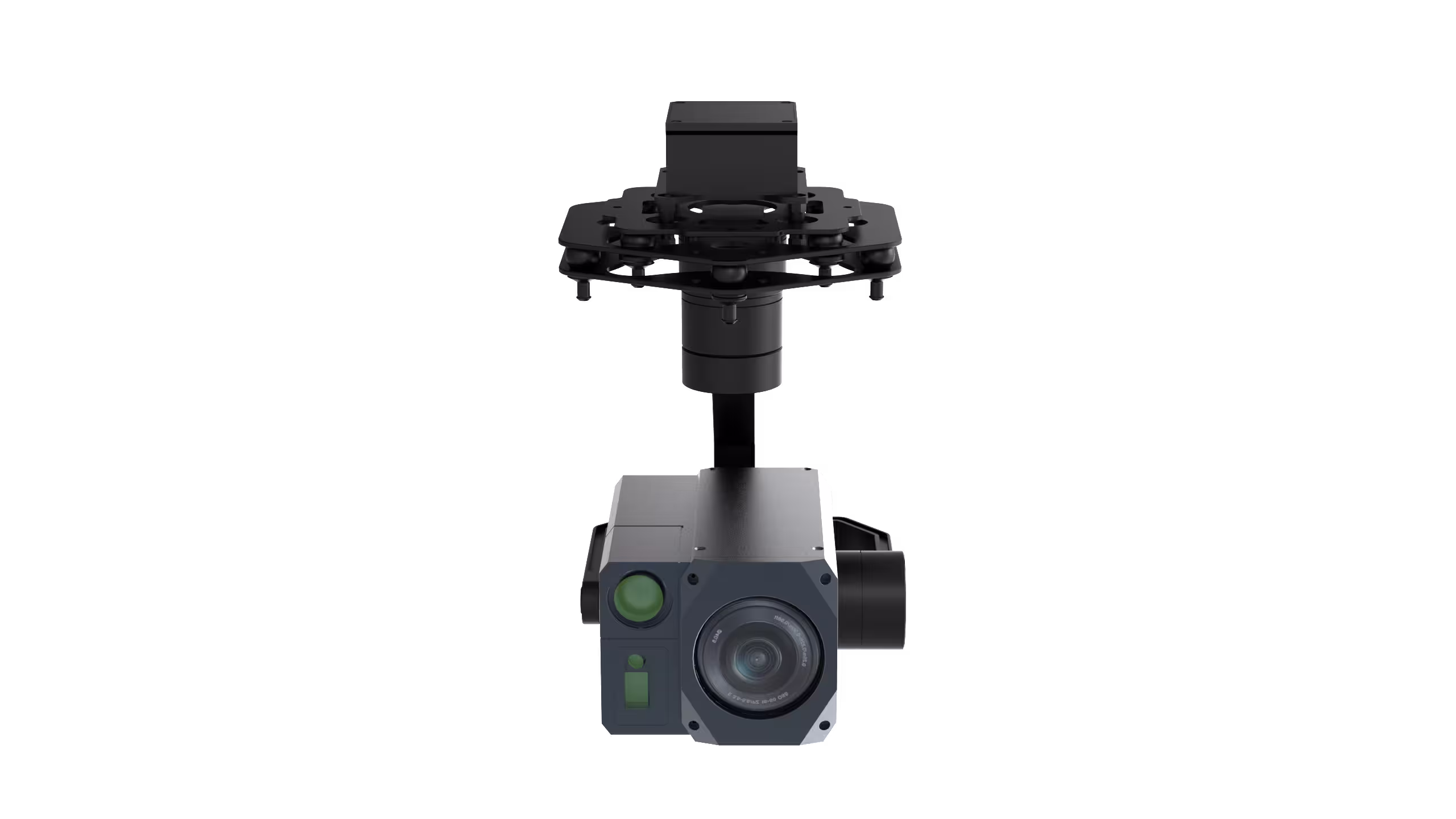
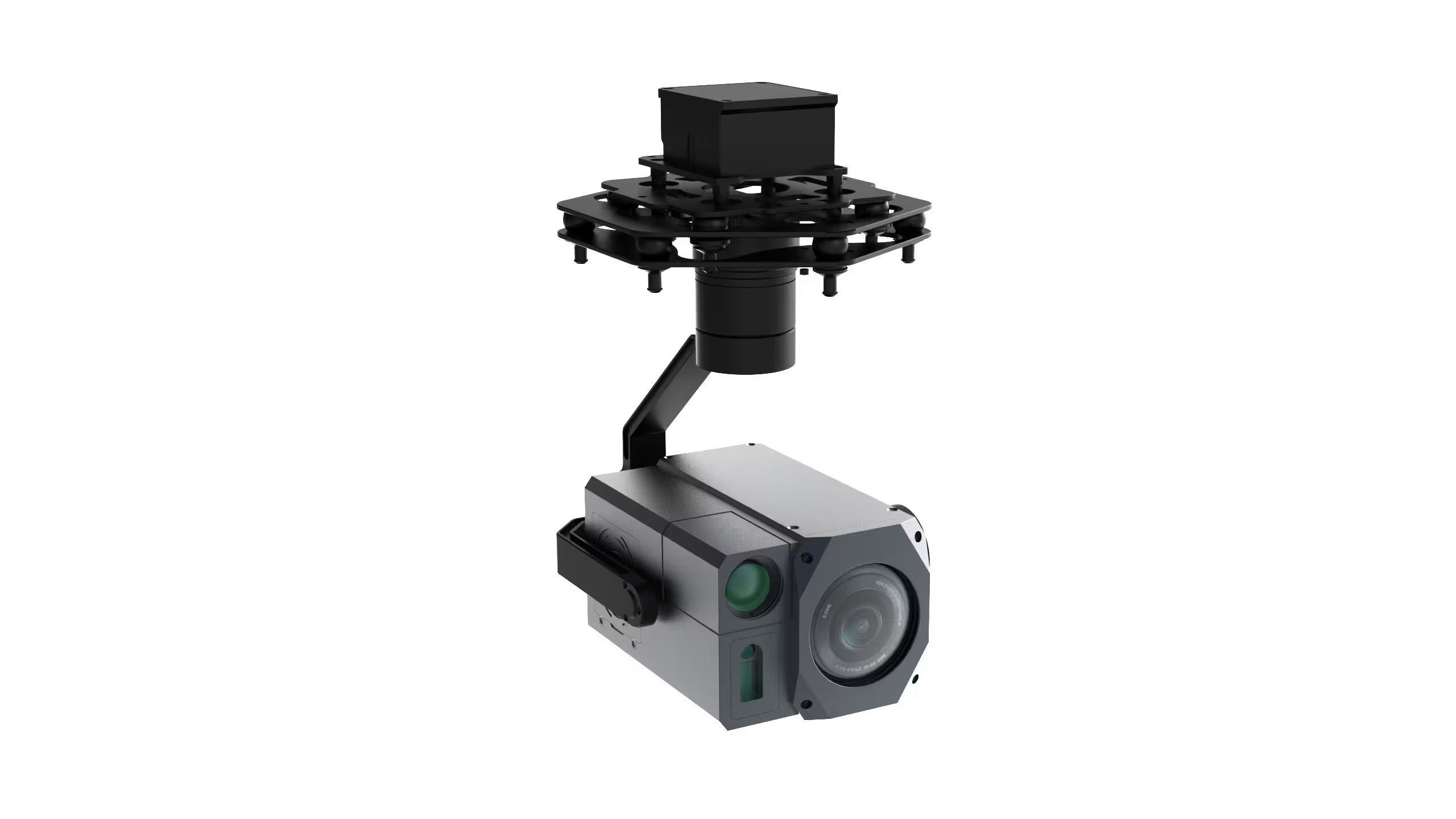
When every second counts in tracking suspects, securing perimeters, or investigating crime scenes, ZT60R transforms your drone into an unblinking eye in the sky. Imagine this: It’s 2 AM, and a fleeing vehicle vanishes into dense urban alleys. Your drone, armed with ZT60R’s 30X enhanced optical zoom (4.17MP ultra-starlight sensor), zeroes in from 1km away—capturing license plates and facial details even in near-total darkness. When the target darts into a shadowed warehouse, switch to the 640x512 infrared thermal imager (19mm lens) to pierce through darkness and smoke, painting heat signatures of hidden individuals in crisp clarity. Need to confirm their location? The built-in 1500m laser rangefinder (±1m accuracy) locks their distance instantly, while AI-powered vehicle/person detection auto-tracks movement, so you never lose sight. For SWAT teams, border patrol, or city police: ZT60R doesn’t just observe—it dominates the night.
For Energy & Utility Inspectors: Stabilize the Unstable, Inspect the Impossible
High-voltage power lines, wind turbine blades, or oil pipeline networks stretch for miles—often over rugged terrain where human access is risky or impossible. ZT60R turns your drone into a precision inspector that laughs at turbulence. Picture this: You’re flying over a 500kV transmission line in 30km/h winds. ZT60R’s 3-axis precision stabilization (±0.02° jitter) eliminates shake, keeping the 30X zoomed lens steady enough to spot hairline cracks on insulators or overheating connectors. Day or night, the 1/1.8” ultra-starlight sensor cuts through haze with visibility enhancement, while the thermal imager flags hotspots before they spark blackouts. Lightweight (1.2kg) and built to withstand -20°C to +60°C extremes, it integrates seamlessly with UAVs—turning hours of risky climbs into 15-minute drone missions. For utility teams: ZT60R doesn’t just inspect—it redefines efficiency.
For Fire & Emergency Response: Cut Through Chaos, Save Lives Faster
Wildfires rage, buildings burn, or chemical spills spread—chaos that demands instant, actionable intelligence. ZT60R equips your drone to be the first responder’s most critical tool. Imagine a multi-story building fire: Smoke billows, obscuring visibility. ZT60R’s electronic fog penetration cuts through the haze, while the thermal imager maps hotspots to identify trapped victims or structural weak points (e.g., a glowing beam about to collapse). Outside, AI detection flags firefighters’ heat signatures to ensure no one is left behind, while the laser rangefinder calculates safe distances for ground crews. Even in driving rain or freezing temperatures (-20°C), its rugged design keeps performing—so you can prioritize rescue over equipment worries. For fire departments and disaster response teams: ZT60R doesn’t just observe chaos—it cuts through it.
For Search & Rescue (SAR) Operators: Find the Lost, Even When Hope Fades
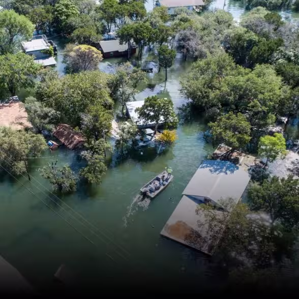
In remote wilderness, dense forests, or disaster zones, every minute lost reduces survival chances. ZT60R turns your drone into a lifesaver with eyes that never tire. Picture this: A hiker is missing in a mountain range at dusk. ZT60R’s super image stabilization keeps the 30X zoom locked on a 16x16-pixel target (the hiker’s reflective jacket) from 2km away, while the thermal imager picks up their body heat against cold terrain. The AI auto-tracks movement, even as they stumble, and overlays GPS coordinates (via OSD) to guide ground teams directly to their location. Lightweight enough for extended flights and tough enough for high altitudes, it turns “needle in a haystack” searches into targeted, time-saving missions. For SAR teams: ZT60R doesn’t just search—it finds.