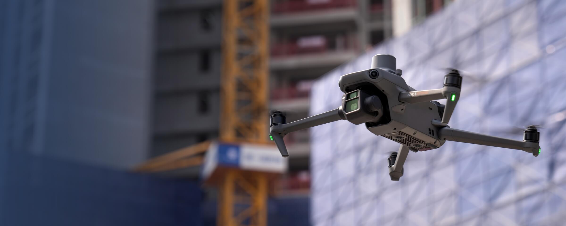
BIM
MMC Drones revolutionize Building Information Modeling (BIM) by delivering efficient and precise data capture solutions. Our advanced drone technology ensures accurate collection of asset information, streamlining BIM processes for enhanced project planning, design, and management. With high-quality data, MMC Drones empower teams to optimize workflows and achieve superior project outcomes.
Painpoints
- – Absence of visualized 3D Models for design-reality comparison.
- – Time and cost inefficiencies with ground solutions.
Advantages
- Generate accurate 3D Models of the site for visual design-reality comparison.
- Elevated efficiency with simple data collection workflow.
Solution
Portable Drone Surveying & Mapping Solution
Skylle Ⅱ + MMC X2C: Portable drone BIM solution for construction—centimeter precision, one-tap 3D mapping, multi-data outputs (3D models, DSM, DEM, point clouds).
- Ultra-portable: Carbon fiber drone, quick-release design, lightweight camera—easy transport across job sites.
- One-tap 3D mapping: Autonomous flight, 5-lens sync capture, mechanical shutter for crisp imagery.
- Centimeter precision: RTK positioning, synchronized exposure—trustworthy data for BIM.
- Multi-data outputs: 3D models, DSM, DEM, point clouds—optimize earthwork monitoring.
Drone Platform
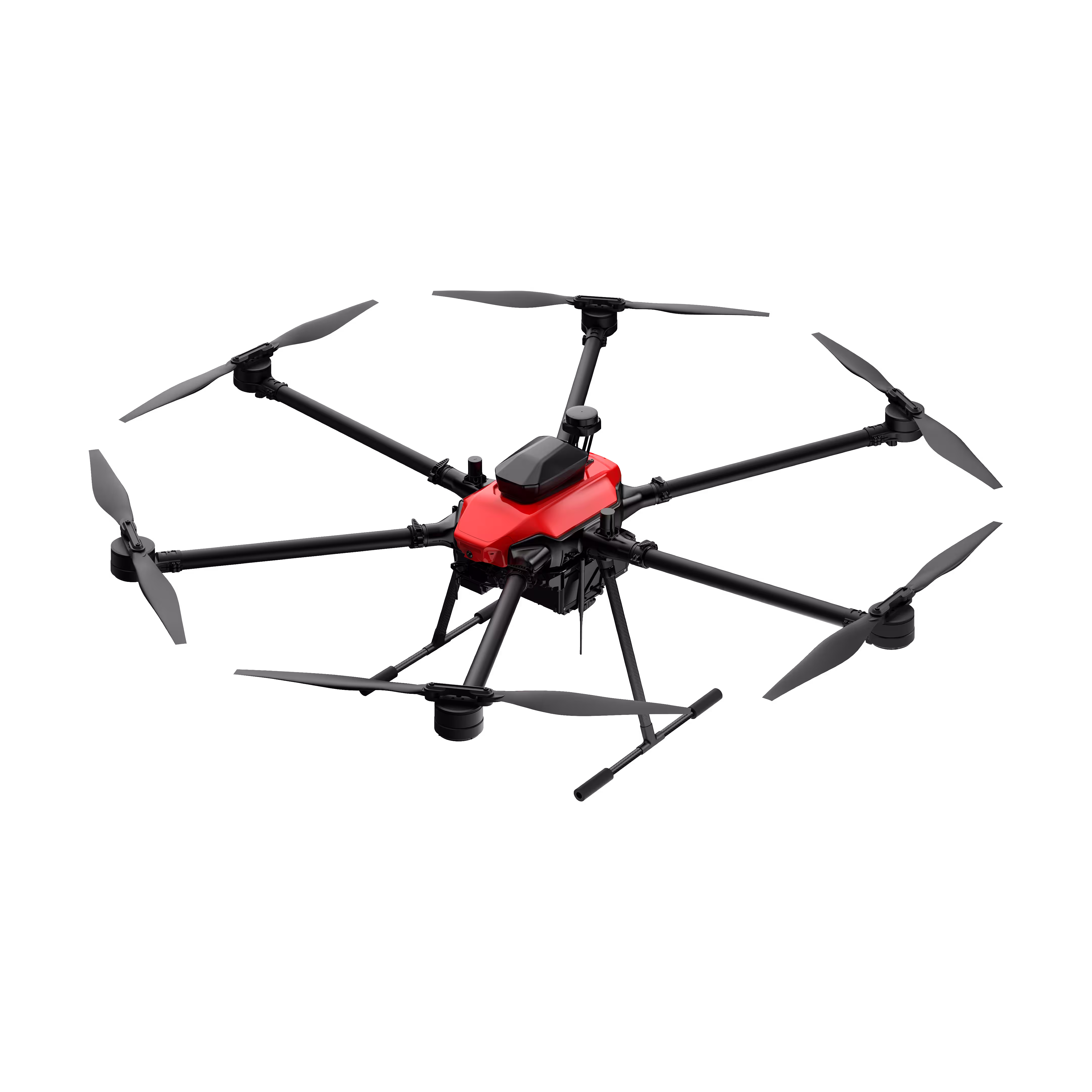
Skylle Ⅱ
Hexacopter Industrial Heavy-Lift Drone - 10kg Payload | 60min Flight Time | RTK cm-Level Positioning | IP54 Rated Read More
Learn MorePayload And Software
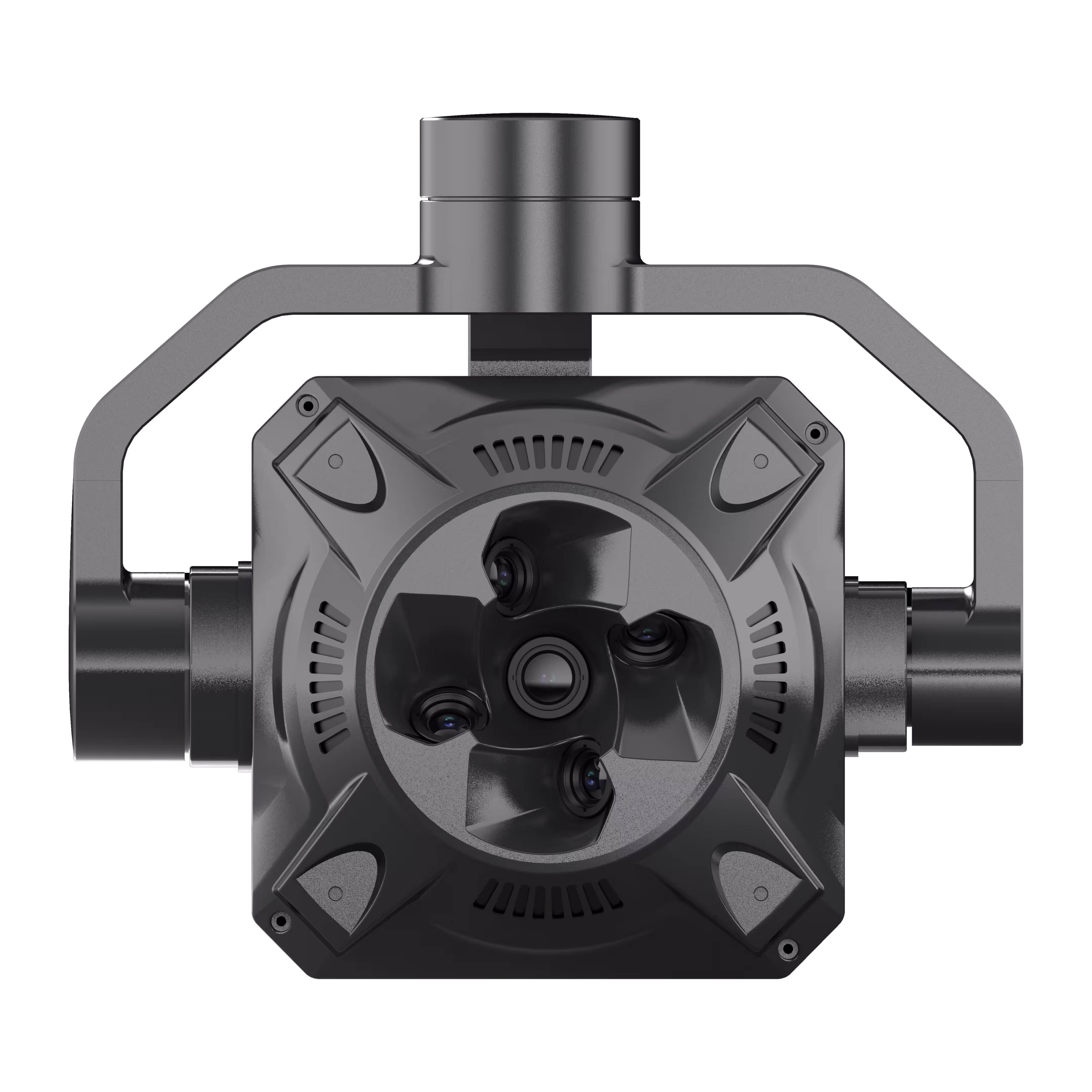
X2C
A professional aerial survey camera designed for 3D modeling, capturing multi-angle spatial images to deliver realistic terrain/texture details for topographic, real estate, and architectural mapping. Read More
Learn MoreSkylle Ⅱ + MMC X2C: Redefine Construction BIM with Portable, Precision Drone Surveying
In the fast-paced world of construction, every project demands accuracy, speed, and adaptability. Traditional surveying methods—time-consuming, labor-intensive, and prone to human error—often lag behind the needs of modern Building Information Modeling (BIM). Enter the Skylle Ⅱ Portable Drone Surveying & Mapping Solution, paired with the MMC X2C 5-Lens Oblique Photogrammetry Camera. Designed for construction professionals, this integrated system delivers centimeter-level precision, one-tap 3D modeling, and multi-site portability—empowering your team to capture, analyze, and act on critical site data like never before.
Why Skylle Ⅱ + MMC X2C? Built for Construction, Engineered for Excellence
1. Ultra-Portable: Move Seamlessly Across Job Sites
Construction teams need tools that keep up with dynamic project locations. The Skylle Ⅱ drone features carbon fiber one-piece molding for durability and lightweight design (17.2kg empty weight), paired with quick-release arms and a foldable structure that fits into a portable backpack or carry case. The MMC X2C camera, weighing just 1.1kg, integrates effortlessly with Skylle Ⅱ’s modular mount, ensuring your entire surveying kit is compact enough to transport between sites in a single case. No heavy equipment, no complex setup—unpack, assemble, and fly in minutes.
2. One-Tap 3D Mapping: Simplify Workflows, Boost Productivity
Forget tedious manual operations. Skylle Ⅱ’s intuitive ground station enables one-tap route planning and autonomous flight, while the MMC X2C’s synchronized 5-lens system (1 vertical + 4 oblique) captures high-resolution imagery in a single pass. Equipped with a mechanical shutter, the X2C eliminates motion blur, ensuring crisp, aligned images for seamless 3D reconstruction. From takeoff to data processing, the workflow is automated—so your team can focus on analysis, not setup.
3. Centimeter-Level Precision: Trust the Data That Drives BIM
BIM demands accuracy, and Skylle Ⅱ + MMC X2C deliver. The system integrates RTK (Real-Time Kinematic) positioning, enabling centimeter-level geotagging of every image. The MMC X2C’s mechanical shutter ensures synchronized exposure across all five lenses, eliminating timestamp errors and guaranteeing precise point cloud alignment. Whether monitoring earthwork volumes or validating as-built conditions, you’ll get data you can trust—down to the centimeter.
4. Multi-Data Outputs: Powering Efficient Earthwork & BIM Integration
From 3D models to elevation data, the solution generates all the outputs your project needs:
- 3D Models (OBJ/PLY): Detailed as-built representations for BIM updates and clash detection.
- DSM/DEM: Digital Surface/ Elevation Models for terrain analysis and drainage planning.
- Point Clouds: Dense, accurate point clouds for volume calculations and progress tracking.
Ideal for earthwork monitoring, the system turns raw survey data into actionable insights—reducing rework, optimizing resource allocation, and keeping projects on schedule.
Engineered for the Toughest Sites
Construction environments are unforgiving, but Skylle Ⅱ + MMC X2C are built to endure. Skylle Ⅱ boasts an IP54 rating (water/dust resistance) and operates in temperatures from -20°C to 65°C, while its dual backup smart batteries ensure 80 minutes of flight time—enough to cover large sites in one mission. The MMC X2C’s rugged metal frame and industrial-grade components stand up to vibrations and harsh weather, ensuring reliability across every job.
Your BIM Workflow, Transformed
With Skylle Ⅱ and MMC X2C, construction surveying moves from a bottleneck to a competitive advantage. Portable enough for multi-site teams, easy enough for on-site crews, and precise enough for BIM, this solution empowers you to:
✅ Cut survey time by 70% compared to traditional methods.
✅ Reduce errors with centimeter-level data.
✅ Streamline BIM updates with real-time 3D models.
✅ Monitor earthwork progress with accurate volume calculations.
Ready to Elevate Your Construction BIM?
The Skylle Ⅱ + MMC X2C solution isn’t just a tool—it’s a catalyst for efficiency, precision, and project success. Contact us today to schedule a demo and see how portable drone surveying can transform your construction workflows.
Skylle Ⅱ Drone | MMC X2C 5-Lens Photogrammetry Camera | Built for Construction. Built for BIM.