Construction
MMC Drones' Construction Solutions provide centimeter-accurate aerial data for all project phases - from site surveys to final verification. Our automated drone systems reduce survey time by 80% while delivering 3D models and progress tracking to optimize workflows, cut costs, and prevent delays.
MMC Drone Solutions for Construction
Progress Management
MMC Drones' Progress Management uses automated aerial imaging to track construction with 75% time savings. Get cm-accurate 3D site models for better team coordination and schedule control. Integrates with existing project tools.
Building Information Modeling (BIM)
MMC Drones revolutionize Building Information Modeling (BIM) by delivering efficient and precise data capture solutions. Our advanced drone technology ensures accurate collection of asset information, streamlining BIM processes for enhanced project planning, design, and management. With high-quality data, MMC Drones empower teams to optimize workflows and achieve superior project outcomes.
Earthwork
MMC Drones' Earthwork Solutions optimize excavation, grading, and material management with precise aerial data. Our drone-powered systems automate volume measurements of earth movements and stockpiles, delivering centimeter-accurate calculations up to 5x faster than manual surveys. Frequent flyovers track progress against designs, minimize over-excavation, and prevent costly rework—ensuring projects stay on budget and schedule.
Heritage Preservation
MMC Drones delivers millimeter-accurate 3D reconstructions of heritage sites using advanced drone mapping. Our non-invasive technology enables precise condition monitoring, restoration planning, and digital archiving while protecting fragile structures. Ideal for conservationists and researchers.

Traditional Challenges for Progress Management
- Lack of up-to-date visual progress information.
- Inefficient collaborations and processes.
- Increased project costs from inefficient project management and rework.
How Drones Aid Progress Management
- Generate highly-accurate 2D and 3D models to monitor progress and easily compare with historical data.
- Easily share drone data between teams for more informed decision-making.
- Stay on budget by collecting accurate data faster and more frequent.
Related Products
Drones
Skylle Ⅱ
Hexacopter Industrial Heavy-Lift Drone - 10kg Payload | 60min Flight Time | RTK cm-Level Positioning | IP54 Rated Read More
Learn More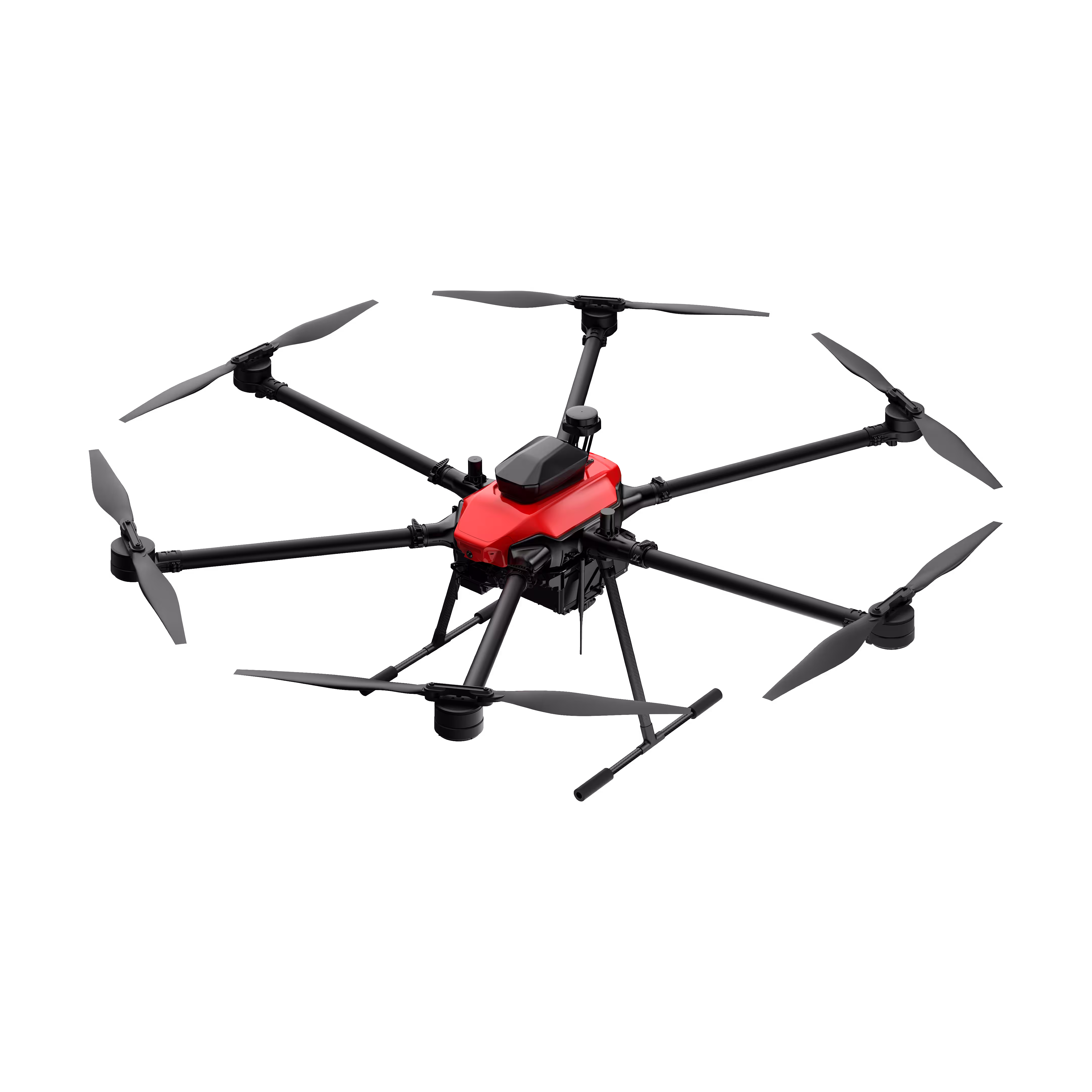
Payloads
X2C
A professional aerial survey camera designed for 3D modeling, capturing multi-angle spatial images to deliver realistic terrain/texture details for topographic, real estate, and architectural mapping. Read More
Learn More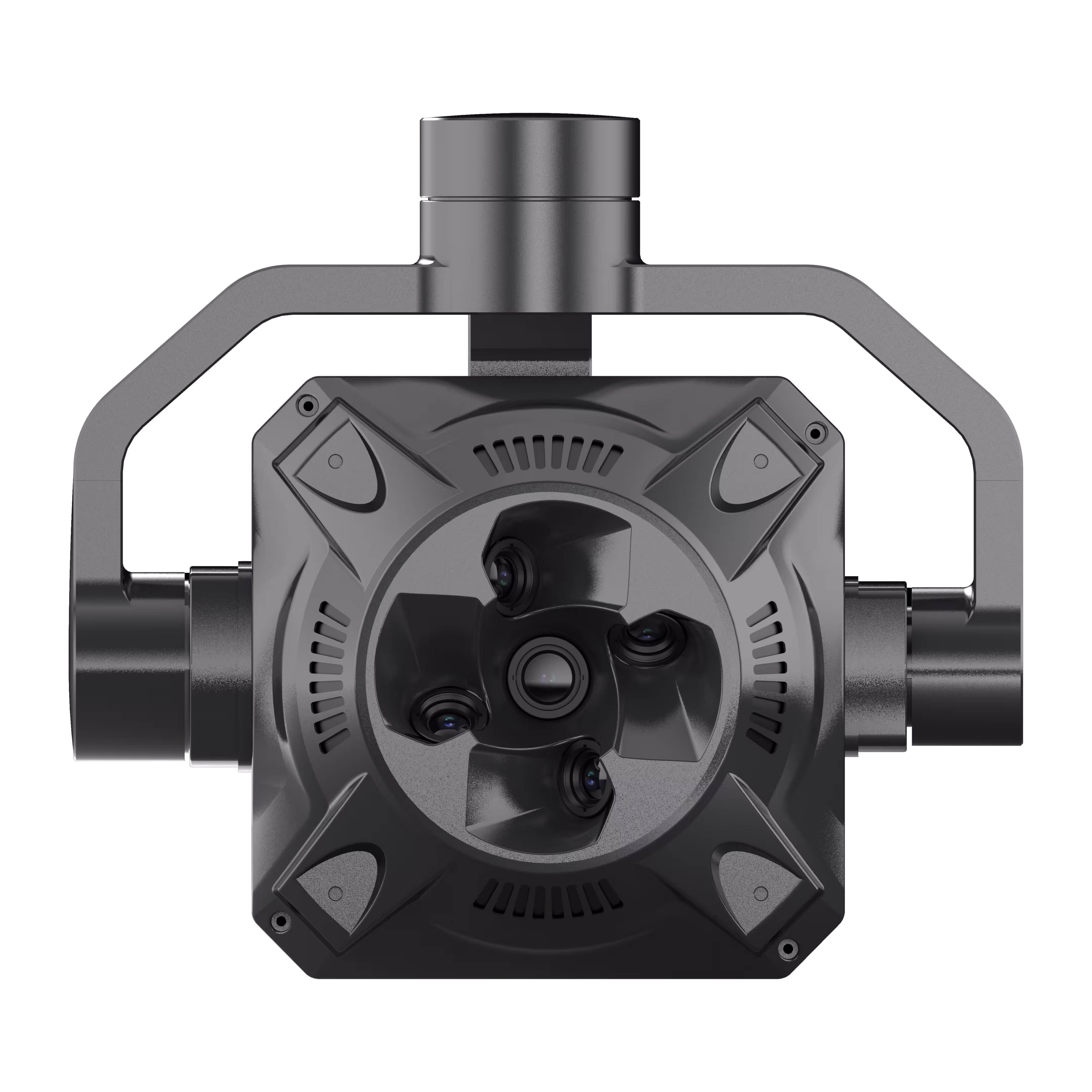

Traditional Challenges for Building Information Modeling (BIM)
- Absence of visualized 3D Models for design-reality comparison.
- Time and cost inefficiencies with ground solutions.
How Drones Aid Building Information Modeling (BIM)
- Generate accurate 3D Models of the site for visual design-reality comparison.
- Elevated efficiency with simple data collection workflow.
Related Products
Drones
Skylle Ⅱ
Hexacopter Industrial Heavy-Lift Drone - 10kg Payload | 60min Flight Time | RTK cm-Level Positioning | IP54 Rated Read More
Learn MorePayloads
X2C
A professional aerial survey camera designed for 3D modeling, capturing multi-angle spatial images to deliver realistic terrain/texture details for topographic, real estate, and architectural mapping. Read More
Learn More
Traditional Challenges for Earthwork
- Absence of frequently updated stockpile measurements can lead to project delays and inaccurate resources supply.
- Inefficient walk-based methods results on higher labor cost and time.
- Stockpile manual measurements accuracy can be compromised by human errors.
How Drones Aid Earthwork
- Generate updated Stockpile Measurement with Point Cloud Data at any time.
- Cut field work time with efficient drone-based data collection.
- Ensure data quality and consistency with repeatable mission flights.
Related Products
Drones
Skylle Ⅱ
Hexacopter Industrial Heavy-Lift Drone - 10kg Payload | 60min Flight Time | RTK cm-Level Positioning | IP54 Rated Read More
Learn MorePayloads
X2C
A professional aerial survey camera designed for 3D modeling, capturing multi-angle spatial images to deliver realistic terrain/texture details for topographic, real estate, and architectural mapping. Read More
Learn More
Traditional Challenges for Heritage Preservation
- Absence of Visualized 3D Models for Protective References and Historical Records.
- Time-Intensive Ground Measurements and Elevated Personnel Risks.
How Drones Aid Heritage Preservation
- Generate accurate 2D and 3D models of the historical to properly plan conservation efforts and research purposes.
- Optimize on-site collection methods with drone-based data capture.
Related Products
Drones
Skylle Ⅱ
Hexacopter Industrial Heavy-Lift Drone - 10kg Payload | 60min Flight Time | RTK cm-Level Positioning | IP54 Rated Read More
Learn MorePayloads
X2C
A professional aerial survey camera designed for 3D modeling, capturing multi-angle spatial images to deliver realistic terrain/texture details for topographic, real estate, and architectural mapping. Read More
Learn More