Mining
MMC Drones transforms mining operations with automated aerial surveys. Our solutions provide real-time stockpile analytics, pit monitoring, and hazard detection—reducing manual work by 90% while improving safety and productivity.
MMC Drone Solutions for Mining
Mining Survey
MMC mining survey revolutionize data collection with drone-powered precision. Our technology delivers safer, faster stockpile measurements and pit modeling, achieving centimeter accuracy in hours instead of days. By replacing risky ground surveys, we reduce costs by 50% while improving data quality.
Facade High Wall
MMC drones transform facade high wall modeling in mining with safe, accurate 3D solutions. Advanced UAVs with cameras or LiDAR capture high-resolution data, creating precise 2D maps and 3D models. These geotagged models reduce risky manual surveys and enhance decision-making.
Asset Inspection
MMC asset inspection solution revolutionizes mining equipment maintenance through non-contact aerial inspections. Our drones capture high-resolution visual and thermal imagery of crushers, conveyors, and processing plants while operations continue.
Site Safety
MMC Drones enhances mining safety with automated aerial inspections. Our solutions capture high-resolution site data to detect hazards, monitor equipment, and track personnel in real-time. Drones reduce inspection risks by 90% versus manual methods while cutting survey time by 75%.

Traditional Challenges for Mining Survey
- Mining survey environments are often remote and fraught with safety risks that threaten personnel safety.
- Traditional ground-based survey methods are costly, timely, and inefficient.
- Ensuring data quality through traditional methods can be challenging.
How Drones Aid Mining Survey
- Swiftly cover vast and hazardous areas, significantly streamlining data collection process and enhancing personnel safety.
- Reduce cost and improve efficiency with easy-to-deploy aerial data collection solutions.
- Repeat data collection missions ensuring the data quality and accuracy.
Related Products
Drones
Skylle Ⅱ
Hexacopter Industrial Heavy-Lift Drone - 10kg Payload | 60min Flight Time | RTK cm-Level Positioning | IP54 Rated Read More
Learn More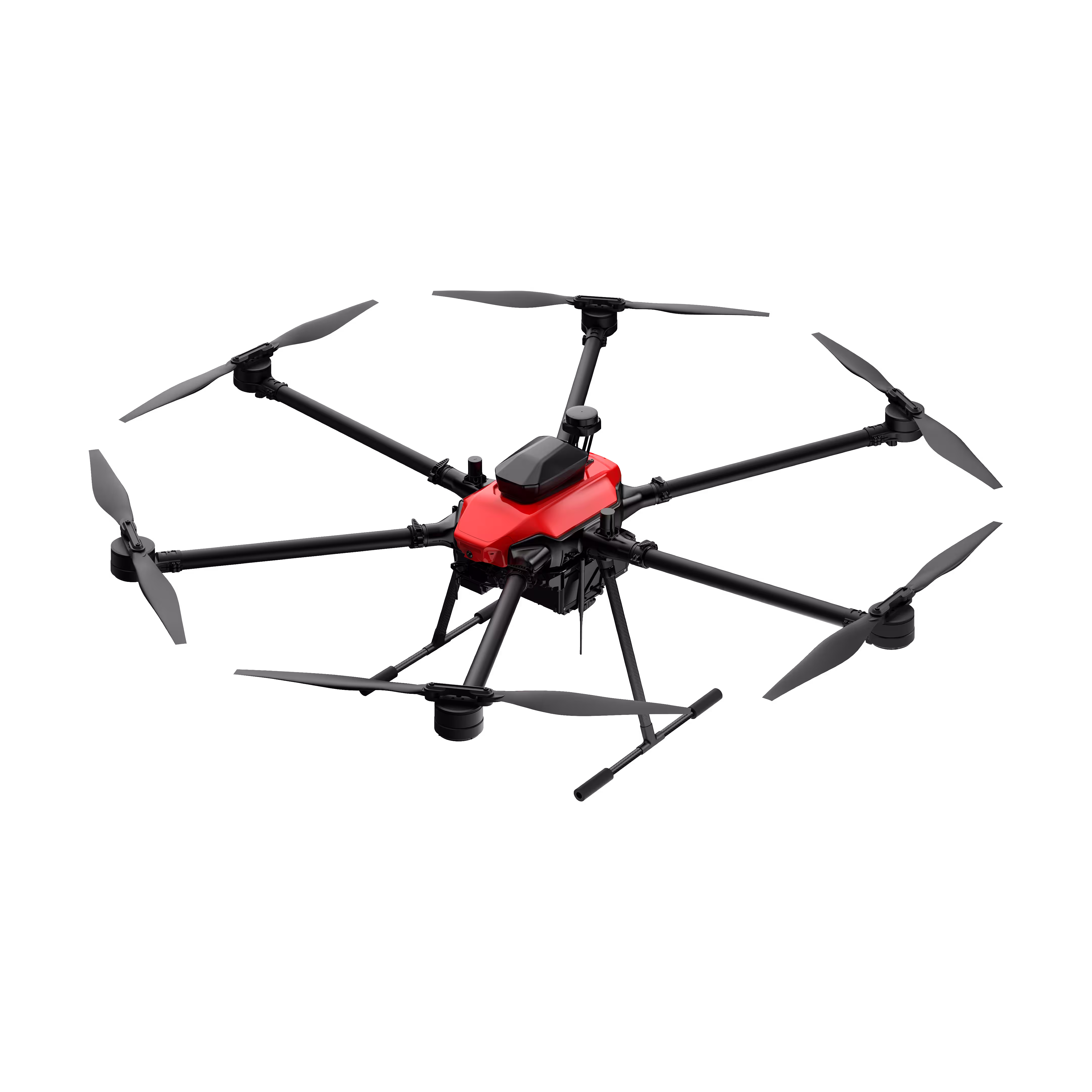
Drones
Notuzi S
Professional-grade UAV designed for versatile industrial applications, catering to sectors such as power inspection, public security, energy, and firefighting. Read More
Learn More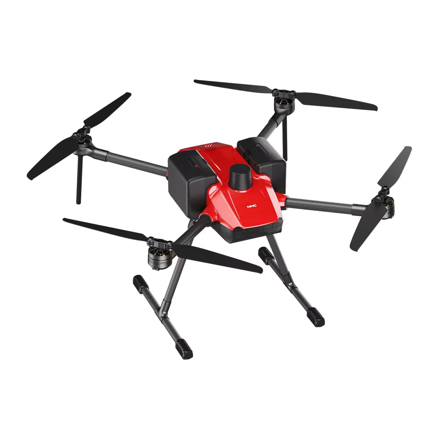
Payloads
X4 Pro
MMC X4 Pro is a high-performance, multi-purpose aerial survey camera designed for 3D modeling and precision mapping. As a professional five-lens oblique photography system, it breaks through the limitations of traditional single-angle mapping cameras, providing an integrated, high-precision, and efficient aerial survey solution for various mapping scenarios. Read More
Learn More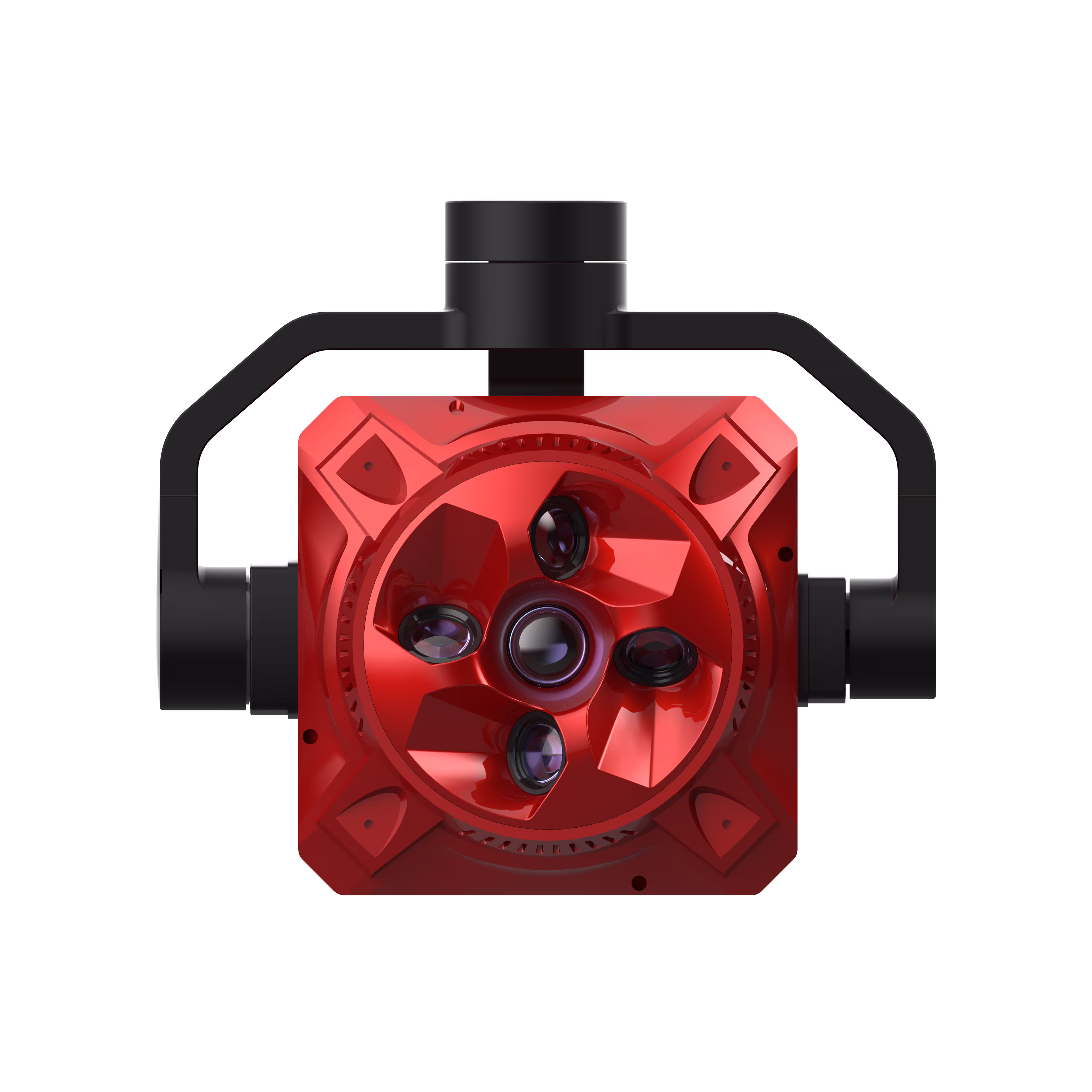
Payloads
X2C
A professional aerial survey camera designed for 3D modeling, capturing multi-angle spatial images to deliver realistic terrain/texture details for topographic, real estate, and architectural mapping. Read More
Learn More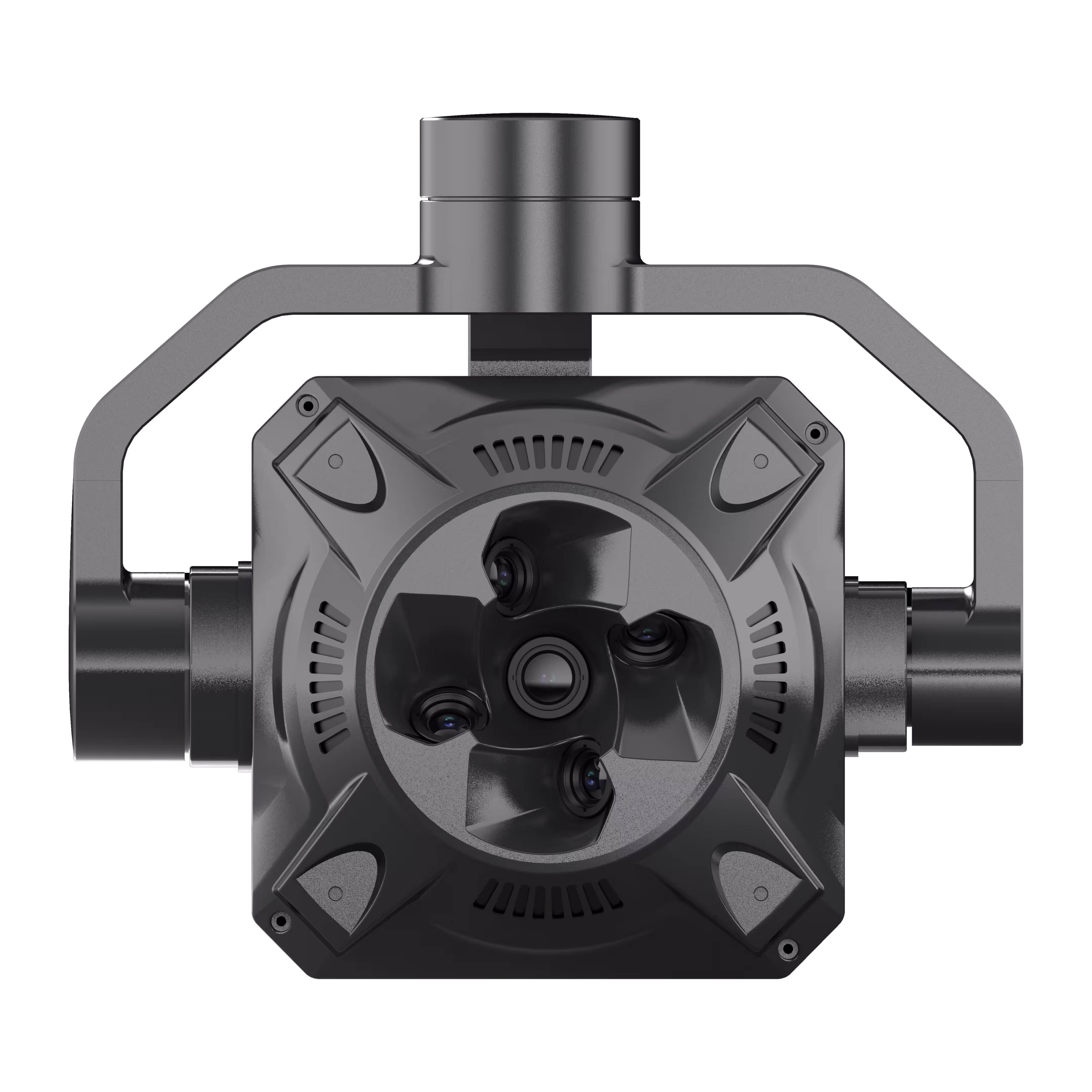

Traditional Challenges for Facade High Wall Surveying
- Traditional high wall surveying methods often exposes personnel to potential risks.
- Time-consuming and inefficient, especially across large mining sites.
- Lack of high-precision and high-resolution data of the high walls.
How Drones Aid Facade High Wall Surveying
- Reduce risk with safer data collection methods without compromising quality.
- Optimize field work and enhance operations with efficient aerial survey solutions.
- Produce geotagged high quality models for improved decision making.
Related Products
Drones
Skylle Ⅱ
Hexacopter Industrial Heavy-Lift Drone - 10kg Payload | 60min Flight Time | RTK cm-Level Positioning | IP54 Rated Read More
Learn MoreDrones
Notuzi S
Professional-grade UAV designed for versatile industrial applications, catering to sectors such as power inspection, public security, energy, and firefighting. Read More
Learn MorePayloads
X4 Pro
MMC X4 Pro is a high-performance, multi-purpose aerial survey camera designed for 3D modeling and precision mapping. As a professional five-lens oblique photography system, it breaks through the limitations of traditional single-angle mapping cameras, providing an integrated, high-precision, and efficient aerial survey solution for various mapping scenarios. Read More
Learn MorePayloads
X2C
A professional aerial survey camera designed for 3D modeling, capturing multi-angle spatial images to deliver realistic terrain/texture details for topographic, real estate, and architectural mapping. Read More
Learn More
Traditional Challenges for Asset Inspection
- Manual inspections are time-consuming and inefficient, especially across large mining sites.
- Conventional inspection methods typically require significant manpower and resources.
- Low inspection frequency might lead to increased operational cost and equipment failures.
- Mining assets in hard-to-reach locations present challenges for traditional inspection methods.
How Drones Aid Asset Inspection
- Easily evaluate assets status, significantly streamlining data collection process.
- Reduce cost and improve efficiency with easy-to-deploy aerial data collection solutions.
- Collect real-time data, enabling mining operations to respond quickly to changing situations.
- Aerial perspective allows you to view assets located difficult areas, offering a more comprehensive inspection.
Related Products
Drones
Skylle Ⅱ
Hexacopter Industrial Heavy-Lift Drone - 10kg Payload | 60min Flight Time | RTK cm-Level Positioning | IP54 Rated Read More
Learn MoreDrones
Notuzi S
Professional-grade UAV designed for versatile industrial applications, catering to sectors such as power inspection, public security, energy, and firefighting. Read More
Learn MorePayloads
X4 Pro
MMC X4 Pro is a high-performance, multi-purpose aerial survey camera designed for 3D modeling and precision mapping. As a professional five-lens oblique photography system, it breaks through the limitations of traditional single-angle mapping cameras, providing an integrated, high-precision, and efficient aerial survey solution for various mapping scenarios. Read More
Learn MorePayloads
X2C
A professional aerial survey camera designed for 3D modeling, capturing multi-angle spatial images to deliver realistic terrain/texture details for topographic, real estate, and architectural mapping. Read More
Learn More
Traditional Challenges for Mining Site Safety
- Mining areas ofen have inaccessible or high-risk zones, posing challenges for personnel safety.
- Obtaining timely and accurate information for swift responses can be difficult.
- Manual inspections might overlook hidden hazards, and data collection might not be comprehensive or accurate.
How Drones Aid Mining Site Safety
- Improve mine operational safety and reduce risk with frequent aerial oversight.
- Enhance decision-making processes with real-time imagery from the mine operations.
- Create high-precision 2D and 3D models for accurate risk identification and assesment.
Related Products
Drones
Notuzi S
Professional-grade UAV designed for versatile industrial applications, catering to sectors such as power inspection, public security, energy, and firefighting. Read More
Learn MorePayloads
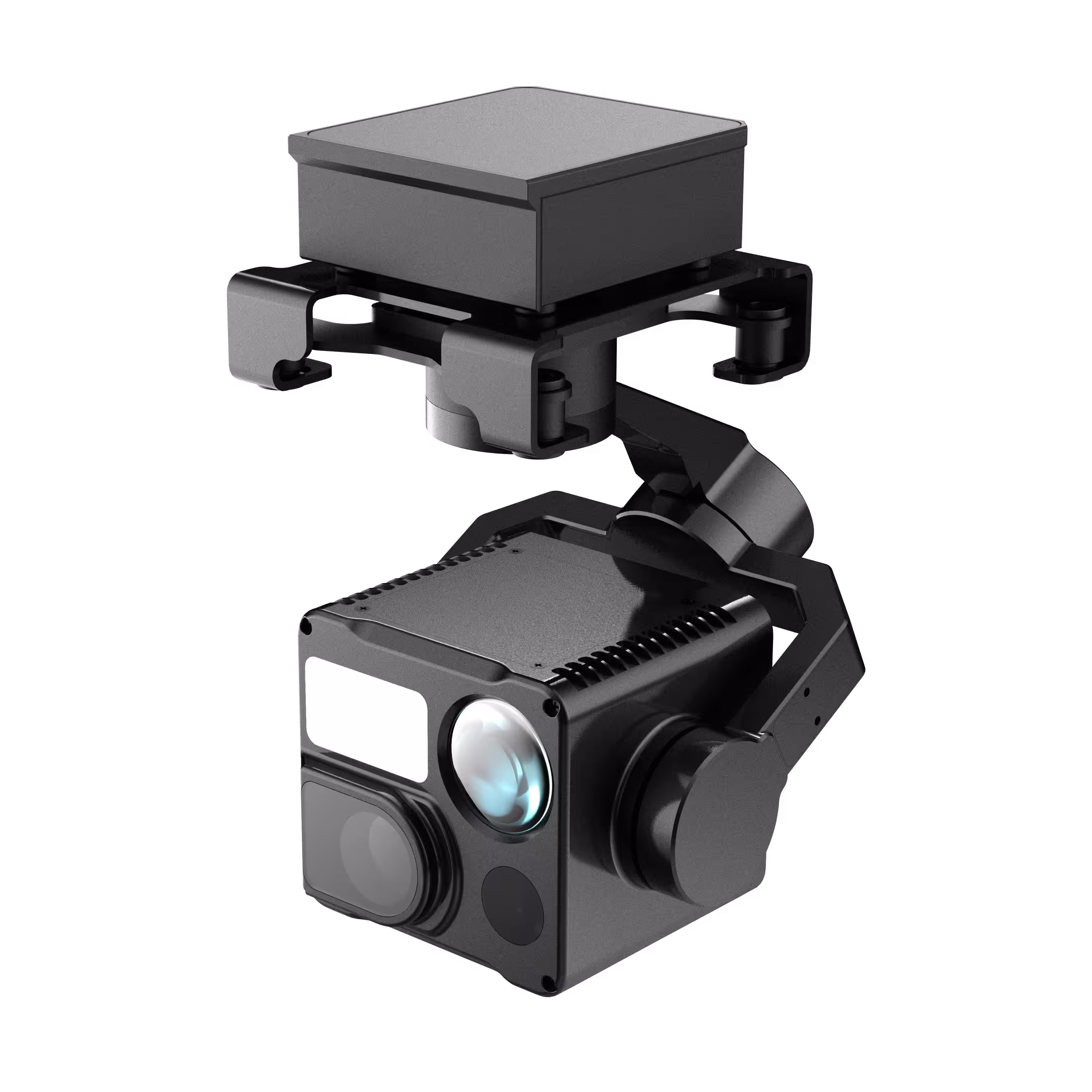
HT10RW
A compact 4-in-1 camera payload (380g) designed for industrial drones, integrating multi-sensor capabilities to meet diverse mission requirements across day/night and complex environments. It is widely applicable in power inspection, oil pipeline monitoring, photovoltaic inspection, urban fire rescue, and forest fire prevention. Read More
Learn More