Redefining the Boundaries of Long-Endurance, Heavy-Payload Aerial Operations
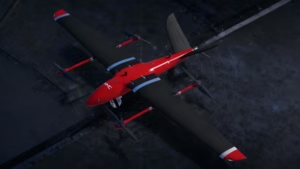
In the fast-evolving landscape of professional unmanned aerial systems (UAS), the MMC M10 stands as a revolutionary force, combining unparalleled payload capacity, extended endurance, and versatile mission capabilities. This electric vertical takeoff and landing (VTOL) fixed-wing drone is engineered for the most demanding applications, from large-scale surveying and infrastructure inspections to emergency response and defense operations. With its ability to carry heavy payloads, operate in extreme environments, and deliver precision data, the M10 redefines what’s possible in professional aerial missions. Whether you’re a geospatial expert mapping vast terrains, an energy professional inspecting remote assets, a security agency conducting long-range surveillance, or an emergency responder saving lives, the MMC M10 is your ultimate partner for mission success.
Why the MMC M10 is the Ideal Choice for High-Stakes Operations
The MMC M10 is designed to meet the rigorous demands of professional users, offering a unique blend of heavy-lift capacity, long-endurance flight, and robust reliability. Its innovative VTOL design combines the precision hovering of multirotor drones with the range and efficiency of fixed-wing aircraft, making it a standout choice for complex missions.
1. Unmatched Payload Capacity & Flight Endurance
The M10 is a powerhouse, capable of carrying substantial payloads while maintaining exceptional flight times:
- Heavy-Lift Capability: Supports a maximum payload of 10kg, one of the highest in its class, accommodating advanced sensors and equipment.
- Extended Flight Times: Achieves 150+ minutes with no payload, 125 minutes with a 5kg payload, and 100 minutes at full 10kg capacity, far surpassing traditional multirotor drones.
- Compact Deployment: Requires only a 10×10 meter space for vertical takeoff and landing, eliminating the need for runways or catapults, ideal for rugged or confined environments.
- High-Speed Efficiency: Cruises at 68-72 km/h (19-20 m/s) with a maximum speed of 126 km/h (35 m/s), enabling rapid coverage of large areas.
- All-Weather Performance: Operates in temperatures from -40°C to 60°C and features Level 7 wind resistance (up to 17 m/s in fixed-wing mode), ensuring reliability in extreme conditions.
2. Military-Grade Durability & Redundancy
Built for mission-critical reliability, the M10 is engineered to withstand the toughest challenges:
- Carbon-Fiber Airframe: Lightweight yet ultra-strong, providing durability without sacrificing performance.
- Triple-Redundant Systems: Equipped with dual IMUs, dual GPS, and dual barometers, ensuring operational stability even in challenging conditions.
- Auto-Recovery Mode: Seamlessly switches to multirotor mode for a safe landing if the fixed-wing system encounters issues.
- Extreme Environment Ready: Withstands harsh climates, from Arctic cold to desert heat, making it ideal for diverse operational scenarios.
These features ensure the M10 remains operational in high-stakes missions where reliability is non-negotiable.
Key Applications: Where the MMC M10 Excels
The MMC M10 is tailored to meet the needs of four core user groups, delivering specialized solutions for a wide range of professional applications.
1. Large-Scale Surveying & Mapping
For geospatial professionals, the M10 is a high-efficiency mapping platform that outperforms traditional methods:
- Precision Positioning: PPK/RTK technology delivers 1cm accuracy, ideal for high-precision surveys.
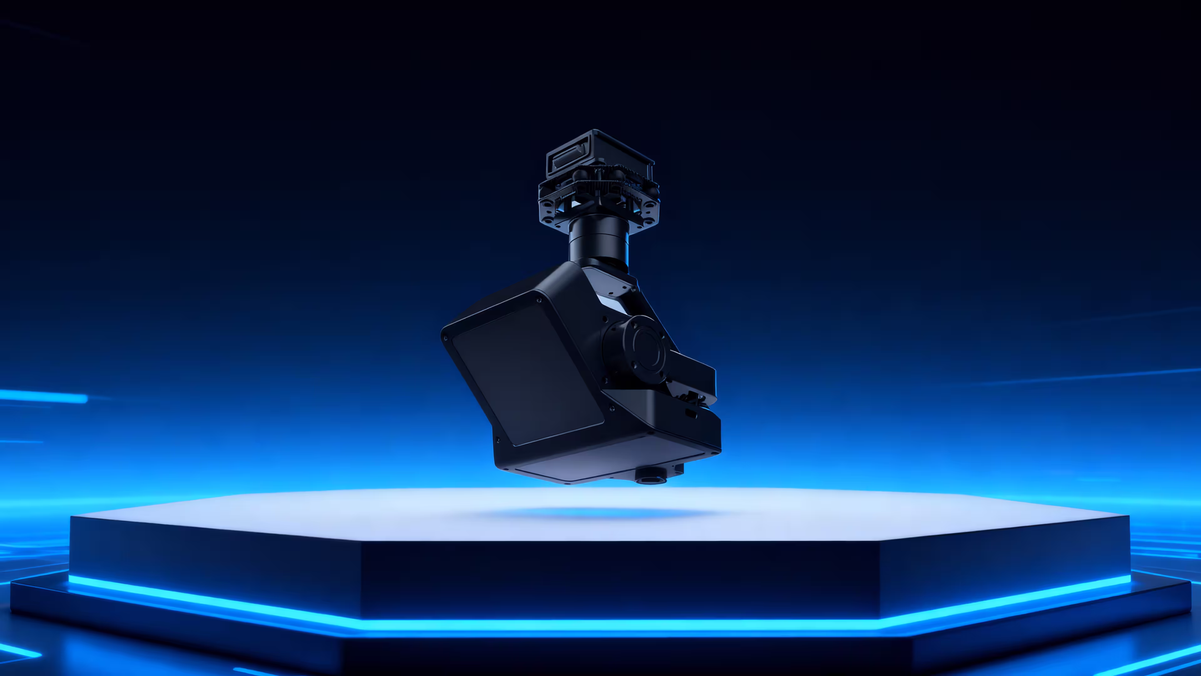
- Versatile Payloads: Compatible with high-resolution cameras, LiDAR, and multispectral sensors, enabling comprehensive data collection.
- Unmatched Coverage: Maps 300+ km² per flight, compared to 50 km² for multirotor drones, significantly reducing project timelines.
- Automated Terrain Following: Operates as low as 10m above ground level (AGL) for detailed topographic data.
Use Cases:
- Cadastral Mapping: Produces 1:500 scale maps for land management and urban planning.
- Mining Volume Calculations: Accurately measures stockpile volumes for resource management.
- 3D City Modeling: Supports urban development with high-resolution 3D models.
Testimonial: “The M10’s ability to map 300 km² in a single flight has transformed our surveying operations, delivering precision and efficiency we couldn’t achieve before,” says a lead GIS surveyor.
2. Energy & Infrastructure Inspections
The M10 revolutionizes inspections for energy and utility sectors, enhancing safety and efficiency:
- Long-Range Inspections: Covers 200+ km per flight for power lines, pipelines, wind turbines, and solar farms.
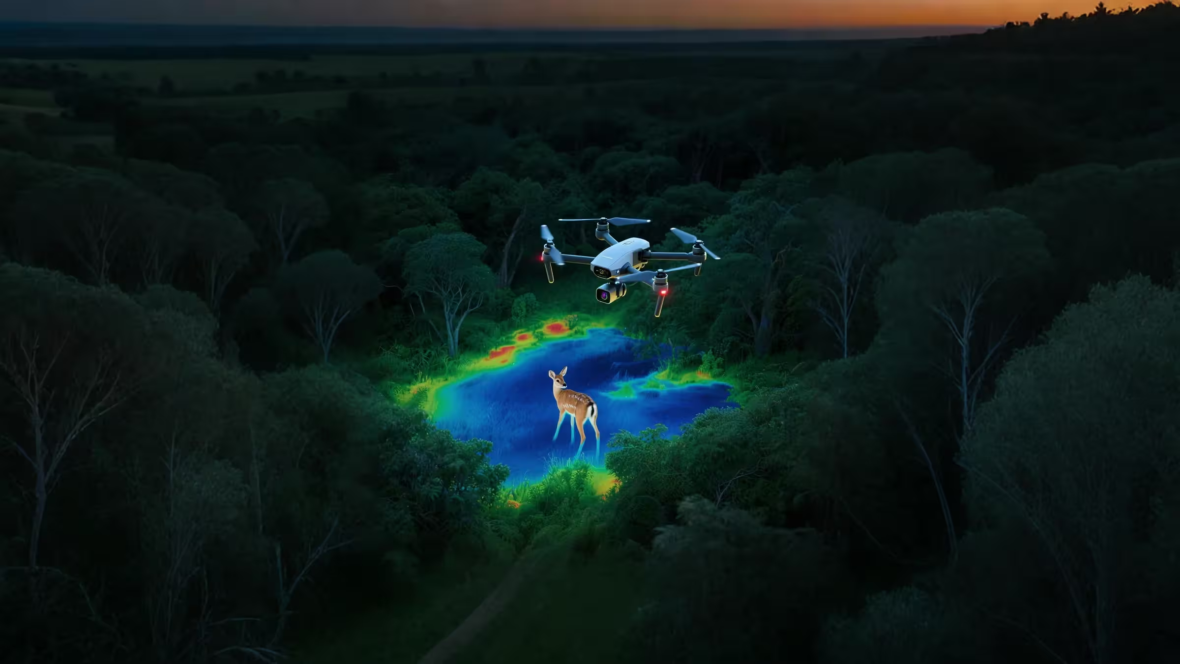
- Thermal Imaging: Detects faults like hot spots or leaks with precision, minimizing downtime.
- AI-Powered Analytics: When paired with MMC’s analytics software, offers automated defect recognition, streamlining reporting and decision-making.
- Reduced Logistics: Long endurance eliminates the need for frequent battery swaps, enabling continuous operations over vast areas.
Use Cases:
- Power Line Patrols: Inspects high-voltage lines in remote regions, reducing risks to human inspectors.
- Oil & Gas Pipelines: Monitors pipelines for structural integrity and leaks.
- Renewable Energy: Ensures wind turbines and solar panels operate at peak performance.
Testimonial: “The M10’s long-range capabilities and AI analytics have cut our inspection times dramatically while improving safety,” reports an energy utility director.
3. Emergency Response & Disaster Relief
In critical situations where time is of the essence, the M10 delivers rapid, reliable performance:
- Rapid Deployment: Sets up in 3 minutes without requiring runways or specialized equipment.
- Real-Time Imaging: Provides high-resolution aerial data for damage assessment and rescue planning.
- Night-Vision SAR: Equipped with thermal cameras to locate missing persons in low-visibility conditions.
Use Cases:
- Earthquake/Tsunami Analysis: Maps disaster zones for rapid response planning.
- Wildfire Monitoring: Tracks fire spread and containment efforts in real time.
- Search & Rescue: Identifies heat signatures in remote or hazardous areas.
Testimonial: “During a recent flood, the M10’s rapid deployment and thermal imaging helped us locate stranded individuals faster than ever,” says an emergency response coordinator.
4. Defense & Security Operations
For defense, law enforcement, and surveillance teams, the M10 offers advanced capabilities for mission-critical operations:
- Long-Range Surveillance: Features 80km encrypted video transmission with 30x zoom and infrared (IR) for day and night monitoring.
- Stealth Design: Low-noise operation ensures discreet surveillance for covert missions.
- Secure Connectivity: Anti-jamming GPS and datalink with 80km dual-band (1.4GHz/1.7GHz) transmission protect sensitive data.
Use Cases:
- Border Surveillance: Monitors coastlines and borders for unauthorized activity.
- Battlefield Reconnaissance: Provides real-time situational awareness in contested environments.
- Illegal Activity Detection: Tracks activities like smuggling or poaching in remote areas.
Testimonial: “The M10’s secure data link and stealth operation have been game-changers for our border security missions,” says a defense agency officer.
What Makes the MMC M10 Stand Out?
The M10’s advanced features set it apart as the ultimate heavy-lift VTOL drone for professional applications.
Modular Payload System (3-Minute Swap)
- Supports multiple payloads, including LiDAR for high-precision terrain mapping, dual-sensor gimbals (visible + thermal), and communications relays for extended operations.
- 3-minute payload swaps without tools, enabling rapid adaptation to diverse mission requirements.
Fully Autonomous Operation
- One-click takeoff and landing simplifies operations for users of all experience levels.
- Pre-programmed flight paths support up to 8 missions with 800 waypoints each, ideal for complex surveys and inspections.
- Optional AI obstacle avoidance ensures safe navigation in cluttered environments.
Ultra-Long-Range Data Link
- 80km encrypted transmission (1.4GHz/1.7GHz dual-band) ensures secure, real-time data delivery.
- Anti-interference GPS and datalink maintain reliability in contested or remote areas.
Easy Transport & Rapid Deployment
- Fits in a standard SUV, with disassembly in under 5 minutes.
- Requires no specialized crew, making it accessible for small teams and rapid deployment.
Who Should Use the MMC M10?
The M10 is designed for professionals across industries who require high-performance, heavy-lift aerial solutions:
- Surveying & GIS Companies
- Replace costly manned aircraft with a high-accuracy, cost-effective platform.
- Achieve cm-level precision for large-scale mapping projects.
- Energy & Utility Inspectors
- Minimize risks and costs with long-range, automated inspections.
- Streamline reporting with AI-driven defect detection.
- Defense & Security Agencies
- Conduct long-endurance reconnaissance with secure, real-time data.
- Maintain situational awareness in remote or contested zones.
- Emergency Services & NGOs
- Deploy rapidly for disaster mapping and search-and-rescue operations.
- Leverage thermal imaging for critical missions in low-visibility conditions.
Why Professionals Choose the MMC M10
The M10 has earned accolades from users across industries for its unmatched performance and reliability:
“The M10’s 300 km² coverage per flight has revolutionized our large-scale surveying projects, delivering precision and speed beyond our expectations.”
—Geospatial engineer
“For remote pipeline inspections, the M10’s heavy payload capacity and long endurance have transformed our operations, making them safer and more efficient.”
—Energy sector manager
“The M10’s secure data link and stealth design have been critical for our surveillance missions in challenging environments.”
—Security agency officer
“In a recent wildfire response, the M10’s rapid deployment and thermal imaging saved critical time in locating stranded individuals.”
—Emergency responder
The Future of Heavy-Lift VTOL Drones is Here
The MMC M10 is more than a drone—it’s a high-performance aerial platform that empowers professionals to achieve extraordinary results in the most demanding conditions. Its combination of heavy-lift capacity, extended endurance, and versatile payload options makes it the ideal choice for mapping vast terrains, inspecting critical infrastructure, securing borders, or saving lives in emergencies. With the M10, you can carry more, fly longer, and accomplish the impossible.
Ready to transform your operations?
📩 Contact our experts for a customized demo.
🌐 Visit our website for technical specifications and case studies.
Fly Longer. Carry More. Achieve the Impossible with MMC M10.