Introduction: A Changing Landscape in Water Monitoring
Water is the lifeline of human civilization. It sustains agriculture, supports industries, and safeguards communities against drought and flood. Yet, in the 21st century, water resources management has become more challenging than ever. Climate change is driving erratic rainfall patterns, extreme flooding events are increasing, and urban populations are placing unprecedented strain on existing drainage and wastewater systems. At the same time, traditional approaches to hydrological monitoring—manual gauging, fixed stations, and ad-hoc surveys—are showing their age.
The demand for real-time water flow monitoring has never been higher. Authorities, researchers, and industries are seeking methods that are faster, safer, more accurate, and more adaptive to diverse conditions. Into this context comes a new era of solutions: drone-mounted flow measurement systems, designed to transform the way we observe rivers, channels, and drainage networks.
Among these, the MMC R4 Flow Measurement Radar stands out as a cutting-edge tool. By combining non-contact flow measurement, high-precision water level sensing, stabilized imaging, and intelligent software analytics, this UAV payload is reshaping the very concept of hydrological monitoring.
The Problem with Traditional Flow Monitoring
Hydrologists and engineers have long relied on manual techniques to measure flow velocity and discharge. Staff would wade into rivers with current meters, stretch measuring tapes across channels, or deploy stationary sensors. While these methods laid the foundation of modern water science, they also suffer from limitations:
- Safety Risks: Operators working in flood-prone rivers, industrial wastewater outlets, or sewage systems face significant dangers.
- Labor Intensity: Setting up equipment, manually recording data, and traveling between sites requires extensive human effort.
- Limited Frequency: Measurements are often taken periodically, meaning real-time changes in flow are missed.
- Environmental Disturbances: Floating debris, sediment-laden water, and harsh weather conditions frequently compromise data reliability.
- Lack of Flexibility: Fixed stations are costly to install and maintain, and cannot be rapidly deployed to new or remote sites.
The result is a monitoring system that is fragmented, inefficient, and reactive—a poor match for today’s complex water management challenges.
The Rise of UAV-Based Hydrological Monitoring
Unmanned aerial vehicles (UAVs), commonly known as drones, have rapidly evolved beyond aerial photography into essential tools for industry and science. Equipped with advanced sensors, drones can now perform surveying, mapping, inspection, and emergency response. In the water sector, UAVs open unprecedented opportunities:
- They can hover over rivers and channels, eliminating the need for dangerous in-water operations.
- They can carry specialized payloads to measure velocity, discharge, and water level with high precision.
- They can be deployed rapidly and flexibly, even in remote or hazardous locations.
- They can be integrated with real-time data transmission, ensuring decision-makers receive instant insights.
It is within this revolution that the MMC R4 Flow Measurement Radar emerges—not as a simple sensor, but as a comprehensive UAV hydrological monitoring solution.
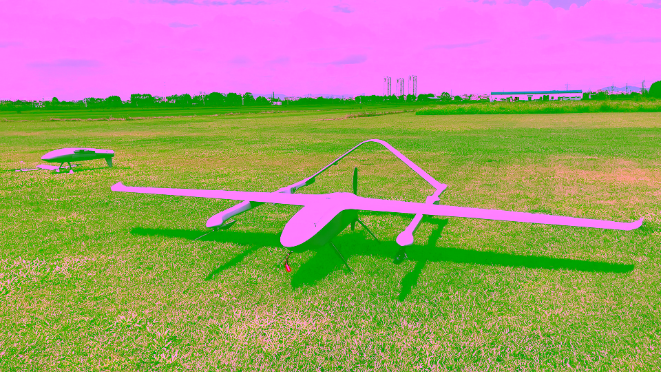
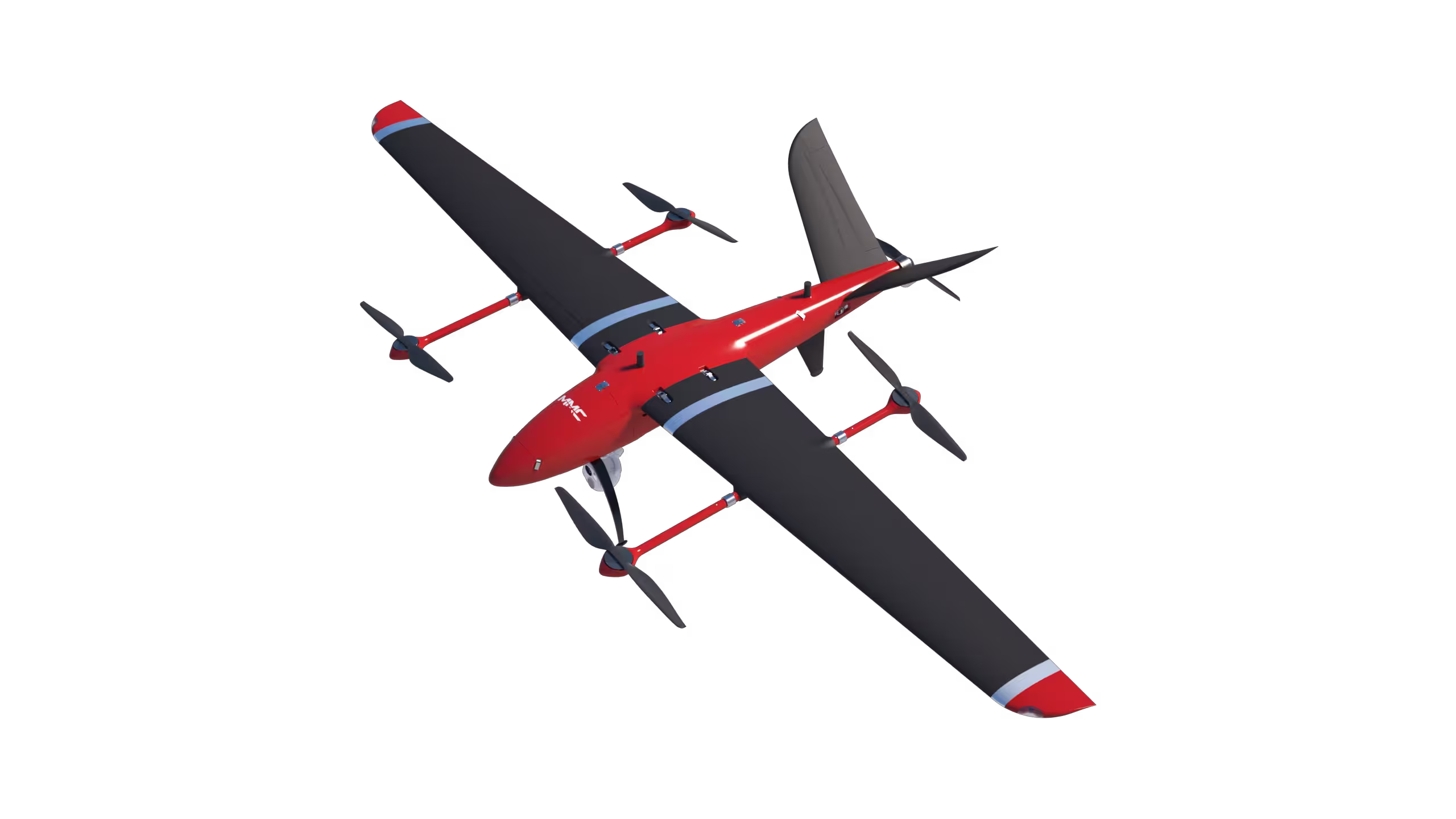
Introducing the MMC R4 Flow Measurement Radar
The MMC R4 is more than just an attachment; it is a drone-mounted flow radar system engineered for professional hydrological monitoring. Designed to integrate seamlessly with UAV platforms, the R4 brings together flow velocity detection, water level measurement, stabilized video capture, and intelligent software analytics.
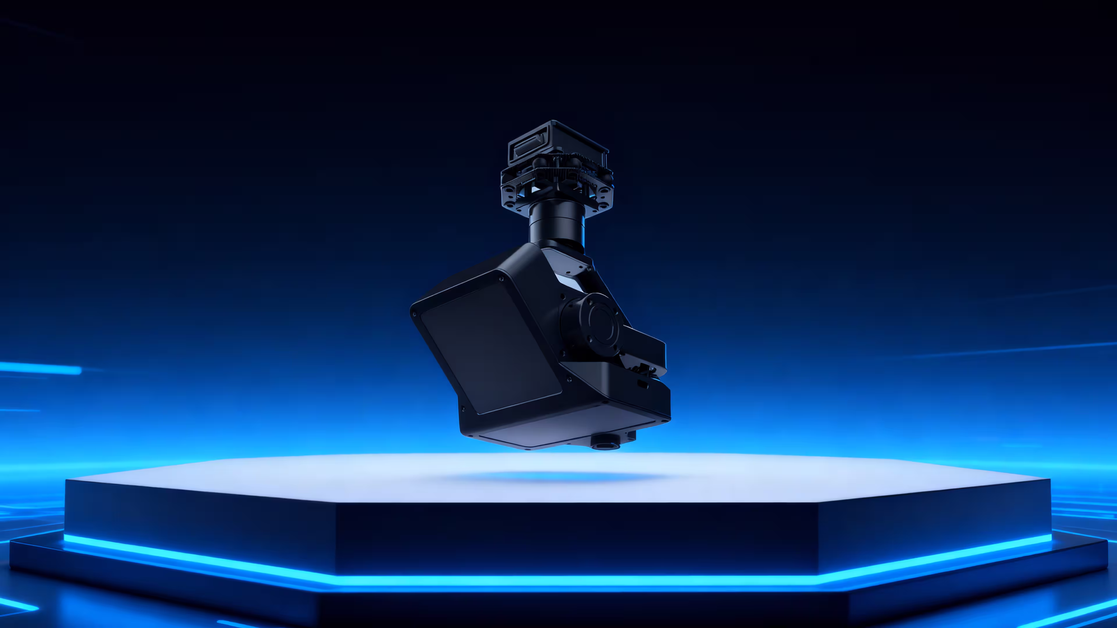
What sets it apart is its ability to perform non-contact discharge measurement. Instead of deploying equipment into the water, the UAV hovers at a safe altitude, using radar pulses and Doppler velocity detection to capture flow characteristics below. Simultaneously, its camera provides a stabilized visual record, and its onboard and ground-based systems convert raw data into actionable insights.
From natural rivers to irrigation channels, industrial wastewater outlets, and underground drainage systems, the R4 can be deployed wherever flow monitoring is needed.
How the Technology Works: Turning Complexity into Simplicity
At its core, the R4 employs radar-based flow sensing technology. A K-band Doppler radar detects the velocity of the water surface, while a high-frequency radar pulse measures water level. By combining these inputs with hydrological models, the system calculates average cross-sectional velocity and ultimately derives accurate discharge values.
To ensure data stability, the payload is mounted on a 3-axis gimbal, countering UAV movement and vibrations. This guarantees that both radar measurements and video streams remain precise and reliable.
What makes the R4 truly powerful, however, is its integration with intelligent ground control software. Operators can:
- Predefine flight paths across river cross-sections.
- Set measurement points where the UAV automatically collects flow and level data.
- Manage multiple monitoring stations by importing or exporting geospatial metadata.
- Adjust or update cross-section profiles, including riverbed elevations and vertical lines.
- Recalculate historical flow data by integrating corrected cross-section information.
- Generate standardized reports in line with GB 50179-2015 River Discharge Measurement Standards.
In essence, the R4 takes tasks that once required days of labor and turns them into an automated, repeatable, and scientifically validated process.
Advantages of the MMC R4 UAV Solution
Every feature of the R4 has been designed with end-user challenges in mind. Its advantages can be summarized across four key dimensions:
- Efficiency
Automated UAV missions allow rapid coverage of multiple sections in a single flight. A task that once required several staff and hours of preparation can now be achieved within minutes, significantly reducing both time and cost. - Safety
By removing the need for personnel to enter hazardous waters, the R4 dramatically lowers operational risk. This is especially valuable in flood events, industrial discharge zones, or urban sewage systems. - Accuracy
With advanced radar algorithms and intelligent cross-section modeling, the R4 delivers high-precision data unaffected by debris, sediment, or adverse weather. Consistency is further assured through Ministry of Water Resources certification. - Intelligence
The integration of mission planning, real-time monitoring, historical data recalculation, and standardized reporting transforms hydrological monitoring from a fragmented manual task into a smart, connected workflow.
Application Scenarios
The versatility of the MMC R4 makes it applicable across a broad spectrum of water management challenges:
- River Discharge Monitoring
During flood season, authorities must understand changing river conditions in real time. The R4 enables non-contact, real-time flow velocity and discharge measurement, improving flood forecasting and response. - Irrigation Channel Management
Agriculture relies on efficient water distribution. The R4 helps measure canal flow accurately, ensuring equitable allocation and preventing water waste. - Industrial Wastewater Monitoring
Compliance with discharge regulations is critical. UAV-based monitoring with the R4 allows continuous oversight of wastewater outlets, ensuring transparency and enforcement without physical risks. - Urban Drainage and Sewage Systems
Modern cities face growing challenges from stormwater and sewage overflow. By hovering over manholes, drainage canals, or underground outlets, the R4 provides reliable data for urban water management.
A Day in the Field: From Planning to Insights
Imagine a hydrological survey team tasked with assessing a mid-sized river prone to seasonal flooding. Traditionally, the team would have had to deploy boats, stretch gauging lines, and spend hours collecting velocity measurements at different depths. Safety risks would be high, and results would take days to process.
With the MMC R4 solution, the process changes dramatically. Using the ground control software, the team defines cross-section lines along the river and assigns waypoints. Once the UAV takes off, it autonomously follows the planned route, hovering at each point while the radar measures surface velocity and water level. The video feed confirms site conditions in real time.
Within minutes, the software calculates average discharge values, which are then exported into a standardized report. Back at headquarters, decision-makers already have the data they need to determine whether upstream reservoirs should release or hold water.
The entire process—from planning to decision—has been reduced from days to hours, with greater accuracy and lower risk.
Future Outlook: Toward Smarter Water Management
The MMC R4 is not just a tool; it is part of a larger transformation. As digitalization reshapes industries, hydrology too is entering an age of smart monitoring networks. Future applications may integrate UAV-based data with satellite imagery, IoT-based ground sensors, and AI-driven predictive models. Together, these systems will allow authorities to manage rivers, canals, and drainage systems proactively rather than reactively.
In this vision, the R4 plays a crucial role: delivering reliable, real-time, and high-precision data that forms the foundation of digital water governance.
Conclusion
The challenges of modern water resources management demand more than outdated manual methods. They require solutions that are fast, safe, intelligent, and adaptable. The MMC R4 Flow Measurement Radar answers that call, bringing together UAV mobility, radar sensing, stabilized imaging, and advanced software into a comprehensive hydrological monitoring system.
By enabling non-contact discharge measurement, real-time water flow monitoring, and automated reporting, the R4 helps governments, researchers, and industries modernize their approach to water management.
In rivers, irrigation canals, industrial outlets, and urban drainage systems alike, the MMC R4 is setting a new standard—where efficiency, safety, accuracy, and intelligence converge. For those seeking to build a future of smarter, safer, and more sustainable water governance, the R4 is not just a solution; it is the future itself.