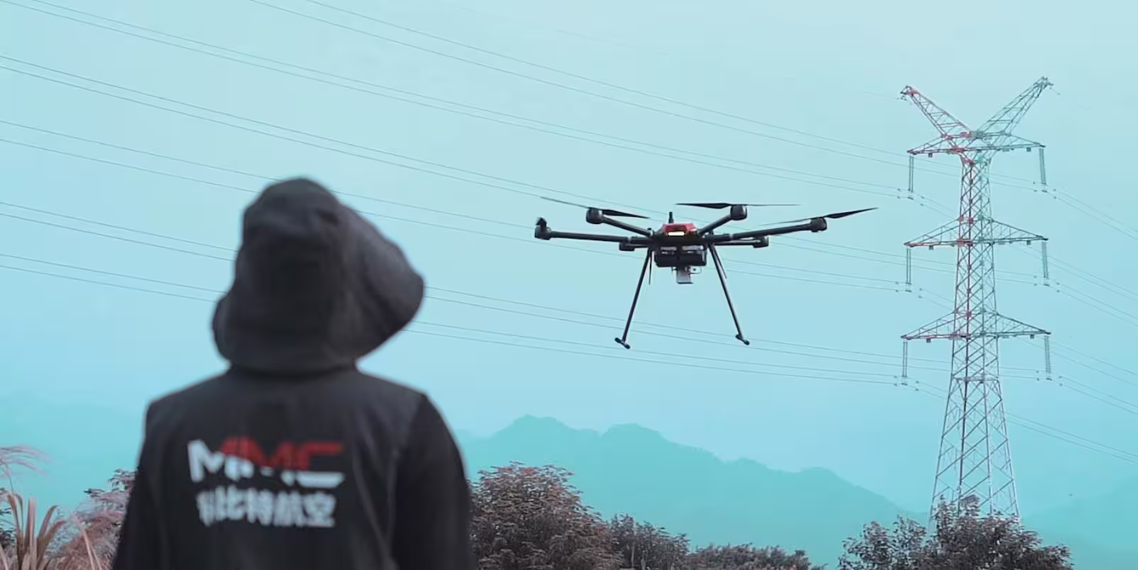
In the high-stakes world of professional UAV operations, every second, every connection, and every decision counts. Whether you’re an industrial inspector monitoring power grids at 3,000 meters, a surveyor mapping remote terrain, or a first responder coordinating a search-and-rescue mission, the tools you rely on must keep pace with the complexity of your mission.
Enter the Etlas Neo Ⅲ – not just a ground control station (GCS), but a universal command center engineered to break down barriers: third-party compatibility that unites your fleet, dual-touch precision that puts control at your fingertips, and rugged reliability that thrives where other devices fail.
This is the GCS professionals have been demanding – built for those who refuse to be limited by brand silos, clunky interfaces, or fragile hardware.
Third-Party Compatibility: One Station, Every Drone. Finally.
The biggest pain point for UAV operators? Managing a fleet of drones from different manufacturers – each requiring its own proprietary GCS, software, and training. Etlas Neo Ⅲ shatters this paradigm with universal third-party integration, supporting leading UAV brands including DJI, Autel, Parrot, Yuneec, and custom-built platforms.
How? By leveraging open-source protocols like Mavlink and PX4, alongside custom API support for proprietary systems, it acts as a “translator” between your drones and your mission.
Imagine this: A utility company uses DJI Matrice for high-resolution inspections and Autel EVO II for thermal mapping. With Etlas Neo Ⅲ, their team switches between drones in seconds – no juggling laptops, no reconfiguring software, no wasted time.
For agriculture specialists flying both fixed-wing crop scanners and multirotor sprayers, it means seamless workflow continuity. Even defense and public safety units with mixed fleets (e.g., surveillance drones, cargo carriers) benefit from centralized control, reducing training costs and operational delays by up to 40%.
“We used to carry three different GCS units for our drone fleet,” says a lead inspector at a Fortune 500 energy firm. “Etlas Neo Ⅲ cut our setup time in half and eliminated the risk of misconfigurations. It’s like having a universal remote for the sky.”
Dual-Touch Control: Work Smarter, Not Harder – Two Screens, Endless Possibilities
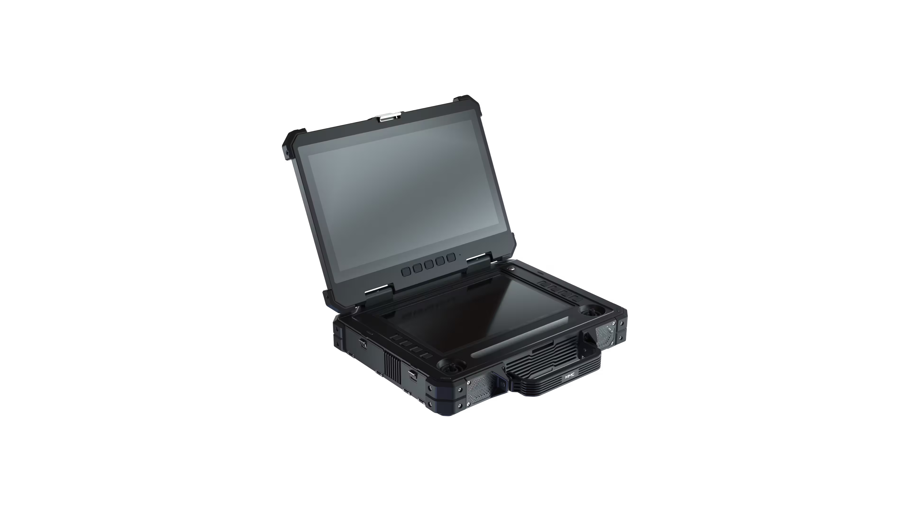
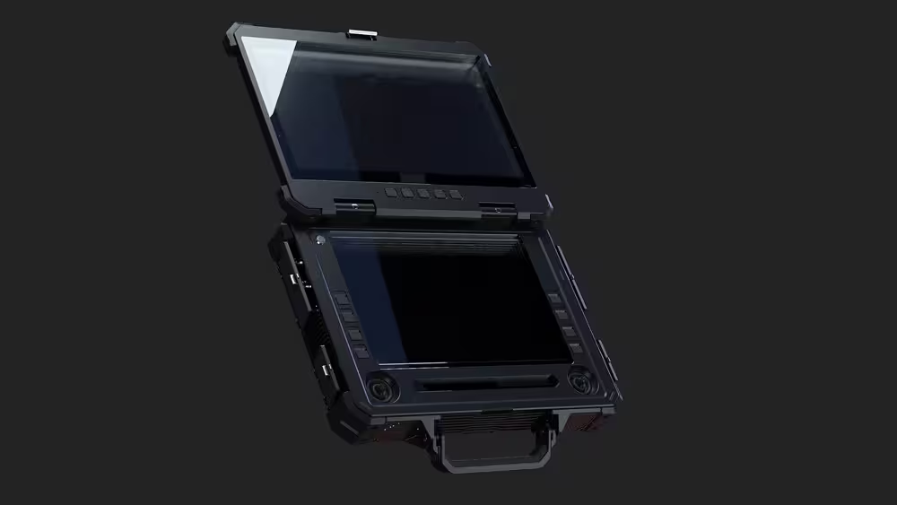
In the field, every tap, swipe, and decision matters. Etlas Neo Ⅲ’s dual 10-point touchscreens (15.6” upper display / 12.1” lower display) transform how you interact with your UAVs, turning complex tasks into intuitive gestures. The upper screen delivers 4K HDR live feeds with 1500nits brightness – visible even under scorching desert sun or snowy glare – while the lower screen handles mission-critical tasks:
- Real-Time Payload Adjustment: Swipe to zoom thermal cameras, toggle laser rangefinders, or adjust gimbal angles without digging through menus.
- Dynamic Route Planning: Drag-and-drop waypoints, set altitude constraints, or reroute mid-flight to avoid obstacles – all while monitoring live telemetry (battery life, speed, GPS accuracy) on the same screen.
- Multi-Task Mastery: Split the lower screen to run mapping software (e.g., Pix4D, DroneDeploy) alongside flight logs, or compare live thermal data with preloaded CAD blueprints.
But it’s not just about screens – it’s about tactile precision. The displays support glove-friendly operation (critical for cold-weather or chemical-handling scenarios) and respond to 0.1mm touch accuracy, so even the finest adjustments (e.g., focusing a 40x zoom lens on a power line insulator) feel effortless.
For teams transitioning from clunky physical controllers, this translates to a 35% boost in task efficiency – and fewer errors in high-pressure situations.
Rugged Reliability: Built to Outlast the Toughest Missions
UAV operations don’t happen in climate-controlled offices – they happen in monsoon rains, desert dust storms, Arctic blizzards, and vibrating vehicle cabins. Etlas Neo Ⅲ isn’t just built to survive these conditions; it’s built to excel in them.
- IP65 Ingress Protection: Sealed against rain, dust, and sand, it laughs off unexpected downpours during agricultural surveys or dusty construction site inspections.
- Extreme Temperature Tolerance: From -20°C (-4°F) in mountainous search-and-rescue missions to +60°C (140°F) in desert oilfield patrols, its internal thermal management system keeps components cool and responsive.
- Magnesium-Aluminum Alloy Frame: Lightweight yet impact-resistant (tested to withstand 1.2m drops onto concrete), it handles the bumps of off-road vehicle mounting or hasty field deployments.
- 5-Hour Hot-Swap Battery: Swap batteries in 30 seconds without powering down – ensuring continuous operation during all-day mapping projects or extended emergency response.
“We deployed Etlas Neo Ⅲ during Hurricane Ida recovery,” recalls a FEMA drone coordinator. “It sat in a Humvee bouncing through floodwaters for 12 hours, screens covered in mud, and never missed a beat. We tracked 17 drones across three counties that day – something we couldn’t have done with our old, fragile GCS.”
Beyond Control: Powering Data-Driven Decisions
Etlas Neo Ⅲ isn’t just a controller – it’s a data processing hub that turns raw flight data into actionable insights, fast. Under the hood, an Intel Core i7 processor and 128GB high-speed SSD crunch numbers in real time:
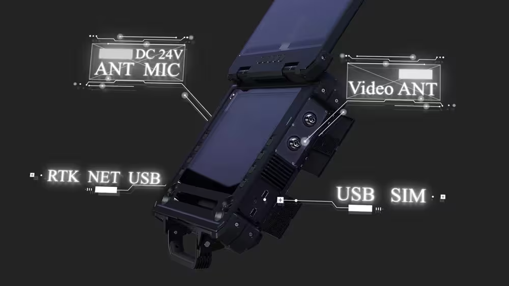
- 80km Secure Data Transmission: With 20Mbps bandwidth and encrypted protocols (AES-256), it streams high-res imagery and sensor data (LiDAR, multispectral) from miles away, even in high-electromagnetic interference (EMI) environments (e.g., near power substations).
- Offline Mapping & AI Integration: Preload offline maps for remote regions; run edge AI tools to auto-detect anomalies (e.g., crop stress, infrastructure cracks) and flag critical issues before you land.
- Flight Log Analytics: Export detailed logs (GPS coordinates, payload settings, battery health) to CSV/PDF for compliance reporting or post-mission debriefs – essential for regulatory audits or team training.
Who Needs Etlas Neo Ⅲ? Everyone Who Refuses to Be Limited
- Energy & Utilities: Inspect power lines, wind turbines, and pipelines with mixed drone fleets (thermal, LiDAR, zoom cameras) – all from one station.
- Agriculture: Monitor crop health across thousands of acres using fixed-wing scanners and multirotor sprayers, switching between drones to target specific zones.
- Public Safety: Coordinate search-and-rescue, crowd control, or disaster assessment with police, fire, and EMS drones – even if each agency uses different brands.
- Construction & Mining: Track progress, survey stockpiles, and inspect structures with drones from multiple vendors, ensuring project timelines stay on track.
The Verdict: Etlas Neo Ⅲ Isn’t Just a GCS – It’s Your Fleet’s Co-Pilot
In a world where UAVs are no longer tools but mission-critical assets, Etlas Neo Ⅲ stands alone: third-party compatibility to unify your fleet, dual-touch precision to streamline operations, and rugged reliability to outlast the harshest conditions.
It’s not just about controlling drones – it’s about empowering your team to focus on what matters: delivering results, safely, efficiently, and without limits.
Ready to redefine what your UAV fleet can achieve?
Etlas Neo Ⅲ: Control the sky, no matter which drone you fly.
Contact us today for a demo – and see why professionals worldwide are ditching brand-locked GCS for the universal solution.


Comments