In the modern age of industrial drone operations, data has become the most valuable resource. Companies and organizations across the globe rely on aerial platforms to observe, measure, and analyze environments that are often too vast, remote, or hazardous for ground-based teams. The challenge is no longer simply flying a drone—it’s about how much high-quality, actionable information can be extracted from every flight.
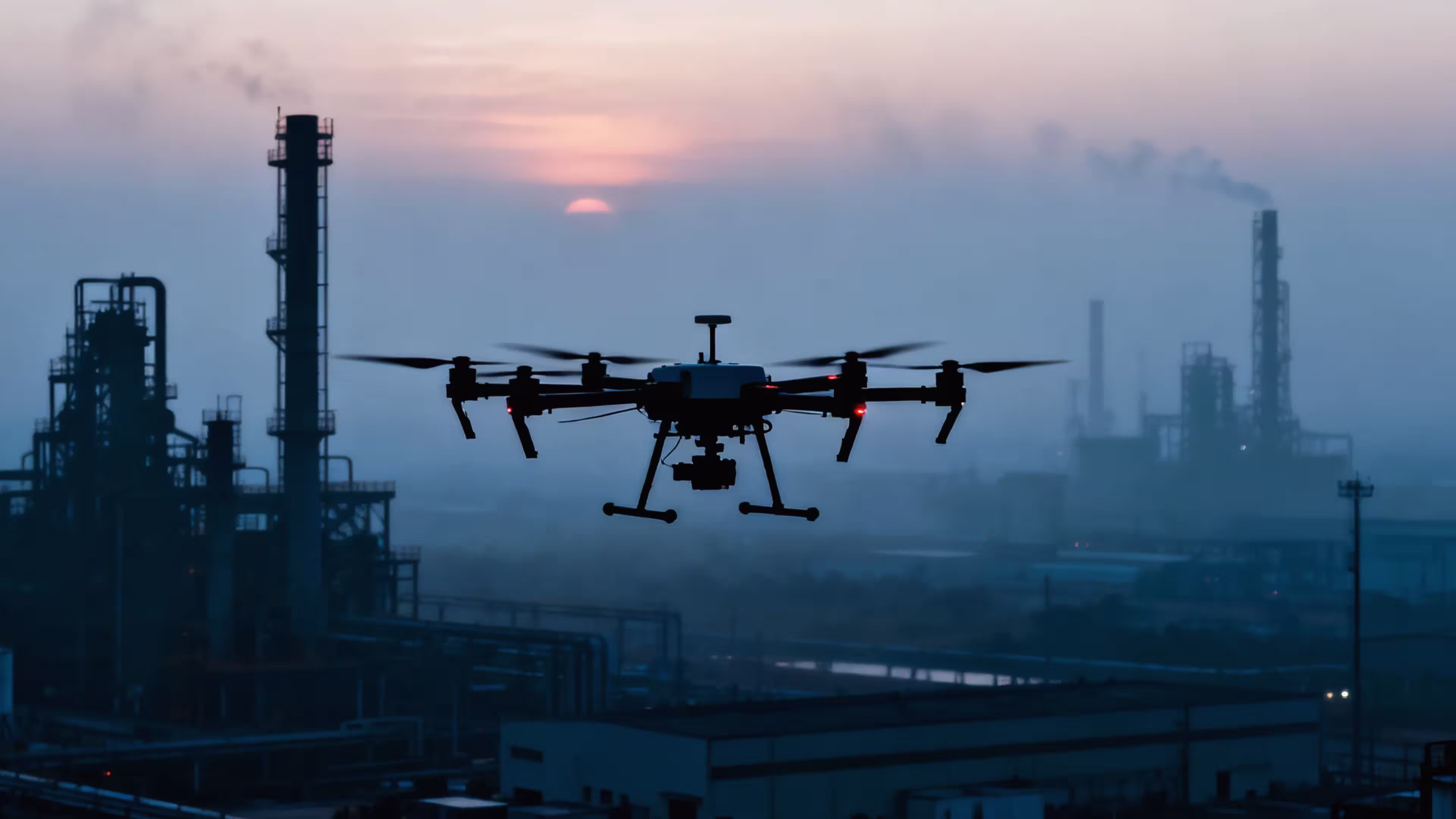
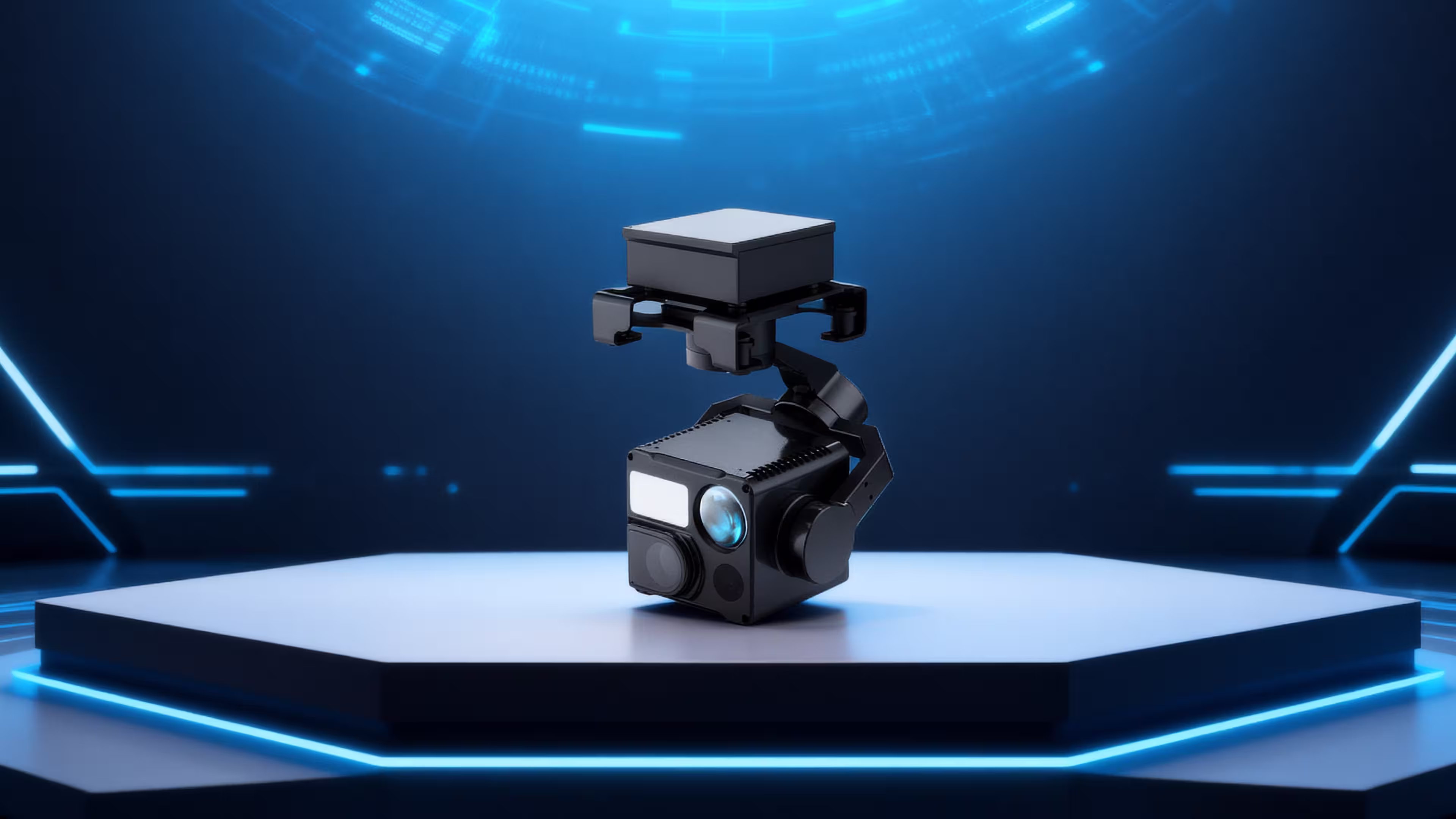
This is where the MMC HT10RW, a compact yet powerful four-sensor gimbal payload, reshapes expectations. Developed by MMC, a global leader in industrial drone technology, the HT10RW integrates cutting-edge optics, infrared thermal imaging, and precision laser ranging into one lightweight unit, creating an all-in-one solution for professional users.
A Compact Powerhouse of Imaging Technology
At only 380 grams, the MMC HT10RW defies its size. Despite being one of the lightest professional-grade payloads in its class, it provides unparalleled functionality. Its core advantage lies in its four-sensor integration:
- Ultra-clear zoom camera: With a 48MP 1/2″ CMOS sensor and 11x optical zoom expandable to 160x hybrid zoom, it captures distant targets in stunning detail. From detecting tiny cracks on a power line insulator to identifying a person in distress kilometers away, its imaging power ensures that no detail is missed.
- Wide-angle visible camera: Offering a 79° field of view, it provides contextual awareness for broader monitoring tasks. Operators can quickly shift from wide coverage to detailed zoom without switching equipment.
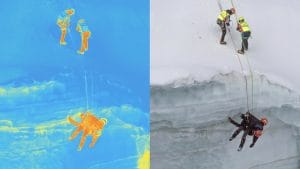
- Thermal imaging camera: Featuring 640×512 resolution and advanced measurement modes, it allows users to identify temperature anomalies, spot heat sources through smoke, and work effectively day or night.
- Laser rangefinder: With a reach of up to 1200 meters and high measurement accuracy, it provides precise distance and geolocation data, enabling operators to map targets with exact coordinates.
These sensors are seamlessly stabilized on a three-axis gimbal, ensuring smooth video capture and accurate alignment even in challenging flight conditions.
Why Multi-Sensor Payloads Matter
For years, aerial missions required switching between multiple payloads: one for zoom imaging, another for thermal, and yet another for laser ranging. This not only consumed valuable time but also placed extra strain on drones due to weight and power requirements.
The HT10RW eliminates this inefficiency. By combining visible-light, thermal, and laser sensors into one compact unit, it reduces flight complexity, enhances mission speed, and increases safety. Operators can carry out full-spectrum inspections in a single flight, making drones far more cost-effective as data collection tools.
Real-World Applications of the MMC HT10RW
Power Line Inspection: Safer, Faster, Smarter
Utility companies must continuously inspect thousands of kilometers of transmission lines that cross remote landscapes. Traditional ground teams face risks of falls, electrical hazards, and long inspection times.
With the HT10RW, drones can fly safely at a distance while the zoom camera captures clear images of insulators, bolts, and fittings. The thermal sensor highlights overheating components, while the rangefinder ensures precise reporting of problem locations. This combination allows utility teams to detect faults early, prevent blackouts, and reduce operational costs.
Oil and Gas Pipeline Surveillance: Reducing Risks Across Vast Terrains
Pipeline monitoring is vital for preventing leaks, spills, and potential disasters. Ground patrols can take days, leaving gaps in surveillance.
The HT10RW enables drones to monitor pipelines with unmatched efficiency. The wide-angle camera provides situational awareness of long stretches, while the zoom lens identifies corrosion or external interference. Infrared sensors detect unusual heat signatures, which may signal leaks. With exact geolocation from the laser rangefinder, maintenance crews can be dispatched precisely where needed, reducing both environmental risk and inspection costs.
Solar Farm Maintenance: Maximizing Clean Energy Efficiency
The rapid global expansion of solar energy has created new challenges in maintaining panel efficiency across vast installations. Manual inspections are not only laborious but also impractical.
Equipped with the HT10RW, drones can scan large solar fields quickly. The thermal camera instantly highlights defective cells or panels with abnormal heating, while the zoom camera verifies surface damage. The result is faster detection, quicker repairs, and maximized energy output. Entire solar farms that once took weeks to inspect can now be covered in just a few hours.
Urban Firefighting: Enhancing Situational Awareness
When fire breaks out in high-rise buildings or densely packed neighborhoods, firefighters need instant intelligence. Smoke and structural complexity often limit visibility from the ground.
The HT10RW provides fire commanders with eyes in the sky. The thermal sensor detects heat sources and trapped individuals through smoke, while the zoom lens provides detailed visuals of structural conditions. The laser rangefinder enables precise measurements, helping direct water cannons and plan rescue routes. These capabilities directly translate to saved lives and reduced property damage.
Forest Fire Prevention and Response: From Early Detection to Real-Time Monitoring
Wildfires are increasing in frequency and intensity worldwide. Early detection and rapid response are critical for protecting forests and communities.
The HT10RW offers long-range thermal imaging that detects abnormal heat signatures invisible to the naked eye. During active wildfires, it helps map fire lines, track spread, and guide ground teams. Its multi-sensor capability ensures accurate monitoring around the clock, even in challenging weather conditions. Forestry agencies benefit from faster detection, improved coordination, and reduced firefighting risks.
Technical Excellence Translated into Real Benefits
While the HT10RW is packed with advanced specifications—6K video capture, 48MP stills, infrared temperature measurement, and 1200m laser rangefinding—the real value lies in how these translate into operational benefits:
- Higher Accuracy: Exact geolocation reduces reporting errors.
- Lower Costs: Multi-sensor integration reduces the need for multiple flights.
- Increased Safety: Remote inspections minimize risks to human workers.
- Faster Operations: Automated flight paths with real-time data transmission accelerate workflows.
- Day-and-Night Reliability: Dual visible and infrared systems ensure uninterrupted missions.
Designed for Seamless Integration
The HT10RW is fully compatible with MMC’s Notuzi S and Skylle II drone platforms, which are known for long endurance, stability, and high payload capacity. Together, they form complete aerial solutions tailored for industrial inspections and emergency response missions.
Beyond Technology: Building a Smarter Future
The MMC HT10RW represents more than just a sensor package. It embodies a philosophy of maximizing efficiency, minimizing risk, and enabling smarter decision-making across industries. By consolidating four essential tools into one compact system, it makes drones indispensable for the modern world.
As industries move toward digital transformation and data-driven operations, payloads like the HT10RW will be at the center of this evolution, bridging the gap between raw aerial data and actionable intelligence.
Conclusion
The MMC HT10RW is not simply an accessory for drones—it is a force multiplier for industries that rely on precision, speed, and reliability. From ensuring the safety of national power grids and oil pipelines to safeguarding cities and forests, the HT10RW demonstrates how compact technology can have a global impact.
By integrating visible zoom, wide-angle coverage, thermal imaging, and laser measurement, this lightweight payload empowers drones to see further, detect deeper, and act smarter. For organizations seeking to unlock the full potential of aerial data collection, the HT10RW is not just an option—it is the solution.